MyTopo
Bryan Wyoming US Topo Map
Couldn't load pickup availability
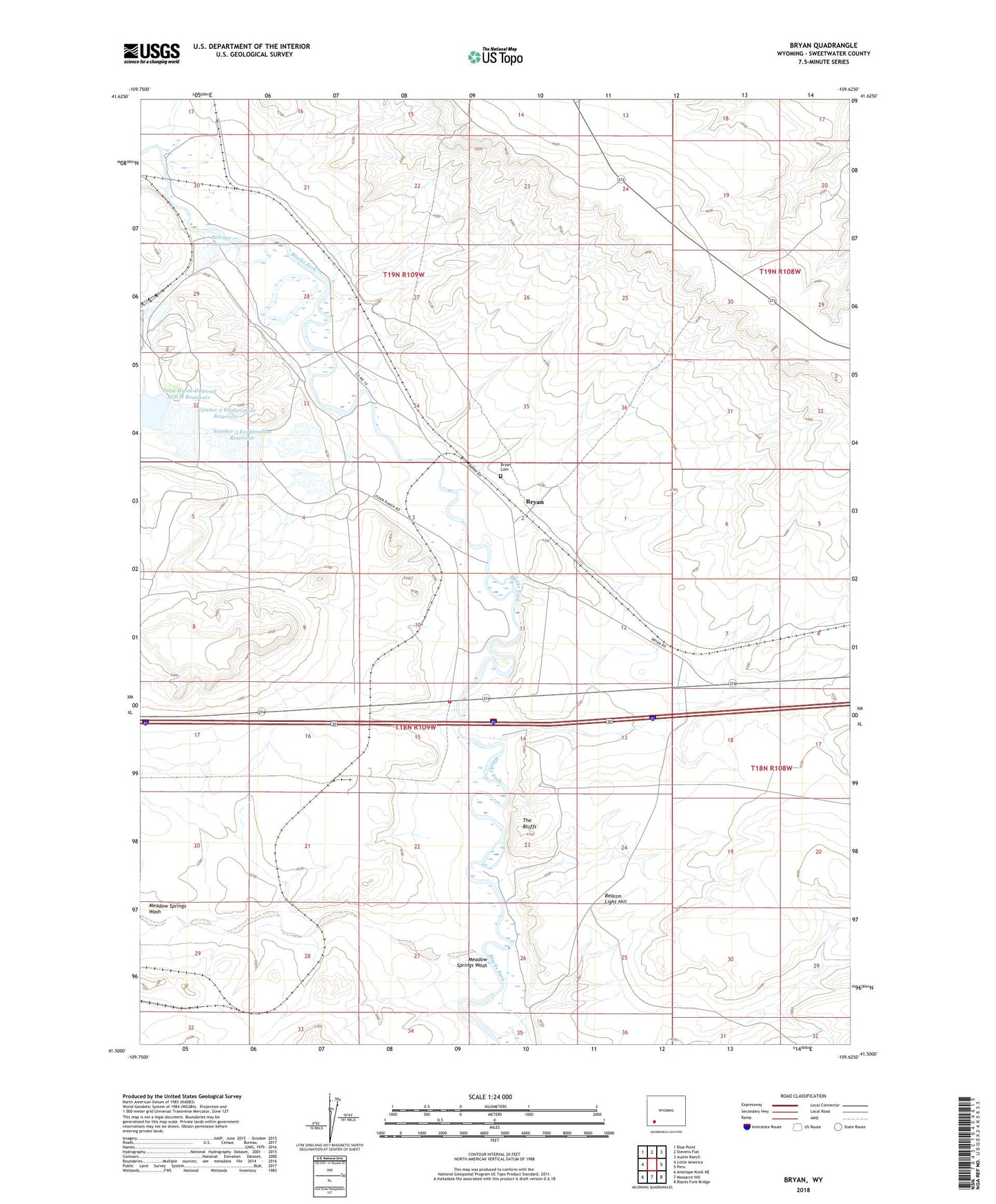
2021 topographic map quadrangle Bryan in the state of Wyoming. Scale: 1:24000. Based on the newly updated USGS 7.5' US Topo map series, this map is in the following counties: Sweetwater. The map contains contour data, water features, and other items you are used to seeing on USGS maps, but also has updated roads and other features. This is the next generation of topographic maps. Printed on high-quality waterproof paper with UV fade-resistant inks.
Quads adjacent to this one:
West: Little America
Northwest: Blue Point
North: Stevens Flat
Northeast: Austin Ranch
East: Peru
Southeast: Blacks Fork Bridge
South: Massacre Hill
Southwest: Antelope Knoll NE
Contains the following named places: Alchem Trona Mine, Allied Number 4 Tailings Pond Dam, Allied Trona Mine, Beacon Light Hill, Bryan, Bryan Cemetery, Diamond Alkali Company Number Three Mine, FMC Wyoming Corporation Fire Brigade, Lone Tree Stage Station, Meadow Springs Wash, Number 2 Dam, Number 2 Evaporation Reservoir, Number 3 Dam, Number 3 Evaporation Reservoir, Number 4 Dam, Number 5a Dam, Number 5a Reservoir, Pierotto Ranch, Potash Company of America Number Two Mine, Sewage Lagoon, Sewage Lagoon Dam, Solid Waste Disposal Cell E Reservoir, Solid Waste Disposal Cell H Reservoir, The Bluffs