MyTopo
Little America Wyoming US Topo Map
Couldn't load pickup availability
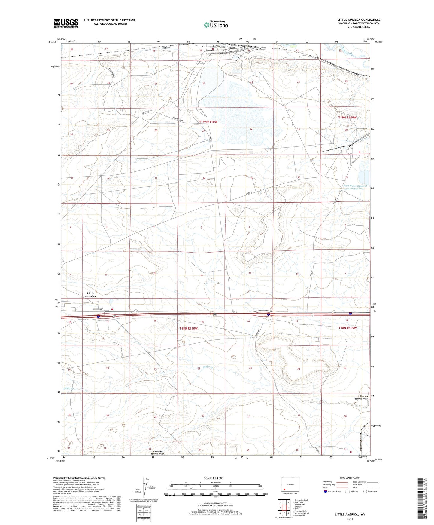
2021 topographic map quadrangle Little America in the state of Wyoming. Scale: 1:24000. Based on the newly updated USGS 7.5' US Topo map series, this map is in the following counties: Sweetwater. The map contains contour data, water features, and other items you are used to seeing on USGS maps, but also has updated roads and other features. This is the next generation of topographic maps. Printed on high-quality waterproof paper with UV fade-resistant inks.
Quads adjacent to this one:
West: Granger
Northwest: Sevenmile Gulch
North: Blue Point
Northeast: Stevens Flat
East: Bryan
Southeast: Massacre Hill
South: Antelope Knoll NE
Southwest: Antelope Knoll
This map covers the same area as the classic USGS quad with code o41109e7.
Contains the following named places: Church and Dwight Response Team, FMC Westvaco Mine Numbers One and Two, FMC Westvaco Number Six Mine, John Hay Junior Number One Mine, Little America, Little America Census Designated Place, Little America Holdings Fire Department, Little America Post Office, Little America Well, Potash Company of America Number One Mine, Solid Waste Disposal Cell E Dam, Solid Waste Disposal Cell F Dam, Solid Waste Disposal Cell F Reservoir, Solid Waste Disposal Cell H Dam, Spider Creek, Tata General Chemical Surface Rescue Team, Union Pacific Number Four Mine, Union Pacific Number One Mine, Union Pacific Number Three Mine, Union Pacific Number Two Mine, Westvaco, Westvaco Mine, Westvaco Number Eight Mine, Westvaco Number Four Mine, Westvaco Number One Mine, Westvaco Number Seven Mine, Westvaco Number Three Mine, Westvaco Number Two Mine, Westvaco Section, Westvaco Shaft Number 3, ZIP Code: 82929