MyTopo
Buffalo SE Wyoming US Topo Map
Couldn't load pickup availability
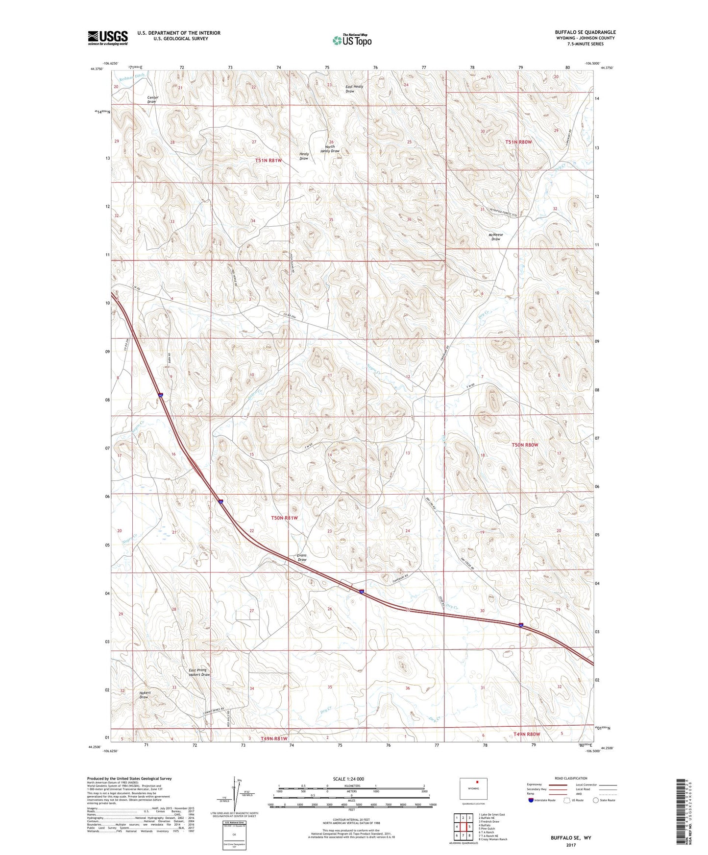
2021 topographic map quadrangle Buffalo SE in the state of Wyoming. Scale: 1:24000. Based on the newly updated USGS 7.5' US Topo map series, this map is in the following counties: Johnson. The map contains contour data, water features, and other items you are used to seeing on USGS maps, but also has updated roads and other features. This is the next generation of topographic maps. Printed on high-quality waterproof paper with UV fade-resistant inks.
Quads adjacent to this one:
West: Buffalo
Northwest: Lake De Smet East
North: Buffalo NE
Northeast: Fredrick Draw
East: Pine Gulch
Southeast: Crazy Woman Ranch
South: T A Ranch NE
Southwest: T A Ranch
Contains the following named places: Bob Dam, Brock Dam, Brock Reservoir, Buffalo Division, Center Draw, Evans Draw, Hepp Dam, Hepp Reservoir, McNeese Draw, Morton Pit Number Two, Negro Creek, Stockrest Well, Walters Mine