MyTopo
Pine Gulch Wyoming US Topo Map
Couldn't load pickup availability
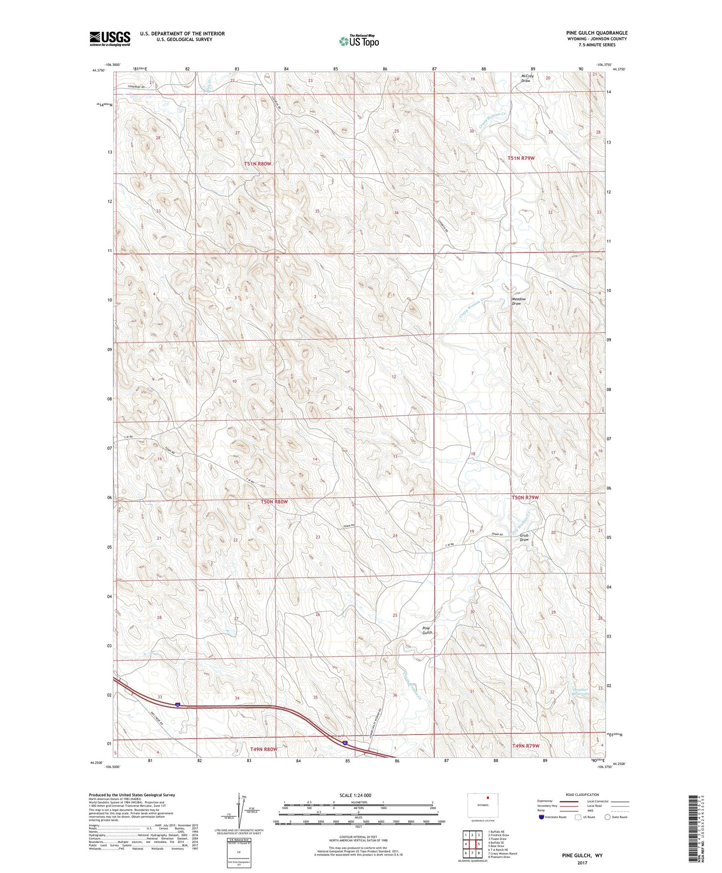
2021 topographic map quadrangle Pine Gulch in the state of Wyoming. Scale: 1:24000. Based on the newly updated USGS 7.5' US Topo map series, this map is in the following counties: Johnson. The map contains contour data, water features, and other items you are used to seeing on USGS maps, but also has updated roads and other features. This is the next generation of topographic maps. Printed on high-quality waterproof paper with UV fade-resistant inks.
Quads adjacent to this one:
West: Buffalo SE
Northwest: Buffalo NE
North: Fredrick Draw
Northeast: Floate Draw
East: Bear Draw
Southeast: Ploessers Draw
South: Crazy Woman Ranch
Southwest: T A Ranch NE
This map covers the same area as the classic USGS quad with code o44106c4.
Contains the following named places: Bob Reservoir, Grub Draw, Heather Dam, Heather Reservoir, Jack Payne Ranch, Lion Dam, Lion Reservoir, McCray Draw, Meadow Draw, Pine Gulch