MyTopo
Burlington Lake Wyoming US Topo Map
Couldn't load pickup availability
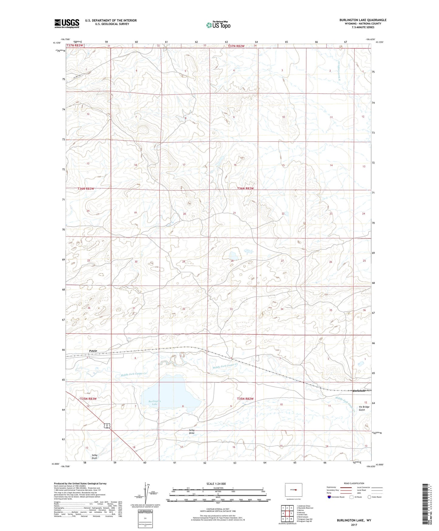
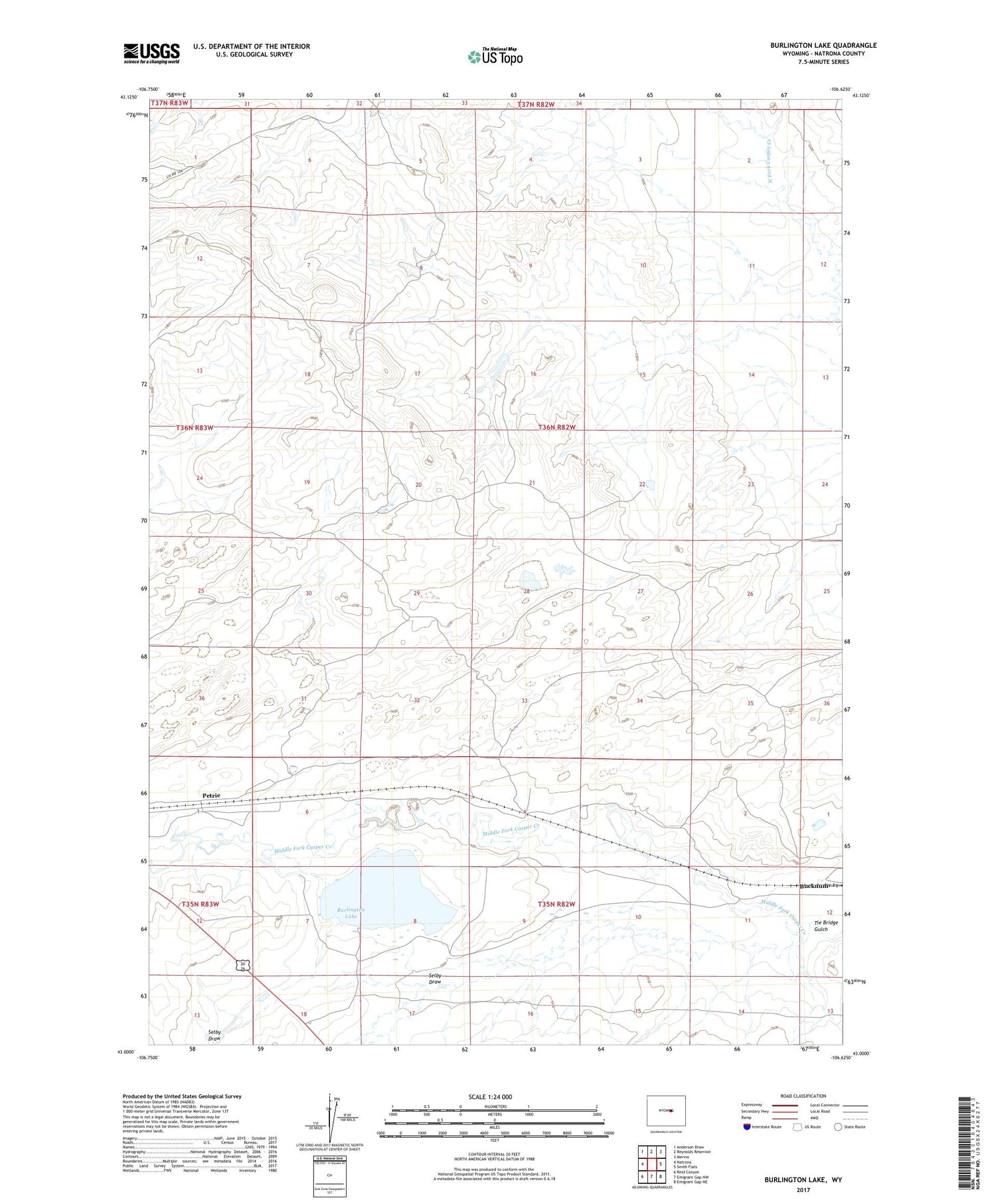
2021 topographic map quadrangle Burlington Lake in the state of Wyoming. Scale: 1:24000. Based on the newly updated USGS 7.5' US Topo map series, this map is in the following counties: Natrona. The map contains contour data, water features, and other items you are used to seeing on USGS maps, but also has updated roads and other features. This is the next generation of topographic maps. Printed on high-quality waterproof paper with UV fade-resistant inks.
Quads adjacent to this one:
West: Natrona
Northwest: Anderson Draw
North: Reynolds Reservoir
Northeast: Merino
East: Smith Flats
Southeast: Emigrant Gap NE
South: Emigrant Gap NW
Southwest: Reid Canyon
Contains the following named places: Bucknum, Burlington Lake, Johnson Number 1 Dam, Johnson Reservoir Number 1, Petrie, Roseberry Number 1 Dam, Roseberry Number 2 Dam, Roseberry Reservoir Number 1, Roseberry Reservoir Number 2, Selby Draw, Tie Bridge Gulch