MyTopo
Burlington Wyoming US Topo Map
Couldn't load pickup availability
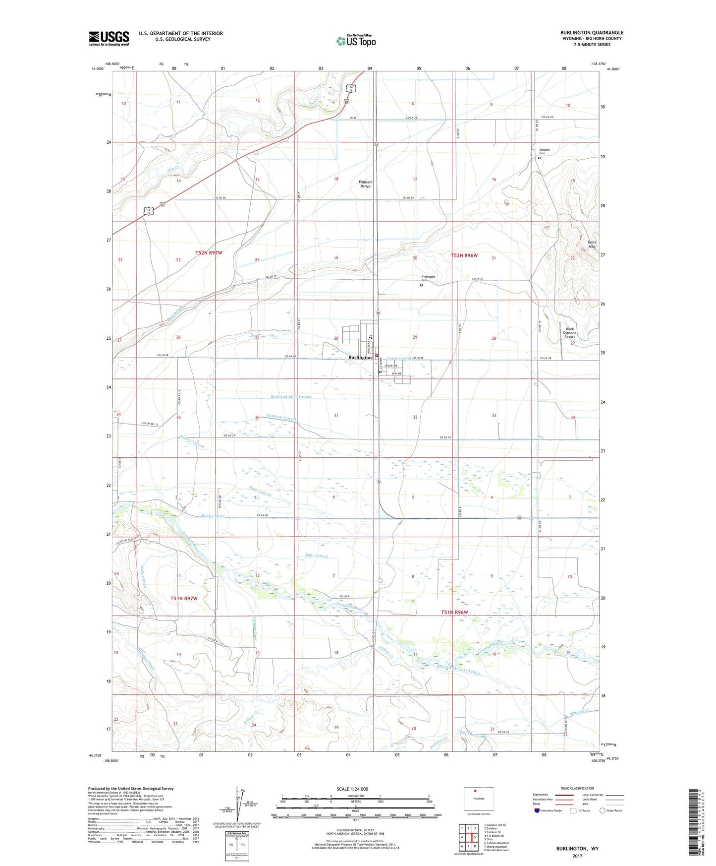
2021 topographic map quadrangle Burlington in the state of Wyoming. Scale: 1:24000. Based on the newly updated USGS 7.5' US Topo map series, this map is in the following counties: Big Horn. The map contains contour data, water features, and other items you are used to seeing on USGS maps, but also has updated roads and other features. This is the next generation of topographic maps. Printed on high-quality waterproof paper with UV fade-resistant inks.
Quads adjacent to this one:
West: Y U Bench NE
Northwest: Gilmore Hill SE
North: Emblem
Northeast: Emblem SE
East: Otto
Southeast: Wardel Reservoir
South: Sheep Mountain
Southwest: Tatman Mountain
Contains the following named places: 42 Lateral, 82411, 82422, Avent School, Bahr Lateral, Bank Lateral, Beck and Allen Lateral, Big Horn County Fire Protection District 4, Black Diamond Airport, Brown and Croxell Ditch, Burlington, Burlington Cemetery, Burlington Elementary School, Burlington Junior High School, Burlington K - 12 School, Burlington Post Office, Emblem Bench, Emblem Cemetery, German Ditch, Maller Ditch, McNiven Lateral, Pearce Lateral, Riley Lateral, Saint Joe Canal, Table Mountain, Tatman Canal, Town Lateral, Town of Burlington, Willow Creek