MyTopo
Y U Bench NE Wyoming US Topo Map
Couldn't load pickup availability
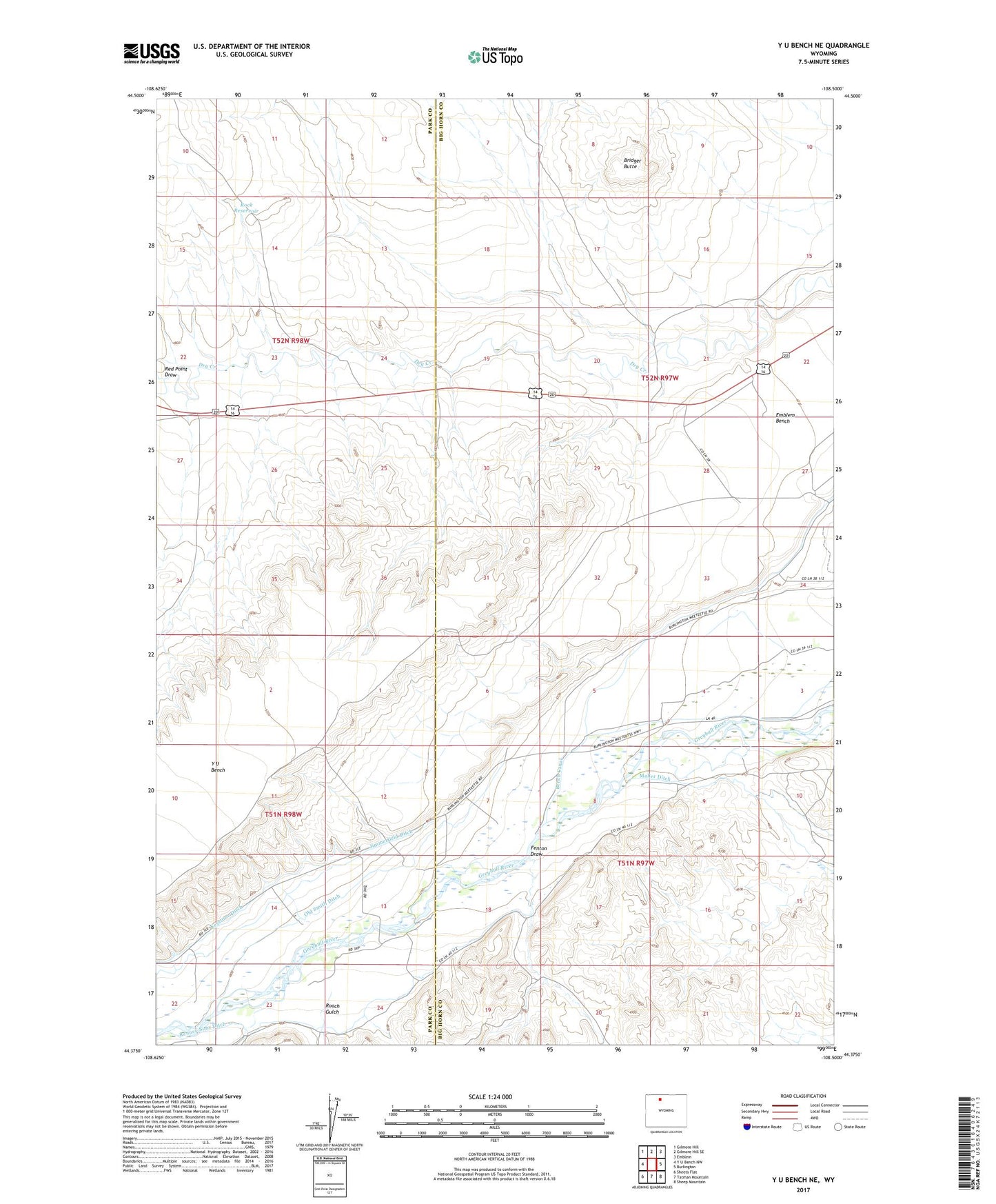
2021 topographic map quadrangle Y U Bench NE in the state of Wyoming. Scale: 1:24000. Based on the newly updated USGS 7.5' US Topo map series, this map is in the following counties: Big Horn, Park. The map contains contour data, water features, and other items you are used to seeing on USGS maps, but also has updated roads and other features. This is the next generation of topographic maps. Printed on high-quality waterproof paper with UV fade-resistant inks.
Quads adjacent to this one:
West: Y U Bench NW
Northwest: Gilmore Hill
North: Gilmore Hill SE
Northeast: Emblem
East: Burlington
Southeast: Sheep Mountain
South: Tatman Mountain
Southwest: Sheets Flat
This map covers the same area as the classic USGS quad with code o44108d5.
Contains the following named places: Bench Canal, Bridger Butte, Fenton, Fenton Draw, Fenton School, Grabbert Corral, Jimmerfield Ditch, Old Smith Ditch, Red Point Draw, Renner-Sims Ditch, Roach Gulch, Rock Reservoir, Saver Reservoir, Thayer Ranch