MyTopo
Byron Wyoming US Topo Map
Couldn't load pickup availability
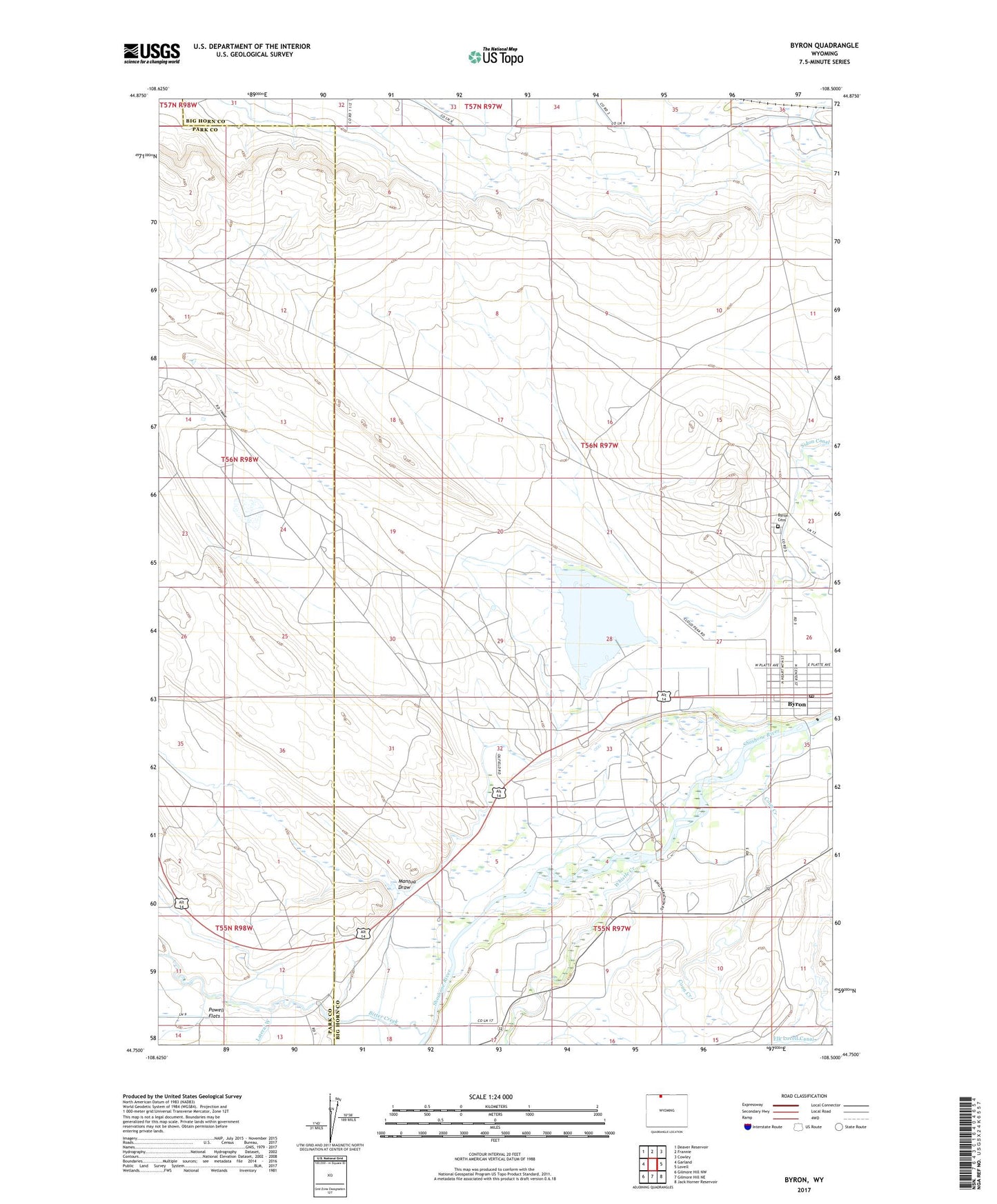
2021 topographic map quadrangle Byron in the state of Wyoming. Scale: 1:24000. Based on the newly updated USGS 7.5' US Topo map series, this map is in the following counties: Big Horn, Park. The map contains contour data, water features, and other items you are used to seeing on USGS maps, but also has updated roads and other features. This is the next generation of topographic maps. Printed on high-quality waterproof paper with UV fade-resistant inks.
Quads adjacent to this one:
West: Garland
Northwest: Deaver Reservoir
North: Frannie
Northeast: Cowley
East: Lovell
Southeast: Jack Horner Reservoir
South: Gilmore Hill NE
Southwest: Gilmore Hill NW
Contains the following named places: Bitter Creek, Byron, Byron Cemetery, Byron Oil Field, Byron Post Office, Byron School, Coon Creek, Garland Oil Field, Mantua Draw, Rocky Mountain High School, Town of Byron, Whistle Creek, ZIP Code: 82412