MyTopo
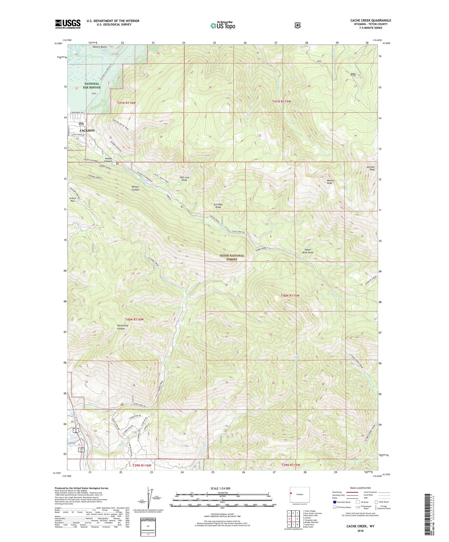
Cache Creek Wyoming US Topo Map
Couldn't load pickup availability
2021 topographic map quadrangle Cache Creek in the state of Wyoming. Scale: 1:24000. Based on the newly updated USGS 7.5' US Topo map series, this map is in the following counties: Teton. The map contains contour data, water features, and other items you are used to seeing on USGS maps, but also has updated roads and other features. This is the next generation of topographic maps. Printed on high-quality waterproof paper with UV fade-resistant inks.
Quads adjacent to this one:
West: Jackson
Northwest: Teton Village
North: Gros Ventre Junction
Northeast: Blue Miner Lake
East: Turquoise Lake
Southeast: Bull Creek
South: Camp Davis
Southwest: Munger Mountain
Contains the following named places: Flat Creek, Game Creek, Gin Pole Draw, Horsethief Canyon, Jackson Mine, Jackson Peak, Millers Springs, Noker Mine Draw, North Fork Horse Creek, Nowlin Creek, Nowlin Peak, Saint John's Medical Center, Salt Lick Draw, Squaw Creek, Sturlin and Sperl Mine, Woods Canyon, ZIP Code: 83001