MyTopo
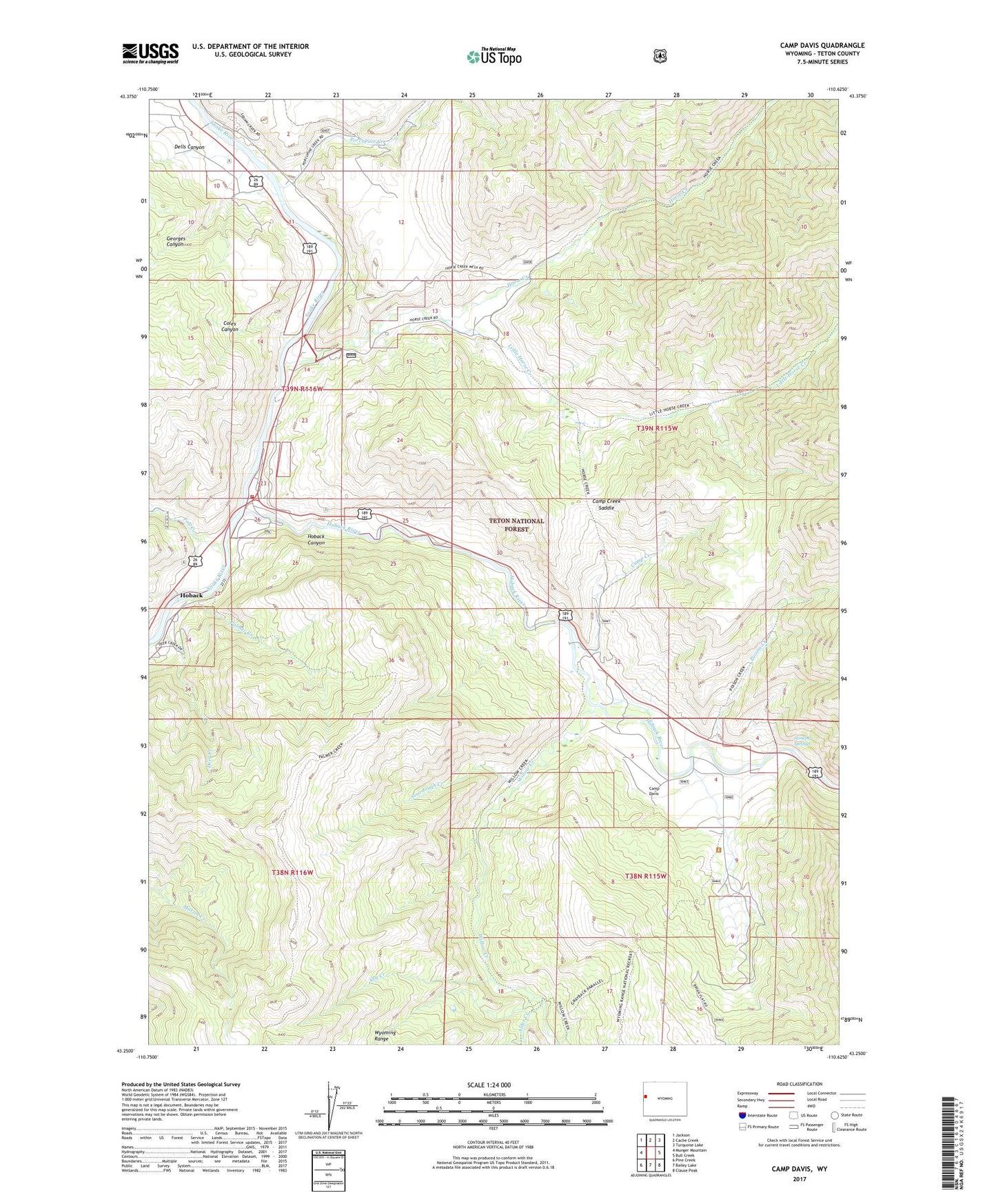
Camp Davis Wyoming US Topo Map
Couldn't load pickup availability
Also explore the Camp Davis Forest Service Topo of this same quad for updated USFS data
2021 topographic map quadrangle Camp Davis in the state of Wyoming. Scale: 1:24000. Based on the newly updated USGS 7.5' US Topo map series, this map is in the following counties: Teton. The map contains contour data, water features, and other items you are used to seeing on USGS maps, but also has updated roads and other features. This is the next generation of topographic maps. Printed on high-quality waterproof paper with UV fade-resistant inks.
Quads adjacent to this one:
West: Munger Mountain
Northwest: Jackson
North: Cache Creek
Northeast: Turquoise Lake
East: Bull Creek
Southeast: Clause Peak
South: Bailey Lake
Southwest: Pine Creek
This map covers the same area as the classic USGS quad with code o43110c6.
Contains the following named places: Alder Creek, Brian Flat Forest Service Station, Broken Arrow Ranch, Camp Creek, Camp Creek Saddle, Camp Davis, Coles Canyon, Deer Creek, Dells Canyon, Fall Creek, Georges Canyon, Hoback Canyon, Hoback Census Designated Place, Hoback Junction, Hoback River, Horse Creek, Jackson Hole Fire and Emergency Medical Services - Firehouse 3 Hoback, Little Horse Creek, Palmer Creek, Poison Creek, Porcupine Creek, Sob Creek, Sourdough Creek, Stinking Springs, Willow Creek, Wyoming Highway Patrol District 3 Division K