MyTopo
Calf Creek Wyoming US Topo Map
Couldn't load pickup availability
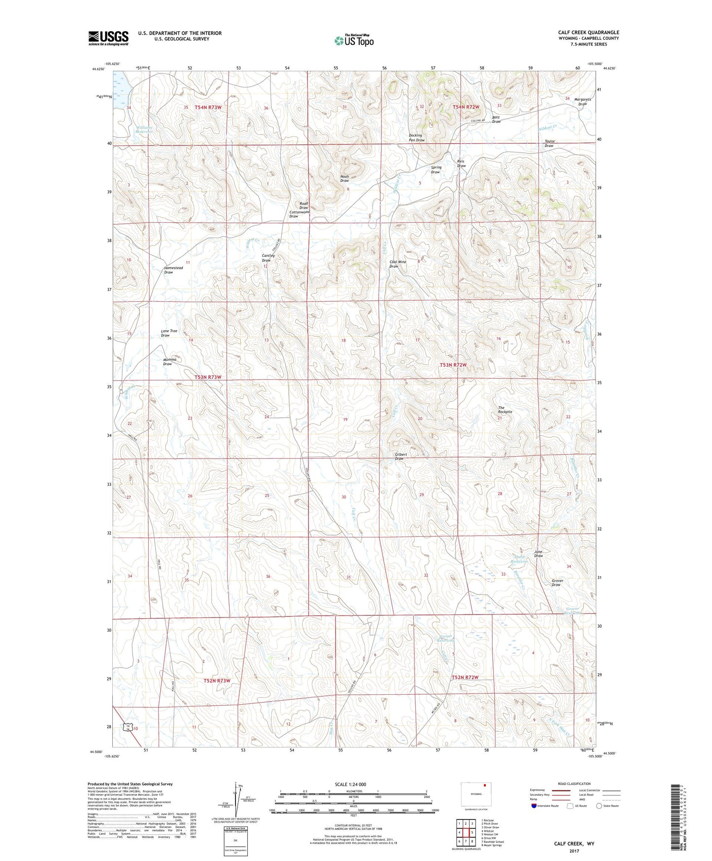
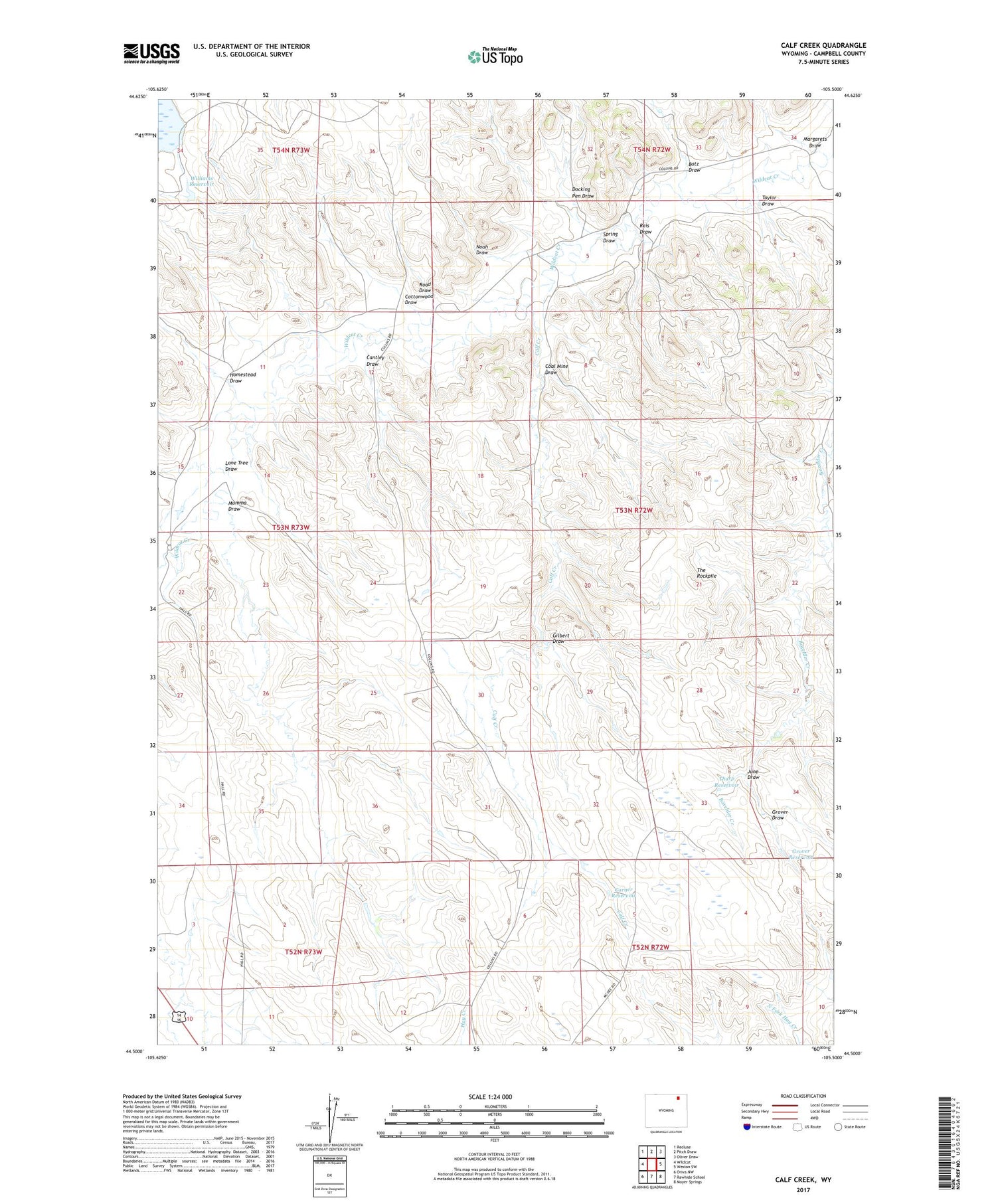
2021 topographic map quadrangle Calf Creek in the state of Wyoming. Scale: 1:24000. Based on the newly updated USGS 7.5' US Topo map series, this map is in the following counties: Campbell. The map contains contour data, water features, and other items you are used to seeing on USGS maps, but also has updated roads and other features. This is the next generation of topographic maps. Printed on high-quality waterproof paper with UV fade-resistant inks.
Quads adjacent to this one:
West: Wildcat
Northwest: Recluse
North: Pitch Draw
Northeast: Oliver Draw
East: Weston SW
Southeast: Moyer Springs
South: Rawhide School
Southwest: Oriva NW
Contains the following named places: Batz Draw, Calf Creek, Cantley Draw, Coal Mine Draw, Corner Reservoir, Cottonwood Draw, Docking Pen Draw, Gas Draw Oil Field, Gilbert Draw, Grover Draw, Grover Reservoir, Homestead Draw, June Draw, Lone Tree Draw, Margarets Draw, Mumma Draw, Noah Draw, Reis Draw, Road Draw, Spring Draw, Taylor Draw, Tharp Reservoir, The Rockpile, Williams Reservoir