MyTopo
Wildcat Wyoming US Topo Map
Couldn't load pickup availability
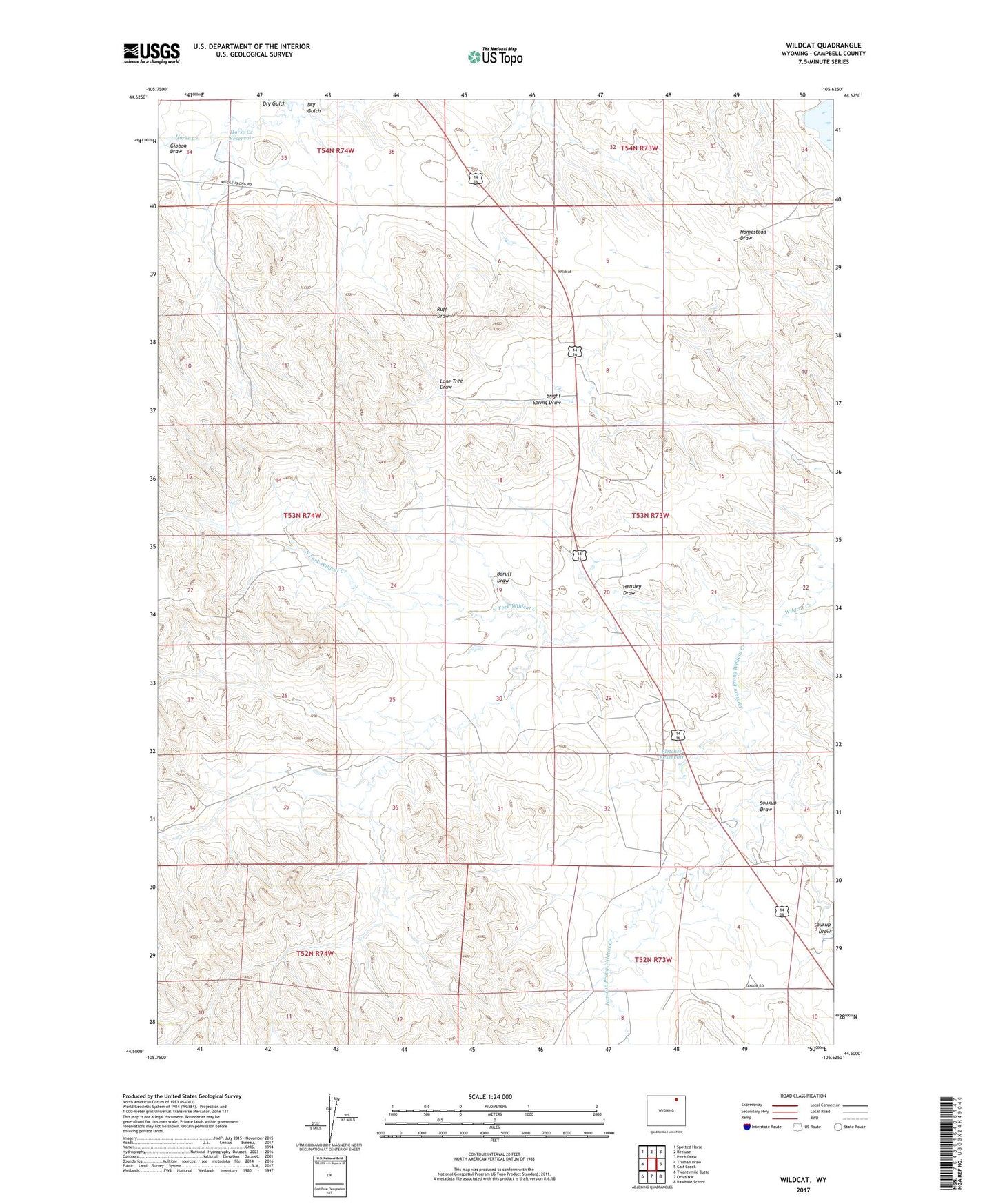
2021 topographic map quadrangle Wildcat in the state of Wyoming. Scale: 1:24000. Based on the newly updated USGS 7.5' US Topo map series, this map is in the following counties: Campbell. The map contains contour data, water features, and other items you are used to seeing on USGS maps, but also has updated roads and other features. This is the next generation of topographic maps. Printed on high-quality waterproof paper with UV fade-resistant inks.
Quads adjacent to this one:
West: Truman Draw
Northwest: Spotted Horse
North: Recluse
Northeast: Pitch Draw
East: Calf Creek
Southeast: Rawhide School
South: Oriva NW
Southwest: Twentymile Butte
This map covers the same area as the classic USGS quad with code o44105e6.
Contains the following named places: Boruff Draw, Bright Spring Draw, Dry Gulch, Fletcher Reservoir, Gibbon Draw, Hensley Draw, Horse Creek Reservoir, Jamison Prong Wildcat Creek, North Fork Wildcat Creek, Scott Dam, Scott Reservoir, Soukup Draw, Wildcat, Wildcat Creek Mine