MyTopo
Cannonball Cut Wyoming US Topo Map
Couldn't load pickup availability
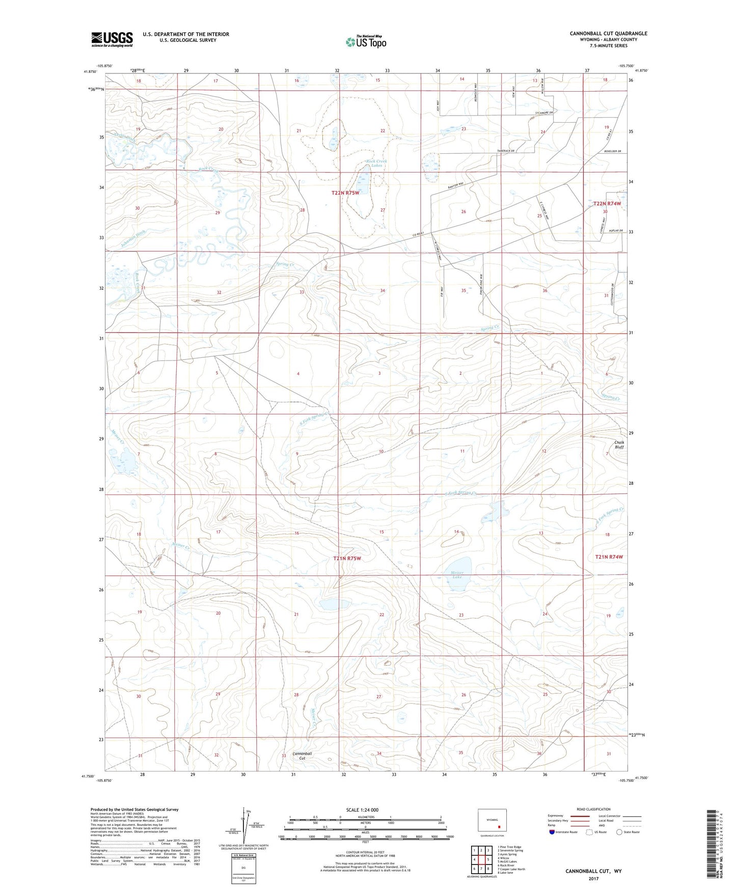
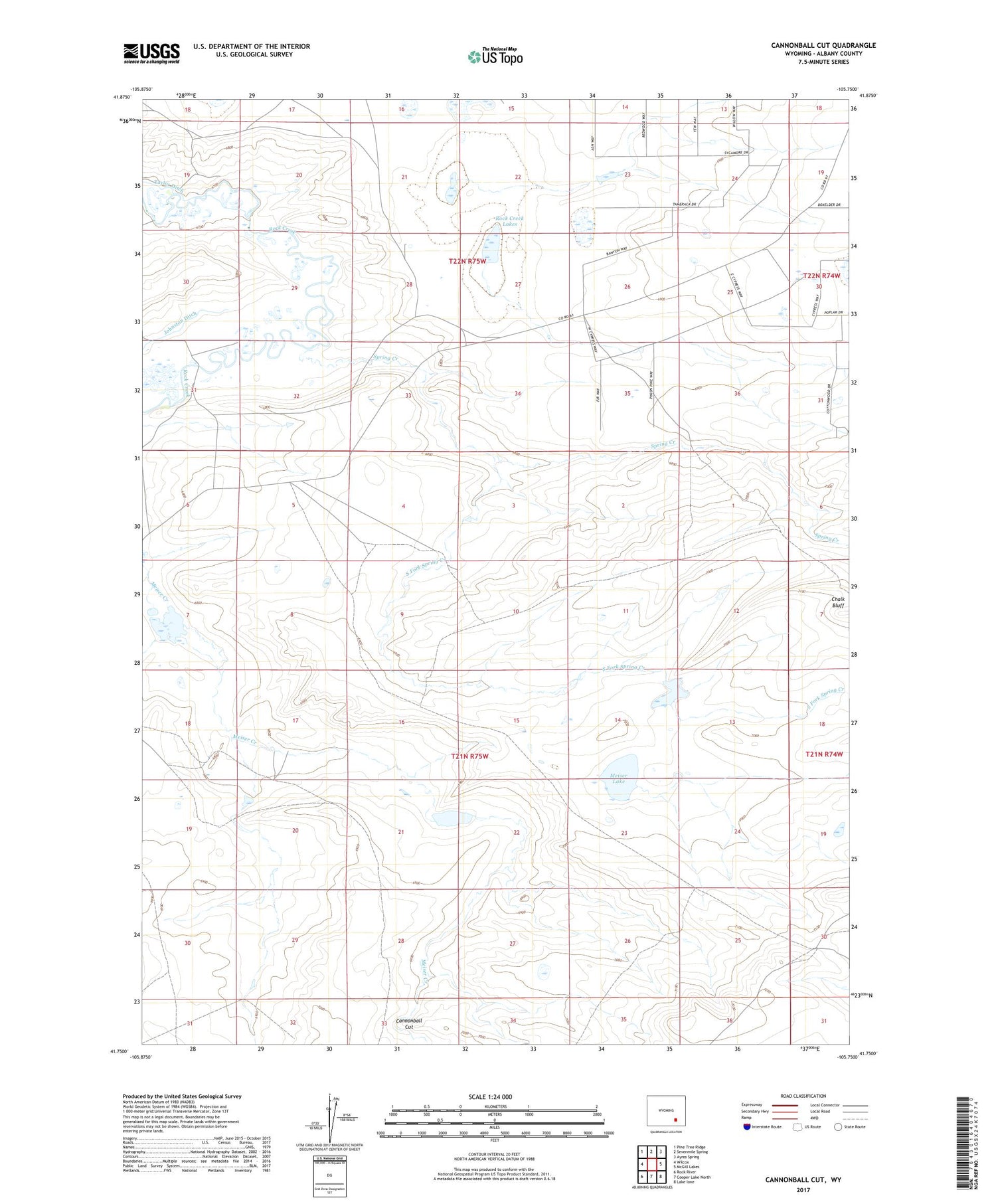
2021 topographic map quadrangle Cannonball Cut in the state of Wyoming. Scale: 1:24000. Based on the newly updated USGS 7.5' US Topo map series, this map is in the following counties: Albany. The map contains contour data, water features, and other items you are used to seeing on USGS maps, but also has updated roads and other features. This is the next generation of topographic maps. Printed on high-quality waterproof paper with UV fade-resistant inks.
Quads adjacent to this one:
West: Wilcox
Northwest: Pine Tree Ridge
North: Sevenmile Spring
Northeast: Ayres Spring
East: McGill Lakes
Southeast: Lake Ione
South: Cooper Lake North
Southwest: Rock River
Contains the following named places: Cannonball Cut, Chalk Bluff, Johnston Ditch, Linscott Claim, McGill Anticline Mine, Meiser Lake, Rock Creek, Rock Creek Lakes, South Fork Spring Creek, Spring Creek, Taylor Ditch, Taylor Mine