MyTopo
Sevenmile Spring Wyoming US Topo Map
Couldn't load pickup availability
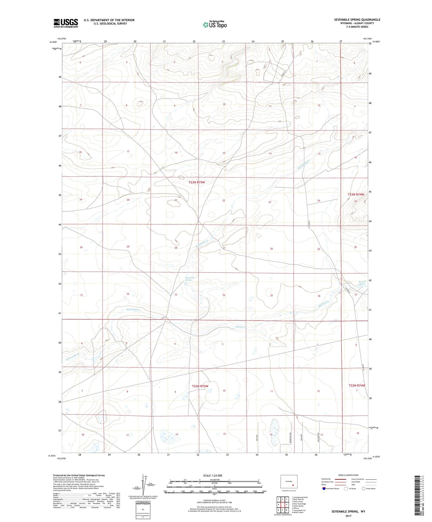
2021 topographic map quadrangle Sevenmile Spring in the state of Wyoming. Scale: 1:24000. Based on the newly updated USGS 7.5' US Topo map series, this map is in the following counties: Albany. The map contains contour data, water features, and other items you are used to seeing on USGS maps, but also has updated roads and other features. This is the next generation of topographic maps. Printed on high-quality waterproof paper with UV fade-resistant inks.
Quads adjacent to this one:
West: Pine Tree Ridge
Northwest: Greasewood Knoll
North: Boot Heel SE
Northeast: Pinto Creek
East: Ayres Spring
Southeast: McGill Lakes
South: Cannonball Cut
Southwest: Wilcox
This map covers the same area as the classic USGS quad with code o41105h7.
Contains the following named places: Boswell Spring, Box Canyon, Gillespie Dam, Gillespie Reservoir, Home Dam, Home Reservoir, Sevenmile Spring, Spring Creek