MyTopo
Lake Ione Wyoming US Topo Map
Couldn't load pickup availability
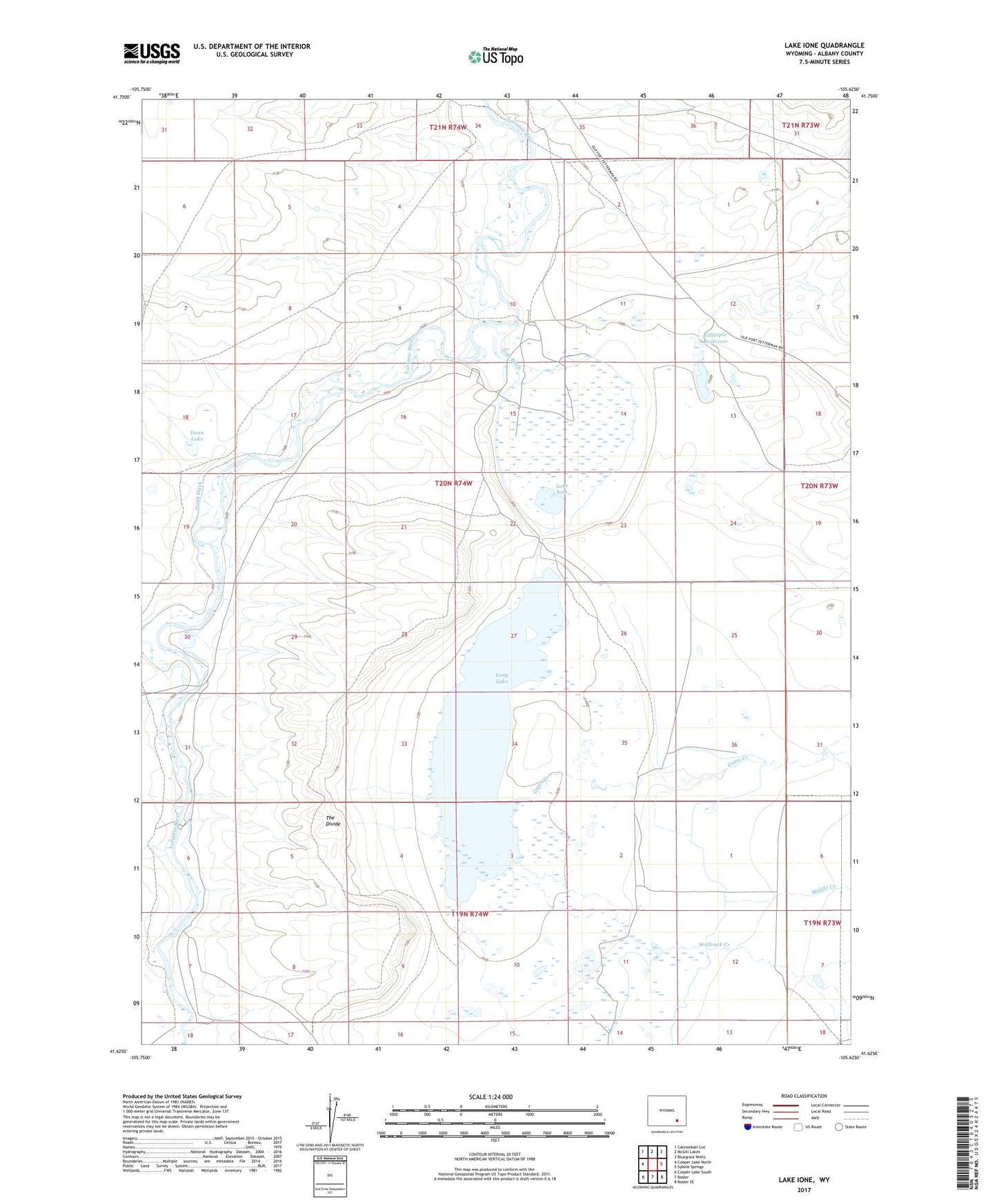
2021 topographic map quadrangle Lake Ione in the state of Wyoming. Scale: 1:24000. Based on the newly updated USGS 7.5' US Topo map series, this map is in the following counties: Albany. The map contains contour data, water features, and other items you are used to seeing on USGS maps, but also has updated roads and other features. This is the next generation of topographic maps. Printed on high-quality waterproof paper with UV fade-resistant inks.
Quads adjacent to this one:
West: Cooper Lake North
Northwest: Cannonball Cut
North: McGill Lakes
Northeast: Bluegrass Wells
East: Sybille Springs
Southeast: Bosler SE
South: Bosler
Southwest: Cooper Lake South
This map covers the same area as the classic USGS quad with code o41105f6.
Contains the following named places: Albany County, Dunn and Gillespie Ditch, Dunn Ditch, Dunn Lake, Gates Creek, Gillespie Reservoir, Ione Ditch, Lake Ione, Long Lake, Middle Creek, Schmale Bros Ranch, The Divide, Wallrock Creek