
MyTopo
Chimney Gulch Wyoming US Topo Map
Couldn't load pickup availability
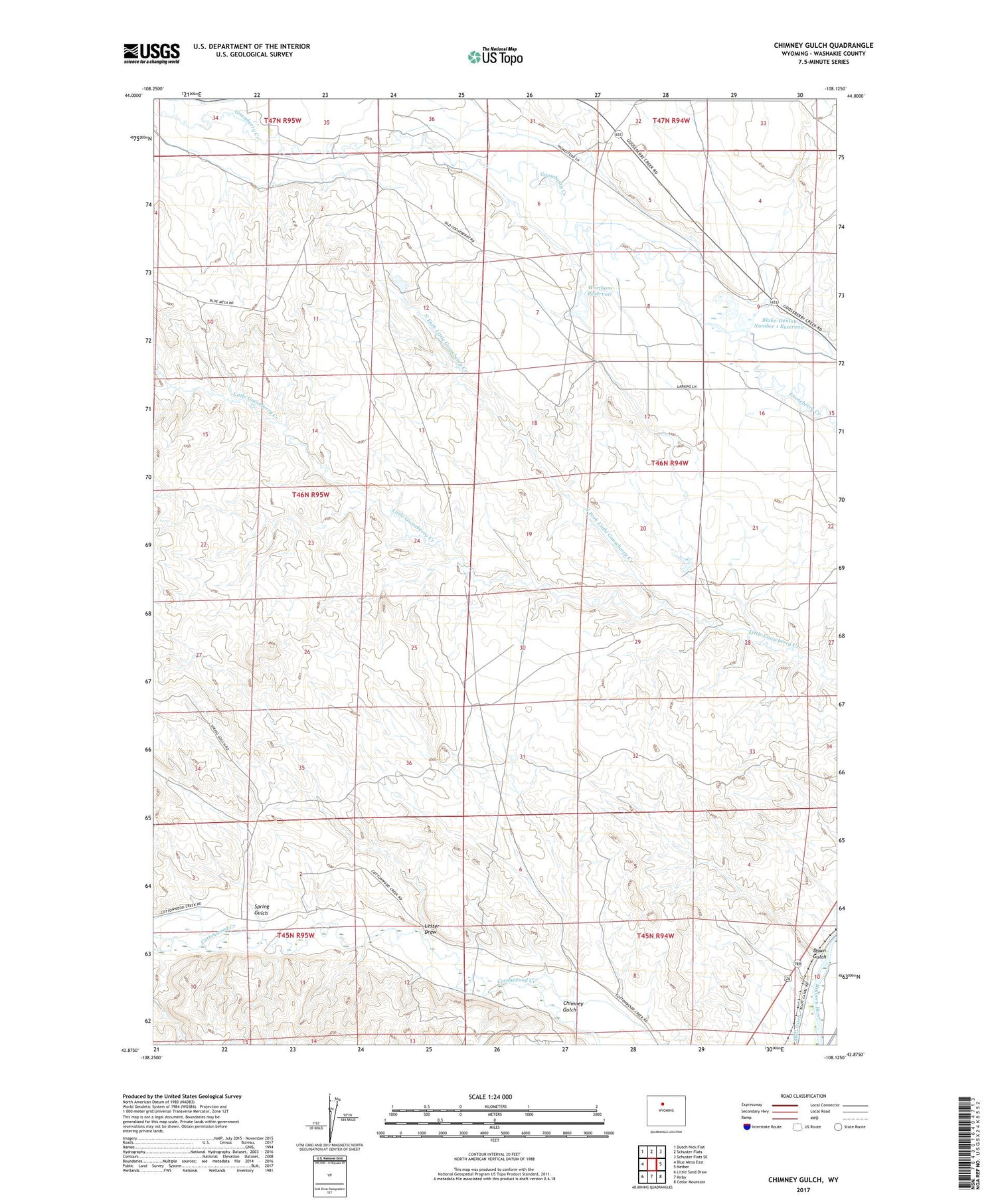
2021 topographic map quadrangle Chimney Gulch in the state of Wyoming. Scale: 1:24000. Based on the newly updated USGS 7.5' US Topo map series, this map is in the following counties: Washakie. The map contains contour data, water features, and other items you are used to seeing on USGS maps, but also has updated roads and other features. This is the next generation of topographic maps. Printed on high-quality waterproof paper with UV fade-resistant inks.
Quads adjacent to this one:
West: Blue Mesa East
Northwest: Dutch Nick Flat
North: Schuster Flats
Northeast: Schuster Flats SE
East: Neiber
Southeast: Cedar Mountain
South: Kirby
Southwest: Little Sand Draw
Contains the following named places: Blake-Denton Number 1 Dam, Blake-Denton Number 1 Reservoir, Blake-Denton Number 2 Dam, Blake-Denton Number 2 Reservoir, Chimney Gulch, Down Gulch, Holland Ditch, Lester Draw, North Fork Little Gooseberry Creek, Spring Gulch, Wortham Dam, Wortham Reservoir, Wortham School, ZIP Code: 82401


