MyTopo
Kirby Wyoming US Topo Map
Couldn't load pickup availability
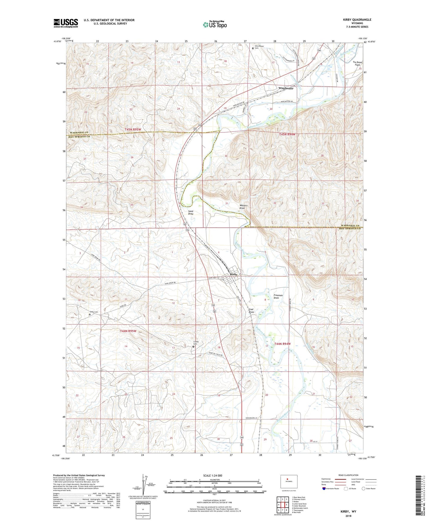
2021 topographic map quadrangle Kirby in the state of Wyoming. Scale: 1:24000. Based on the newly updated USGS 7.5' US Topo map series, this map is in the following counties: Hot Springs, Washakie. The map contains contour data, water features, and other items you are used to seeing on USGS maps, but also has updated roads and other features. This is the next generation of topographic maps. Printed on high-quality waterproof paper with UV fade-resistant inks.
Quads adjacent to this one:
West: Little Sand Draw
Northwest: Blue Mesa East
North: Chimney Gulch
Northeast: Neiber
East: Cedar Mountain
Southeast: Red Hole
South: Thermopolis
Southwest: Rattlesnake Gulch
This map covers the same area as the classic USGS quad with code o43108g2.
Contains the following named places: Coal Draw, Cottonwood Creek, Cowboy Mine, Crosby Cemetery, Crosby Mine, Eagel Mine, Freeman Draw, Gebo, Gebo Cemetery, Kirby, Sand Draw, The Willows, Town of Kirby, Walters Draw, Winchester, Winchester Cemetery, Winchester Chatham Station, ZIP Code: 82430