MyTopo
Clifton Wyoming US Topo Map
Couldn't load pickup availability
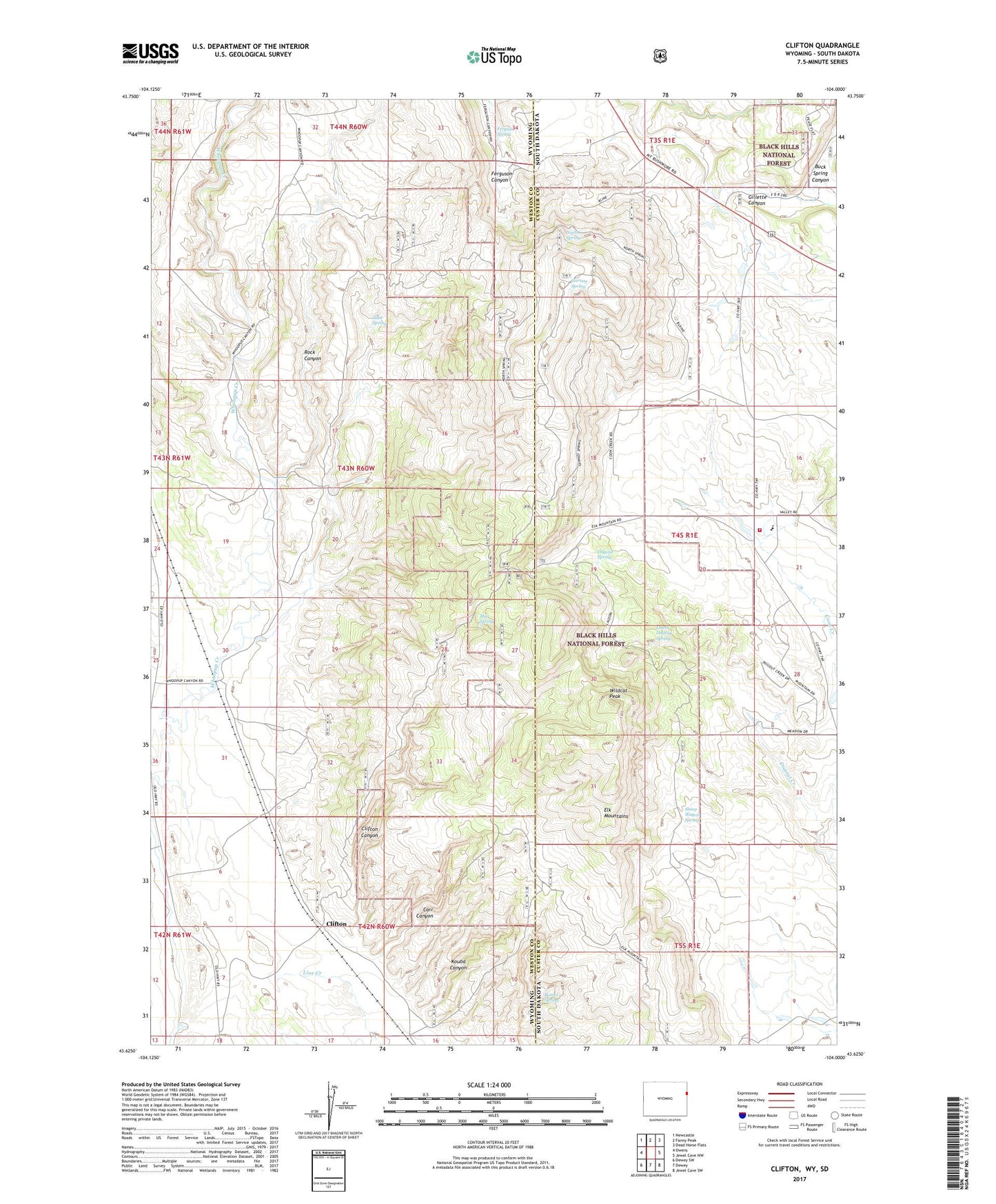
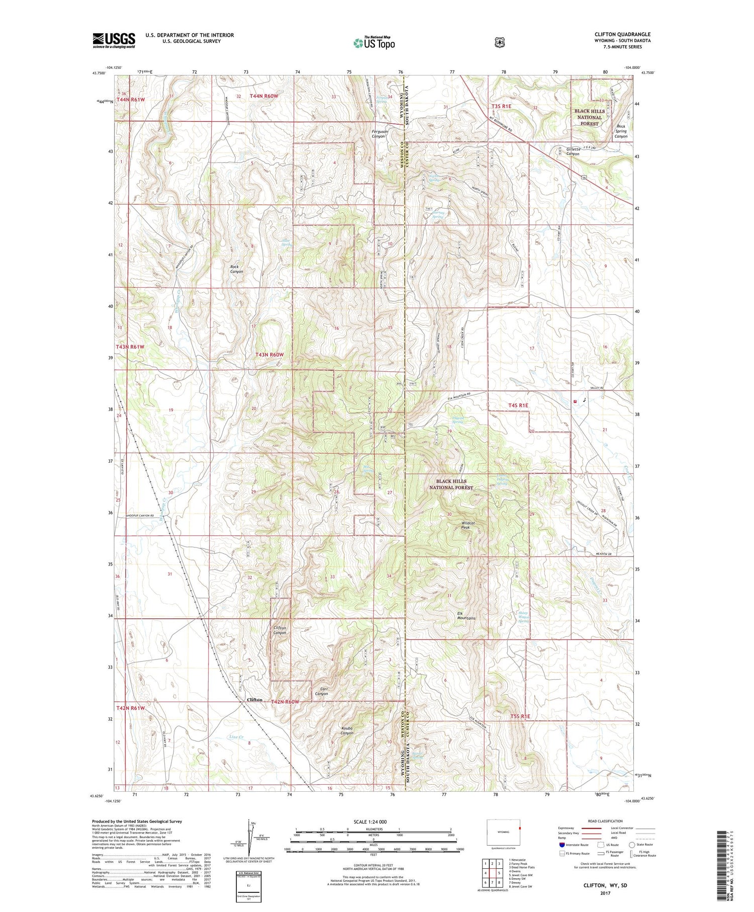
2021 topographic map quadrangle Clifton in the states of Wyoming, South Dakota. Scale: 1:24000. Based on the newly updated USGS 7.5' US Topo map series, this map is in the following counties: Weston, Custer. The map contains contour data, water features, and other items you are used to seeing on USGS maps, but also has updated roads and other features. This is the next generation of topographic maps. Printed on high-quality waterproof paper with UV fade-resistant inks.
Quads adjacent to this one:
West: Owens
Northwest: Newcastle
North: Fanny Peak
Northeast: Dead Horse Flats
East: Jewel Cave NW
Southeast: Jewel Cave SW
South: Dewey
Southwest: Dewey SW
Contains the following named places: Alray Prospect, Barrel Spring, Blaine Ranch, Buck Spring Canyon, Carr Canyon, Clifton, Clifton Canyon, Clifton School, Dugout Spring, Elk Mountains, Elk Mountains Lookout Tower, Ferguson Spring, Foster Mine, Gurney Spring, Highlands Volunteer Fire Department, Kouba Canyon, L. Shuck Property Mine, Lower Dugout Spring, Mix Spring, North Spring, Rock Canyon, Sheep Wagon Spring, Slate Spring, Wildcat Peak