MyTopo
Jewel Cave SW South Dakota US Topo Map
Couldn't load pickup availability
Also explore the Jewel Cave SW Forest Service Topo of this same quad for updated USFS data
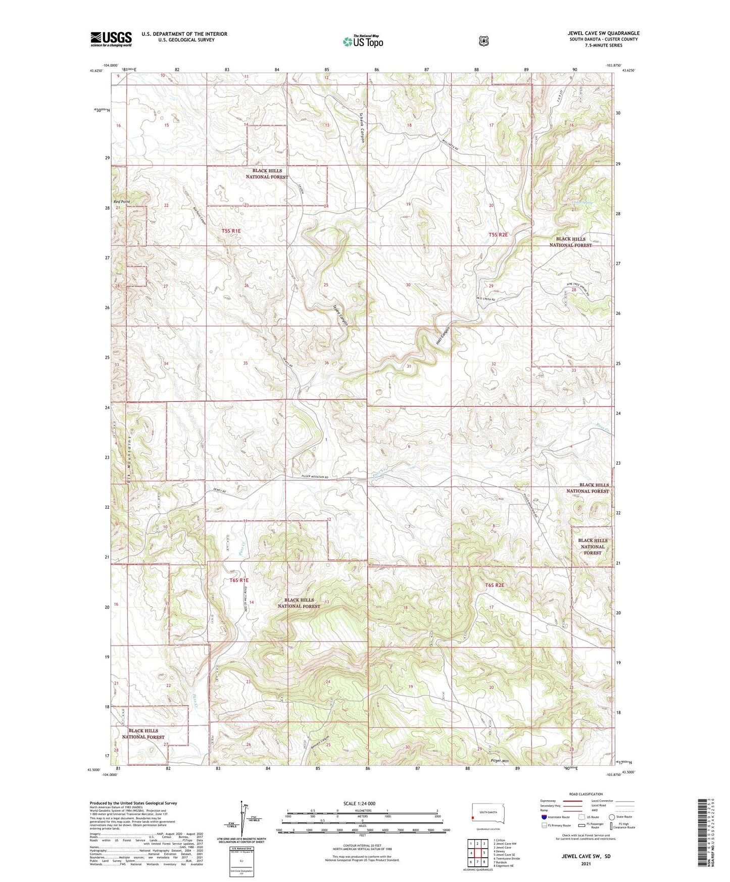
2021 topographic map quadrangle Jewel Cave SW in the state of South Dakota. Scale: 1:24000. Based on the newly updated USGS 7.5' US Topo map series, this map is in the following counties: Custer. The map contains contour data, water features, and other items you are used to seeing on USGS maps, but also has updated roads and other features. This is the next generation of topographic maps. Printed on high-quality waterproof paper with UV fade-resistant inks.
Quads adjacent to this one:
West: Dewey
Northwest: Clifton
North: Jewel Cave NW
Northeast: Jewel Cave
East: Jewel Cave SE
Southeast: Edgemont NE
South: Burdock
This map covers the same area as the classic USGS quad with code o43103e8.
Contains the following named places: Breasne Dam, Cedar Spring, Hell Canyon, Pass Creek Well, Pilger Mountain, Putnam Dam, Red Point Canyon, Schenk Canyon, Tepee Canyon, Walsh Well