MyTopo
Dewey SW Wyoming US Topo Map
Couldn't load pickup availability
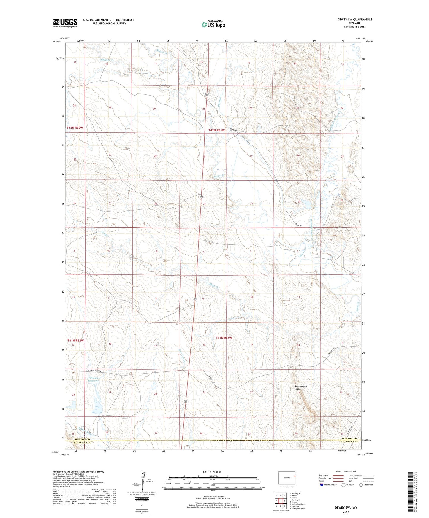
2021 topographic map quadrangle Dewey SW in the state of Wyoming. Scale: 1:24000. Based on the newly updated USGS 7.5' US Topo map series, this map is in the following counties: Weston, Niobrara. The map contains contour data, water features, and other items you are used to seeing on USGS maps, but also has updated roads and other features. This is the next generation of topographic maps. Printed on high-quality waterproof paper with UV fade-resistant inks.
Quads adjacent to this one:
West: Morrisey SE
Northwest: Morrisey NE
North: Owens
Northeast: Clifton
East: Dewey
South: Riverview
Southwest: Little Alkali Creek
This map covers the same area as the classic USGS quad with code o43104e2.
Contains the following named places: Blacktail Creek, Fillinger Dam, Fillinger Reservoir, Gerald Barrow Number One Mine, Gerald Barrow Number Two Mine, Gerald Darrow Number Three Mine, M W Dam, Rattlesnake Ridge, Sheep Creek, Sheep Creek Mine, Slide Dam, Slide Reservoir, South Beaver Creek, Stockade Beaver Creek