MyTopo
Coyer Reservoir Wyoming US Topo Map
Couldn't load pickup availability
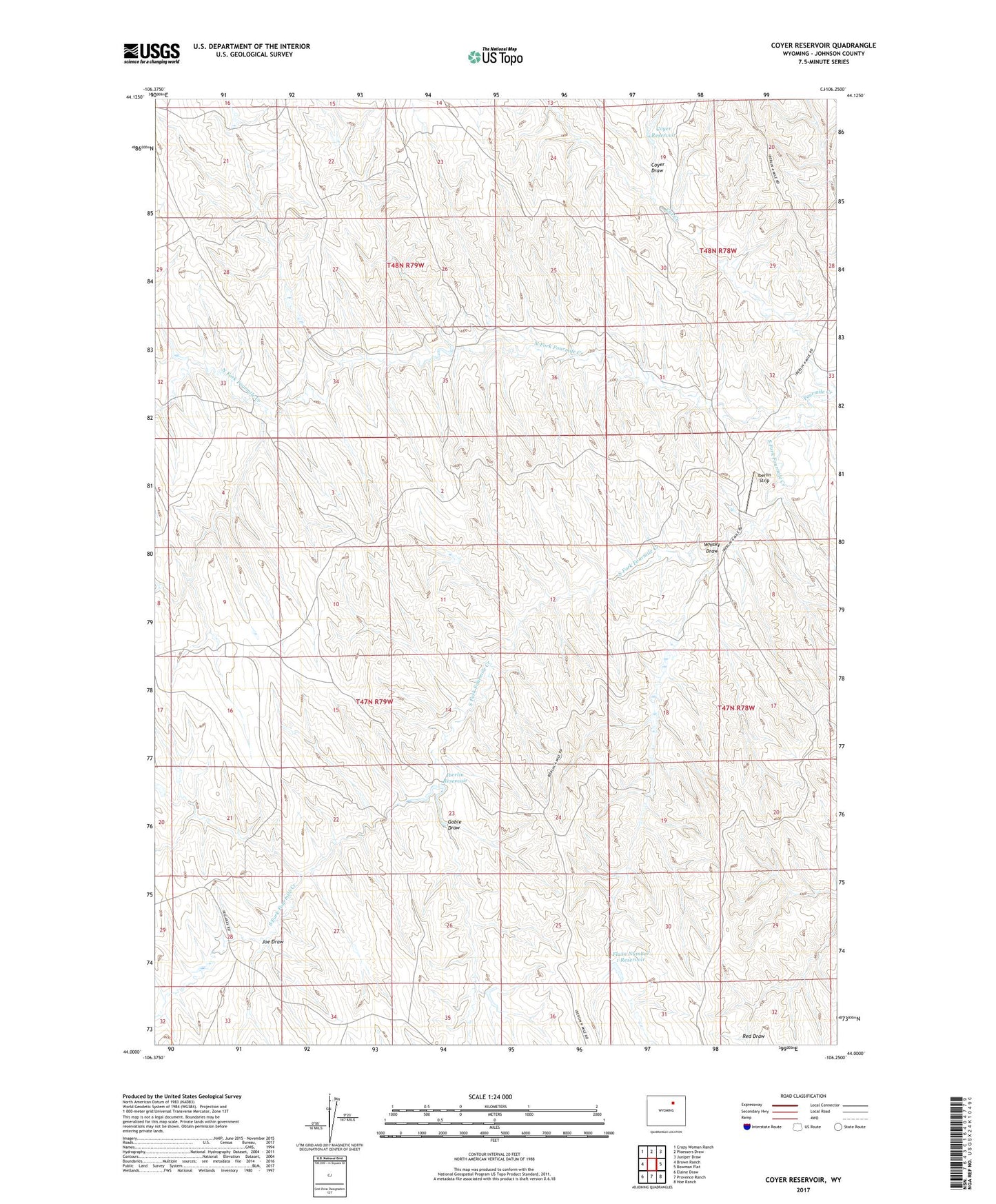
2021 topographic map quadrangle Coyer Reservoir in the state of Wyoming. Scale: 1:24000. Based on the newly updated USGS 7.5' US Topo map series, this map is in the following counties: Johnson. The map contains contour data, water features, and other items you are used to seeing on USGS maps, but also has updated roads and other features. This is the next generation of topographic maps. Printed on high-quality waterproof paper with UV fade-resistant inks.
Quads adjacent to this one:
West: Brown Ranch
Northwest: Crazy Woman Ranch
North: Ploessers Draw
Northeast: Juniper Draw
East: Bowman Flat
Southeast: Hoe Ranch
South: Provence Ranch
Southwest: Elaine Draw
Contains the following named places: Bridge Well, Cat Creek, Coyer Draw, Coyer Reservoir, Falxa Number 1 Dam, Flaxa Number 1 Reservoir, Fourmile Ranch, Goble Draw, Iberlin Dam, Iberlin Reservoir, Iberlin Strip, Joe Draw, North Fork Fourmile Creek, South Fork Fourmile Creek, Whisky Draw