MyTopo
Elaine Draw Wyoming US Topo Map
Couldn't load pickup availability
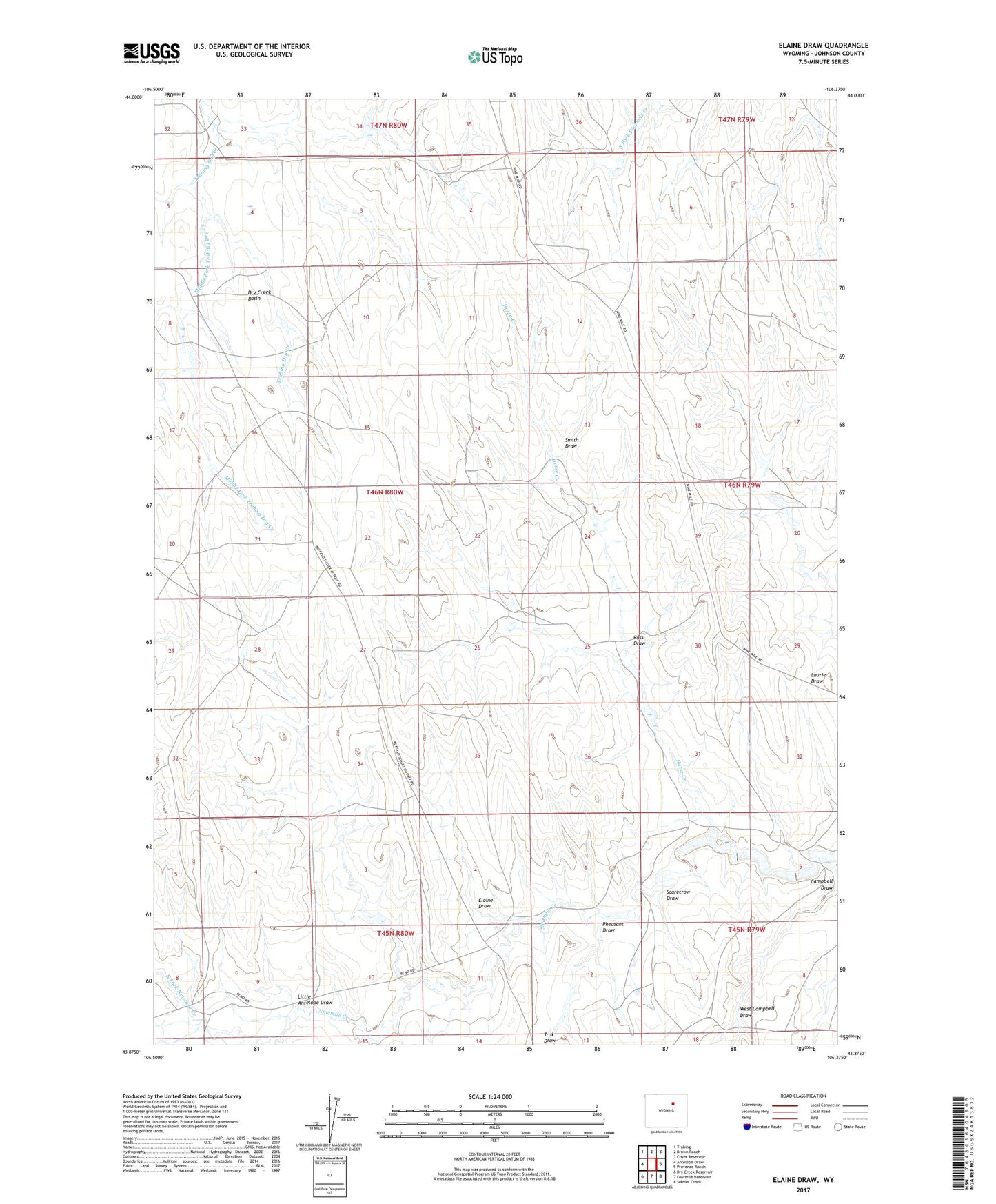
2021 topographic map quadrangle Elaine Draw in the state of Wyoming. Scale: 1:24000. Based on the newly updated USGS 7.5' US Topo map series, this map is in the following counties: Johnson. The map contains contour data, water features, and other items you are used to seeing on USGS maps, but also has updated roads and other features. This is the next generation of topographic maps. Printed on high-quality waterproof paper with UV fade-resistant inks.
Quads adjacent to this one:
West: Antelope Draw
Northwest: Trabing
North: Brown Ranch
Northeast: Coyer Reservoir
East: Provence Ranch
Southeast: Soldier Creek
South: Fourmile Reservoir
Southwest: Dry Creek Reservoir
This map covers the same area as the classic USGS quad with code o43106h4.
Contains the following named places: Campbell Draw, Dry Creek Basin, Eklund J 3 Ranch, Elaine Draw, Horse Creek, Little Antelope Draw, Middle Fork Trabing Dry Creek, North Fork Ninemile Creek, Pheasant Draw, Ross Draw, Scarecrow Draw, Smith Draw, West Campbell Draw