
MyTopo
Dodge Ranch Wyoming US Topo Map
Couldn't load pickup availability
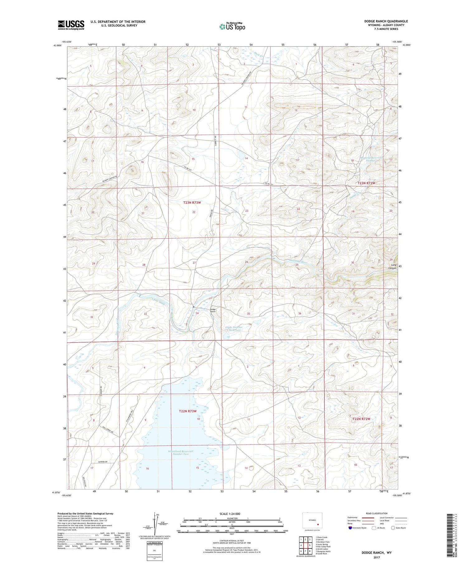
2021 topographic map quadrangle Dodge Ranch in the state of Wyoming. Scale: 1:24000. Based on the newly updated USGS 7.5' US Topo map series, this map is in the following counties: Albany. The map contains contour data, water features, and other items you are used to seeing on USGS maps, but also has updated roads and other features. This is the next generation of topographic maps. Printed on high-quality waterproof paper with UV fade-resistant inks.
Quads adjacent to this one:
West: Ayres Spring
Northwest: Pinto Creek
North: Garrett
Northeast: Davidson Flats
East: Bull Camp Peak
Southeast: Guide Rock
South: Bluegrass Wells
Southwest: McGill Lakes
Contains the following named places: Dodge Creek, Dodge Ranch, Glade Dam, Glade Number 2 Reservoir, Kennedy Number 1 Dam, Kennedy Ranch, Kennedy Reservoir Number 1, Long Canyon, Lost Creek Dam, Lost Creek Reservoir, North Albany Club, Palmer Ranch, South Side Ditch


