MyTopo
Bull Camp Peak Wyoming US Topo Map
Couldn't load pickup availability
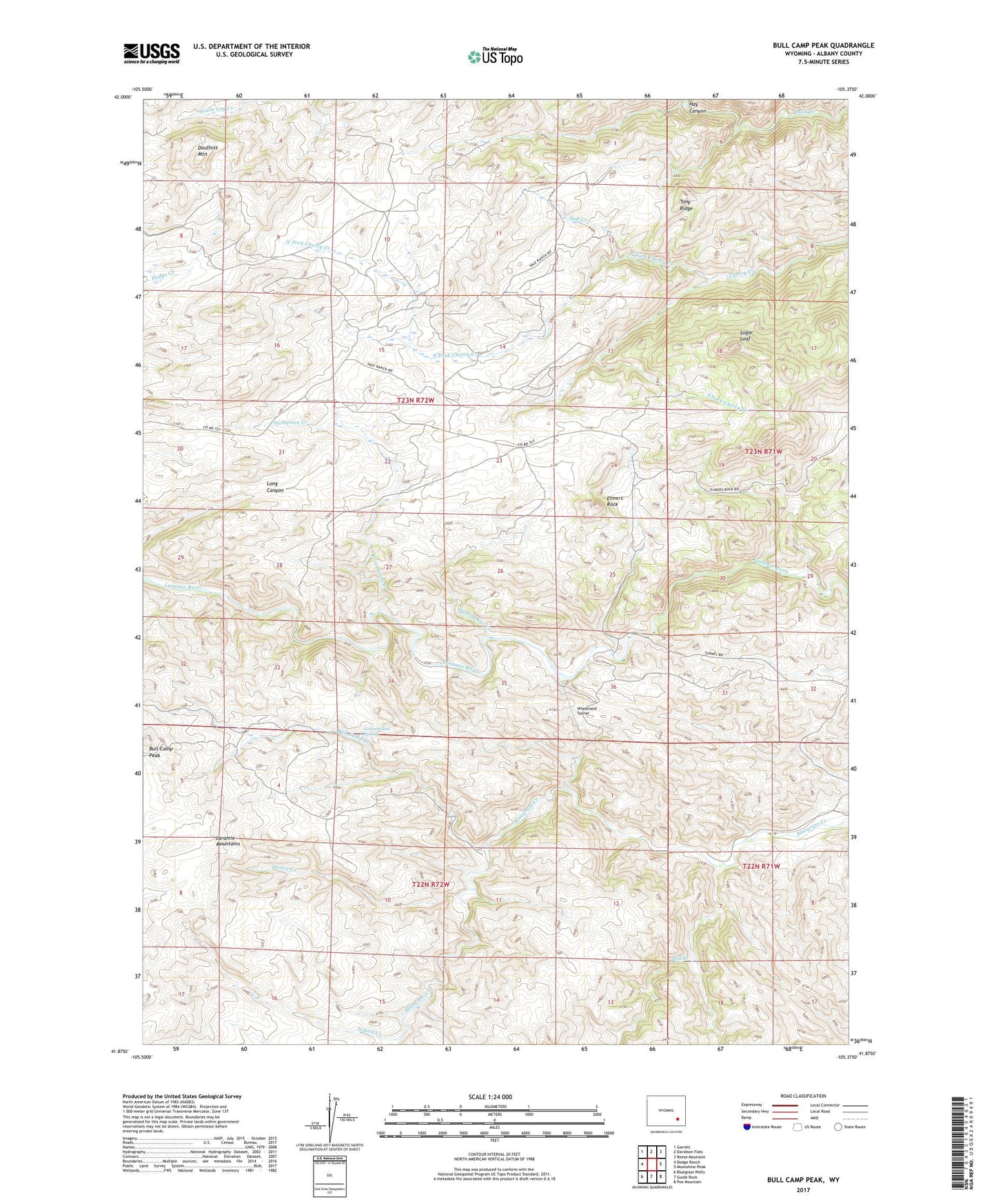
2021 topographic map quadrangle Bull Camp Peak in the state of Wyoming. Scale: 1:24000. Based on the newly updated USGS 7.5' US Topo map series, this map is in the following counties: Albany. The map contains contour data, water features, and other items you are used to seeing on USGS maps, but also has updated roads and other features. This is the next generation of topographic maps. Printed on high-quality waterproof paper with UV fade-resistant inks.
Quads adjacent to this one:
West: Dodge Ranch
Northwest: Garrett
North: Davidson Flats
Northeast: Reese Mountain
East: Moonshine Peak
Southeast: Poe Mountain
South: Guide Rock
Southwest: Bluegrass Wells
This map covers the same area as the classic USGS quad with code o41105h4.
Contains the following named places: Bull Camp Creek, Bull Camp Peak, Cottonwood Spring, Desert Creek, Dipping Vat Creek, Douthitt Mountain, Elmers Rock, Halleck Canyon Area Mine, Halleck Canyon Mine, Hay Canyon, Kennedy Ranch, Kennedy School, Mill Creek, North Fork Cherry Creek, Preemption Creek, Salt Creek, School Creek, Shellhart Fish and Stock Dam, Shellhart Fish and Stock Reservoir, South Fork Cherry Creek, Sugar Loaf, Tony Ridge, Wheatland Tunnel