MyTopo
Davidson Flats Wyoming US Topo Map
Couldn't load pickup availability
Also explore the Davidson Flats Forest Service Topo of this same quad for updated USFS data
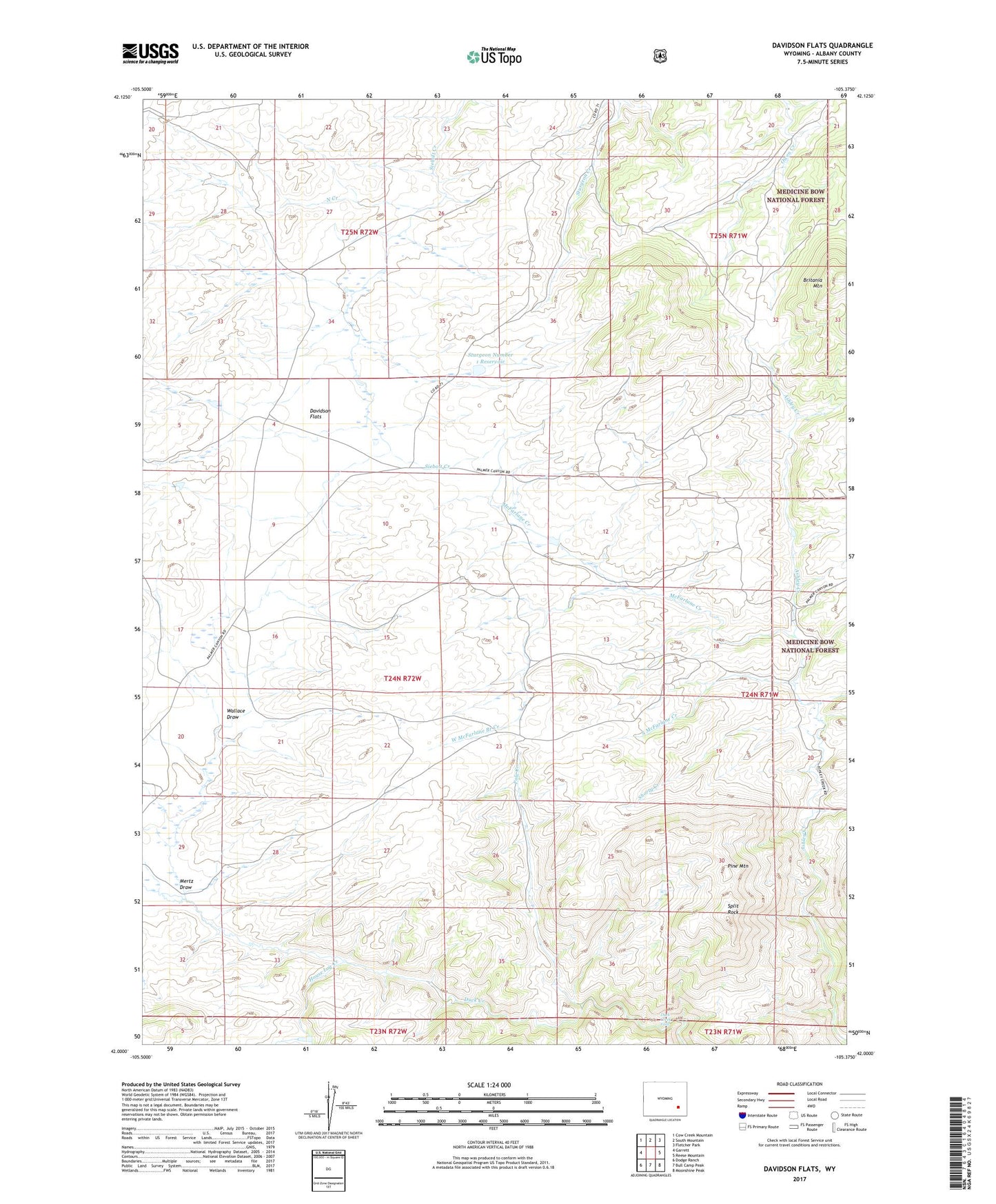
2021 topographic map quadrangle Davidson Flats in the state of Wyoming. Scale: 1:24000. Based on the newly updated USGS 7.5' US Topo map series, this map is in the following counties: Albany. The map contains contour data, water features, and other items you are used to seeing on USGS maps, but also has updated roads and other features. This is the next generation of topographic maps. Printed on high-quality waterproof paper with UV fade-resistant inks.
Quads adjacent to this one:
West: Garrett
Northwest: Cow Creek Mountain
North: South Mountain
Northeast: Fletcher Park
East: Reese Mountain
Southeast: Moonshine Peak
South: Bull Camp Peak
Southwest: Dodge Ranch
This map covers the same area as the classic USGS quad with code o42105a4.
Contains the following named places: Ashley Creek, Britania Mountain, Davidson Flats, Duck Creek Falls, House Log Creek, McFarlane Creek, Mertz Draw, North Creek, Pine Mountain, Pole Creek, Shorty Creek, South McFarlane Creek, Split Rock, Sturgeon Number 1 Dam, Sturgeon Number 1 Reservoir, Wallace Draw, West McFarlane Branch Creek