MyTopo
Fanny Peak Wyoming US Topo Map
Couldn't load pickup availability
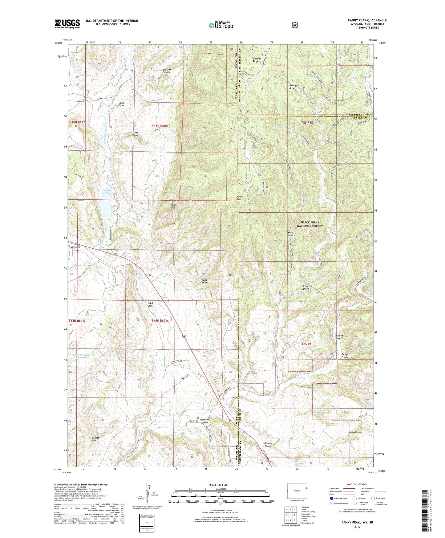
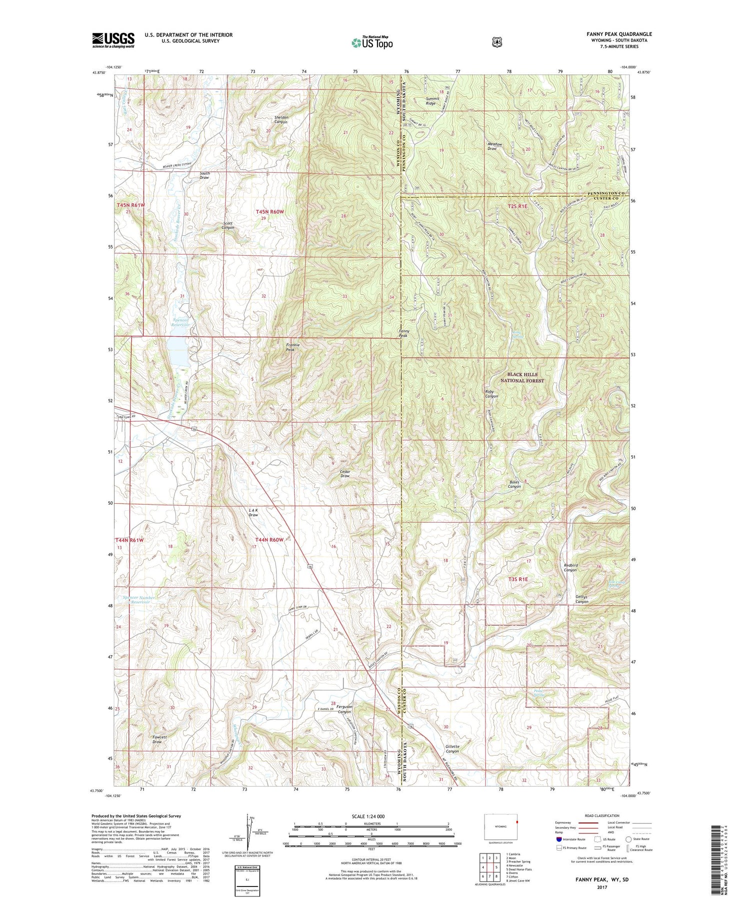
2021 topographic map quadrangle Fanny Peak in the states of Wyoming, South Dakota. Scale: 1:24000. Based on the newly updated USGS 7.5' US Topo map series, this map is in the following counties: Weston, Custer, Pennington. The map contains contour data, water features, and other items you are used to seeing on USGS maps, but also has updated roads and other features. This is the next generation of topographic maps. Printed on high-quality waterproof paper with UV fade-resistant inks.
Quads adjacent to this one:
West: Newcastle
Northwest: Cambria
North: Moon
Northeast: Preacher Spring
East: Dead Horse Flats
Southeast: Jewel Cave NW
South: Clifton
Southwest: Owens
Contains the following named places: Boles Canyon, Cedar Draw, Fanny Peak, Fawcett Draw, Ferguson Canyon, Frannie Peak, Gettys Canyon, Gillette Canyon, L A K Draw, L A K Ranch, L A K Reservoir, Lak Reservoir Area Number One Mine, Lak Reservoir Area Number Three Mine, Meadow Draw, O'Neil Pit, Pease Spring, Raby Pit, Rats Valley Creek, Redbird Canyon, Roby Canyon, Roby Spring, Scott Canyon, Sheldon Canyon, Sheldon Canyon Mine, Side Camp Spring, South Draw, Spencer Dam, Spencer Number 2 Reservoir, Summit Ridge Lookout, Sweet Gravel Pit, Sweet School