MyTopo
Flat Top Wyoming US Topo Map
Couldn't load pickup availability
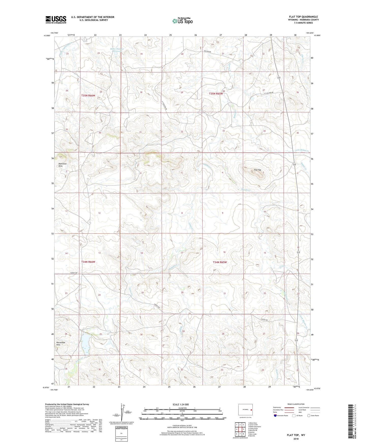
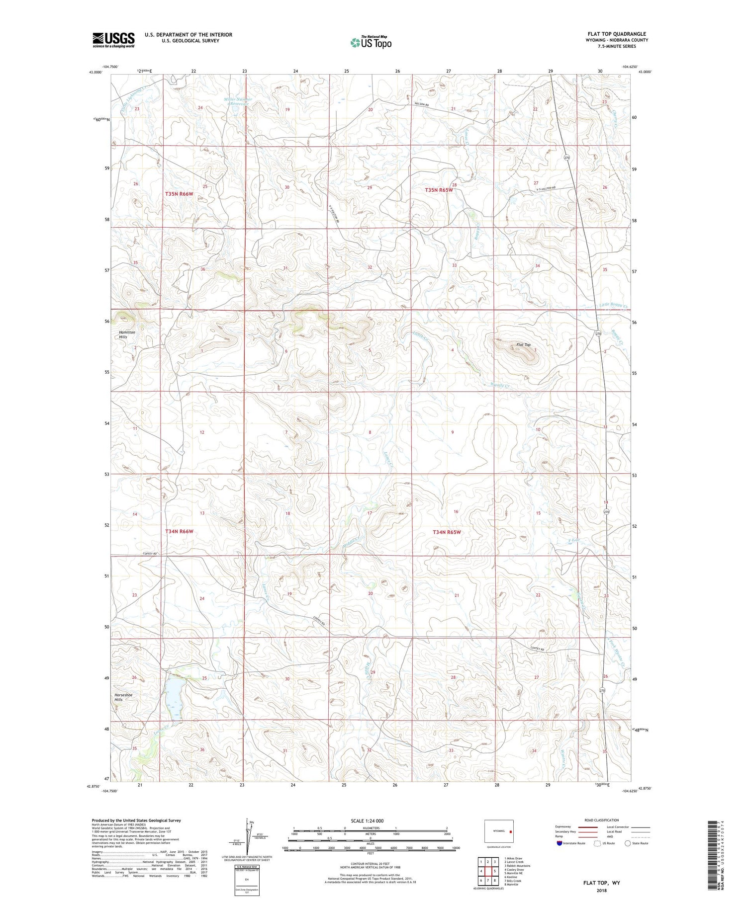
2021 topographic map quadrangle Flat Top in the state of Wyoming. Scale: 1:24000. Based on the newly updated USGS 7.5' US Topo map series, this map is in the following counties: Niobrara. The map contains contour data, water features, and other items you are used to seeing on USGS maps, but also has updated roads and other features. This is the next generation of topographic maps. Printed on high-quality waterproof paper with UV fade-resistant inks.
Quads adjacent to this one:
West: Cooley Draw
Northwest: Mikes Draw
North: Lance Creek
Northeast: Rabbit Mountains
East: Manville NE
Southeast: Manville
South: Bills Creek
Southwest: Keeline
Contains the following named places: Boggy Creek, F F Creek, Flat Top, Joss Dam, Lightning Creek Oil Field, Little Boggy Creek, Middle Creek, Miller Number 1 Dam, Miller Number 1 Reservoir, North Fork Wyatte Creek, Wyatte Creek