MyTopo
Mikes Draw Wyoming US Topo Map
Couldn't load pickup availability
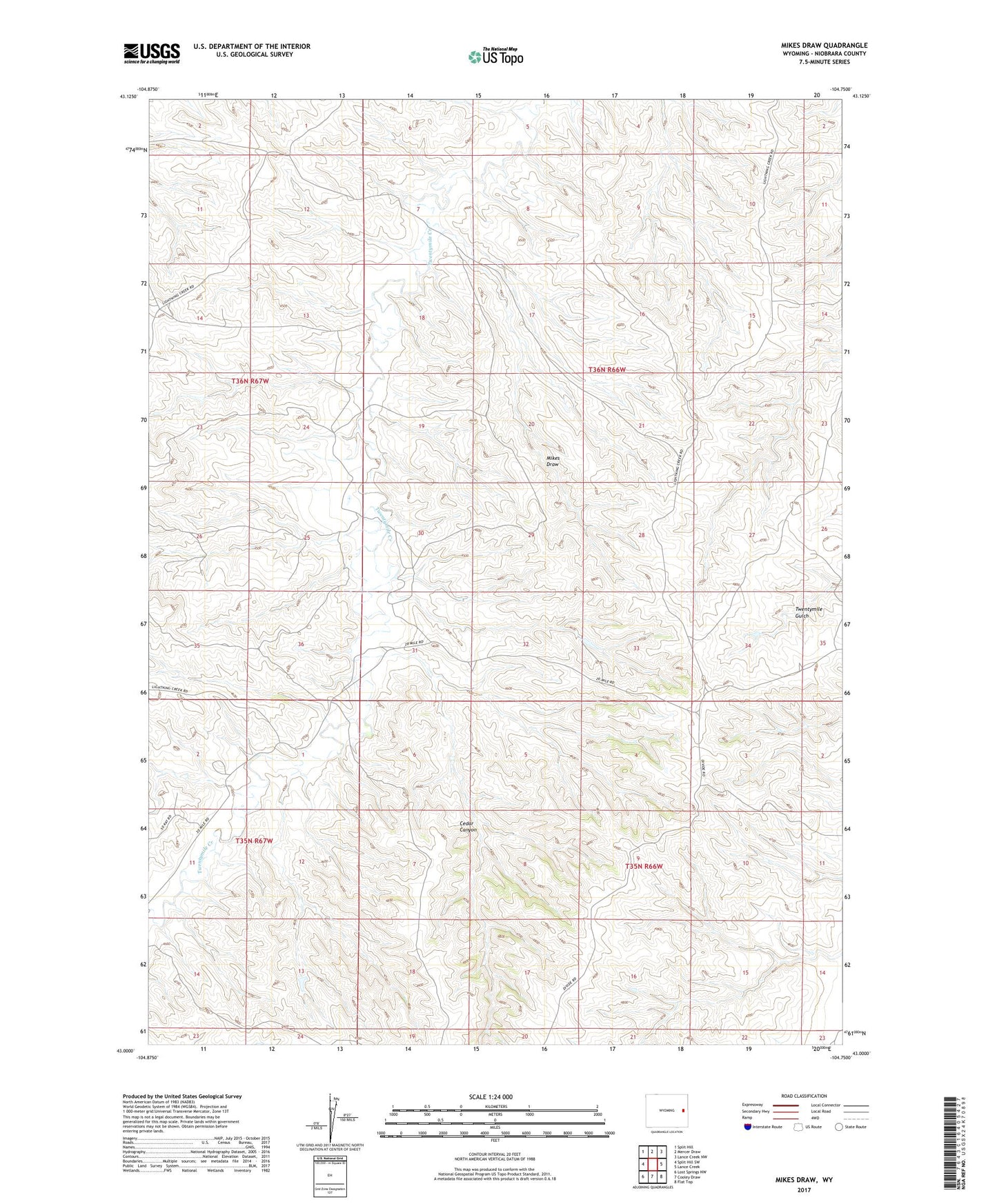
2021 topographic map quadrangle Mikes Draw in the state of Wyoming. Scale: 1:24000. Based on the newly updated USGS 7.5' US Topo map series, this map is in the following counties: Niobrara. The map contains contour data, water features, and other items you are used to seeing on USGS maps, but also has updated roads and other features. This is the next generation of topographic maps. Printed on high-quality waterproof paper with UV fade-resistant inks.
Quads adjacent to this one:
West: Split Hill SW
Northwest: Split Hill
North: Mercer Draw
Northeast: Lance Creek NW
East: Lance Creek
Southeast: Flat Top
South: Cooley Draw
Southwest: Lost Springs NW
This map covers the same area as the classic USGS quad with code o43104a7.
Contains the following named places: Cedar Canyon, Mikes Draw, Phil Number 1 Dam, Phil Number 1 Reservoir, ZIP Code: 82224