MyTopo
Rabbit Mountains Wyoming US Topo Map
Couldn't load pickup availability
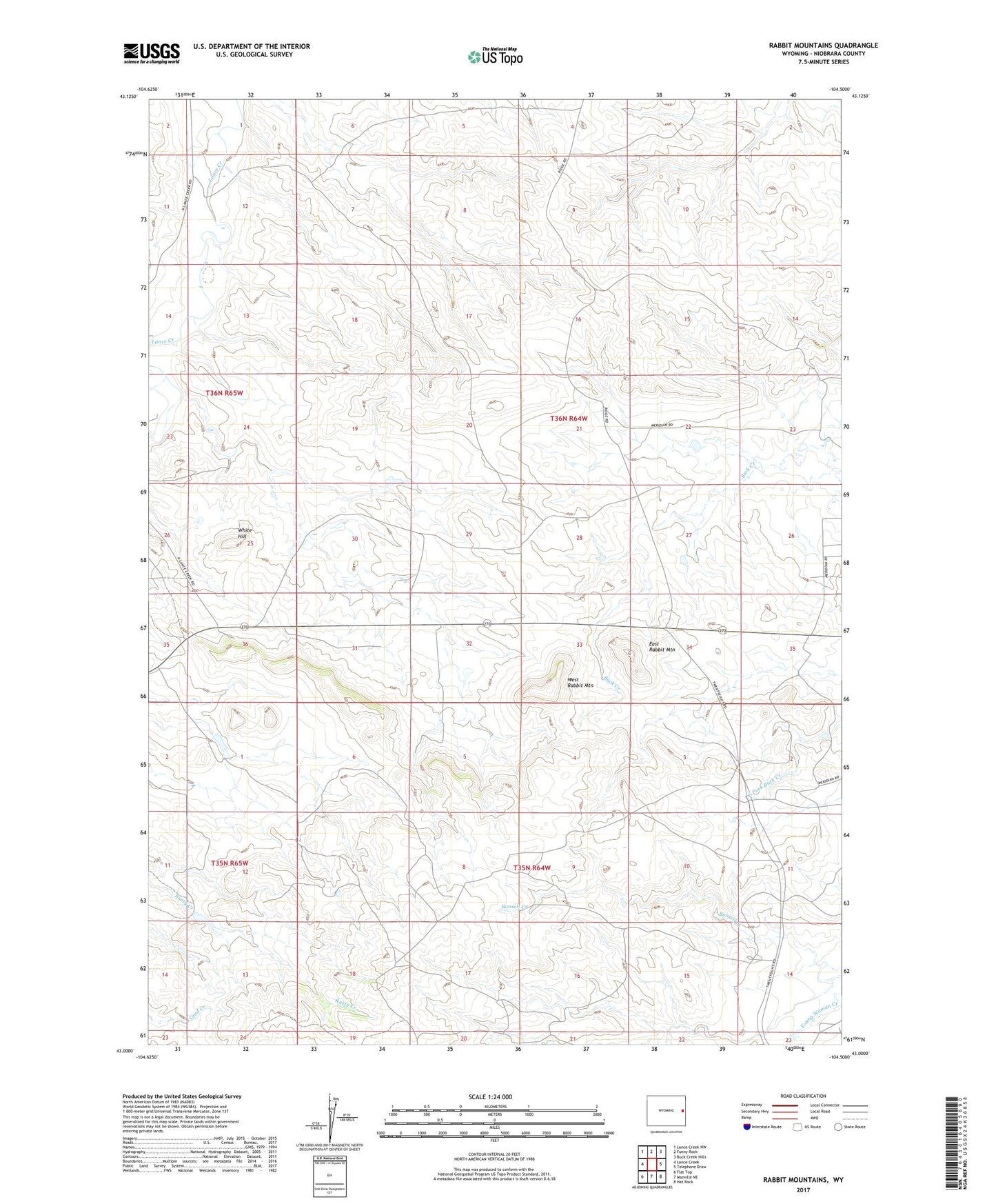
2021 topographic map quadrangle Rabbit Mountains in the state of Wyoming. Scale: 1:24000. Based on the newly updated USGS 7.5' US Topo map series, this map is in the following counties: Niobrara. The map contains contour data, water features, and other items you are used to seeing on USGS maps, but also has updated roads and other features. This is the next generation of topographic maps. Printed on high-quality waterproof paper with UV fade-resistant inks.
Quads adjacent to this one:
West: Lance Creek
Northwest: Lance Creek NW
North: Funny Rock
Northeast: Buck Creek Hills
East: Telephone Draw
Southeast: Hat Rock
South: Manville NE
Southwest: Flat Top
This map covers the same area as the classic USGS quad with code o43104a5.
Contains the following named places: Carrico Number 1 Dam, Carrico Number 1 Reservoir, East Fork Buck Creek, East Rabbit Mountain, Provost Number 2 Dam, Provost Number 2 Reservoir, West Niobrara Division, West Rabbit Mountain, White Hill