MyTopo
Gillies Draw Wyoming US Topo Map
Couldn't load pickup availability
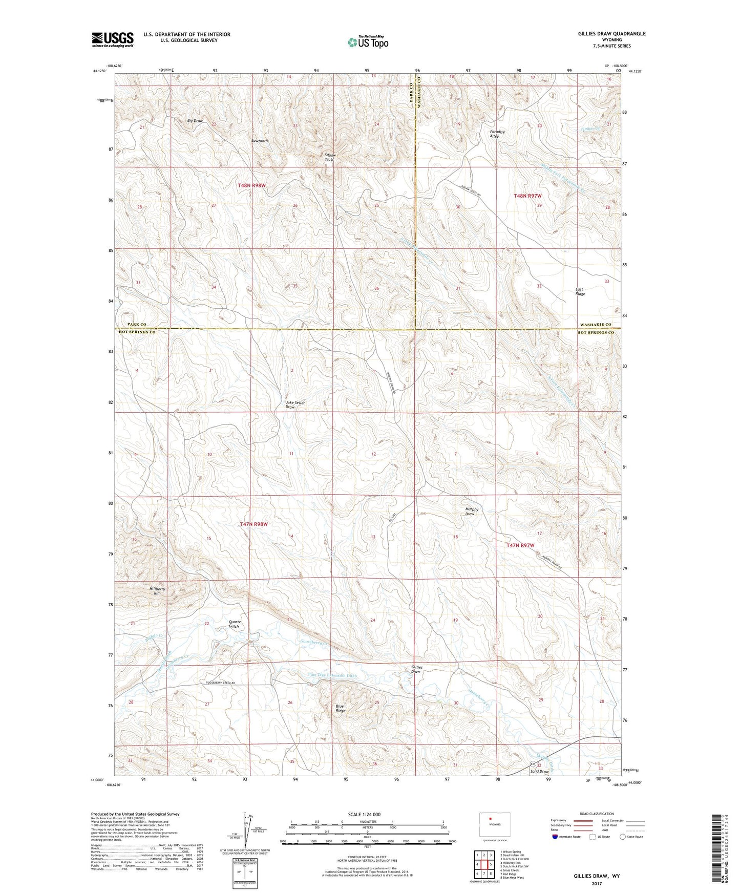
2021 topographic map quadrangle Gillies Draw in the state of Wyoming. Scale: 1:24000. Based on the newly updated USGS 7.5' US Topo map series, this map is in the following counties: Hot Springs, Park, Washakie. The map contains contour data, water features, and other items you are used to seeing on USGS maps, but also has updated roads and other features. This is the next generation of topographic maps. Printed on high-quality waterproof paper with UV fade-resistant inks.
Quads adjacent to this one:
West: Hillberry Rim
Northwest: Wilson Spring
North: Dead Indian Hill
Northeast: Dutch Nick Flat NW
East: Dutch Nick Flat SW
Southeast: Blue Mesa West
South: Red Ridge
Southwest: Grass Creek
Contains the following named places: Buffalo Creek, Bull Knoll, Gillies Draw, Jake Seller Draw, Murphy Ditch, Pine Tree Extension Ditch, Quartz Ditch, Quartz Gulch, Sand Draw, Sawtooth, Squaw Teats