MyTopo
Gordon Creek Wyoming US Topo Map
Couldn't load pickup availability
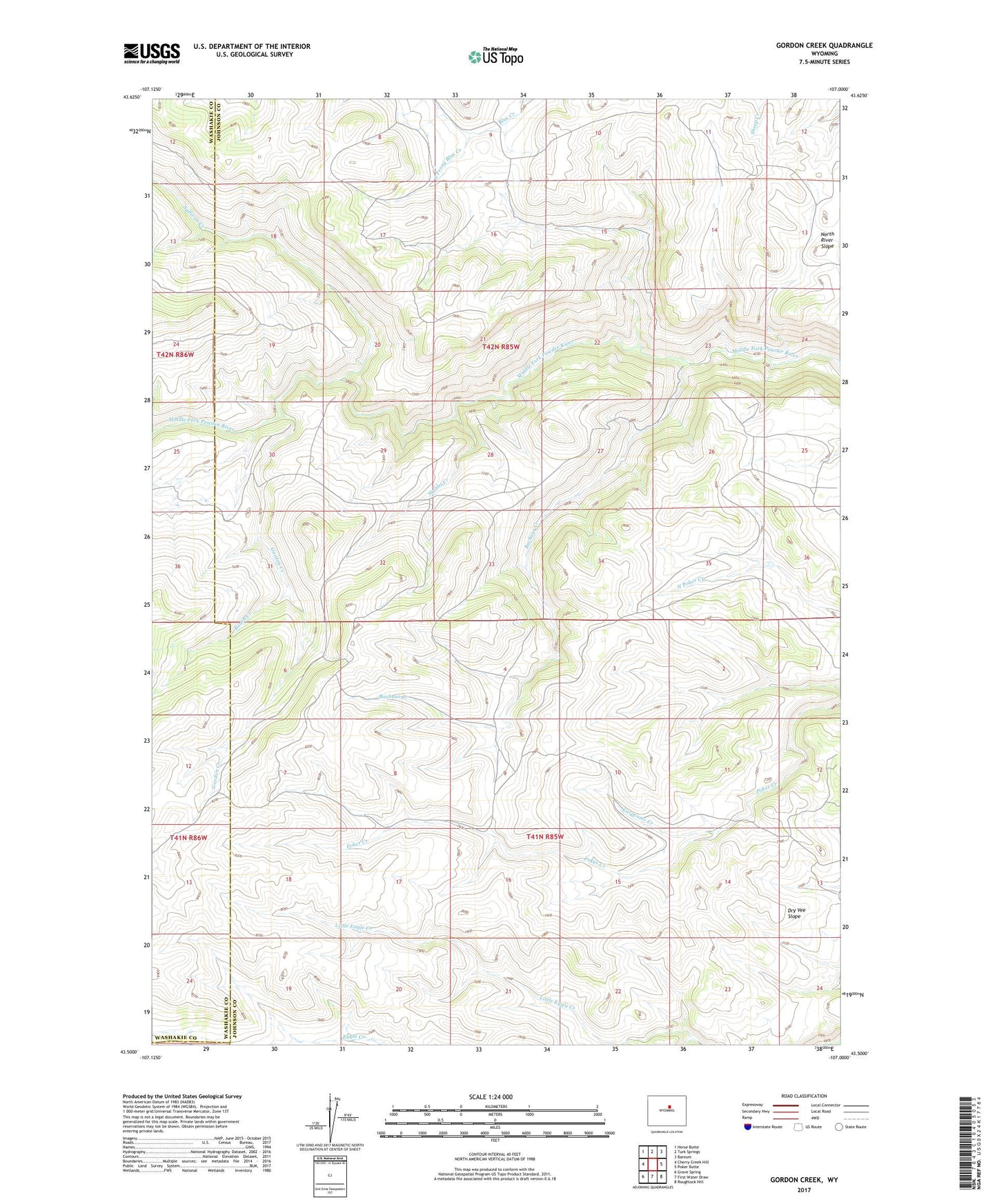
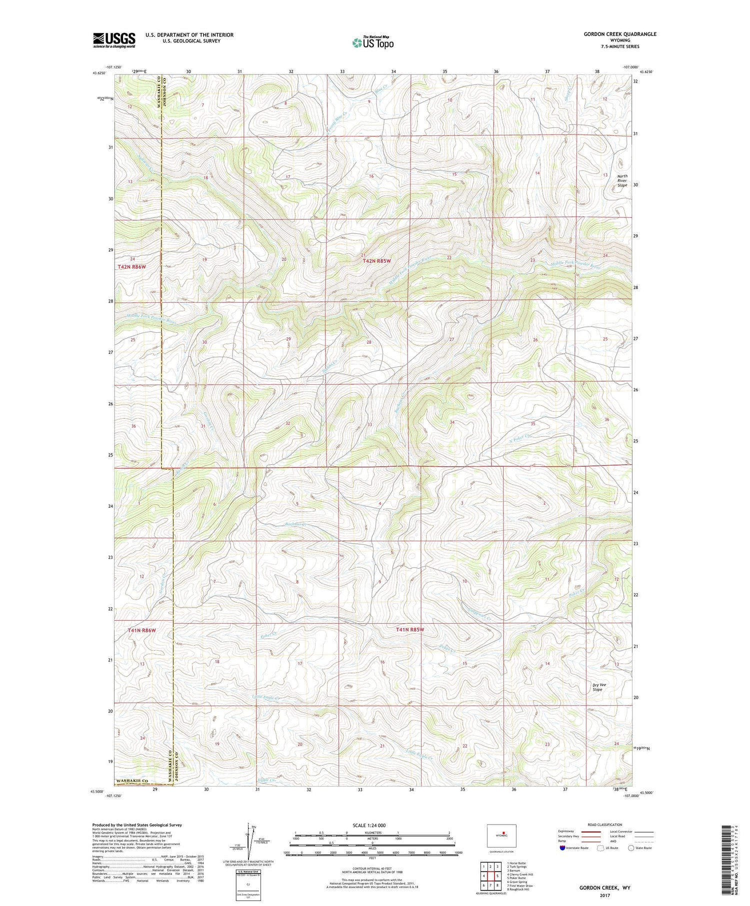
2021 topographic map quadrangle Gordon Creek in the state of Wyoming. Scale: 1:24000. Based on the newly updated USGS 7.5' US Topo map series, this map is in the following counties: Johnson, Washakie, Natrona. The map contains contour data, water features, and other items you are used to seeing on USGS maps, but also has updated roads and other features. This is the next generation of topographic maps. Printed on high-quality waterproof paper with UV fade-resistant inks.
Quads adjacent to this one:
West: Cherry Creek Hill
Northwest: Horse Butte
North: Turk Springs
Northeast: Barnum
East: Poker Butte
Southeast: Roughlock Hill
South: First Water Draw
Southwest: Grave Spring
Contains the following named places: Bachaus Creek, Carpenter Creek, Gordon Creek, Little Eagle Creek, North Poker Creek Dam, North Poker Creek Reservoir, Roush Creek, South Prong Blue Creek, Stubbs Creek, Sullivan Creek