MyTopo
Roughlock Hill Wyoming US Topo Map
Couldn't load pickup availability
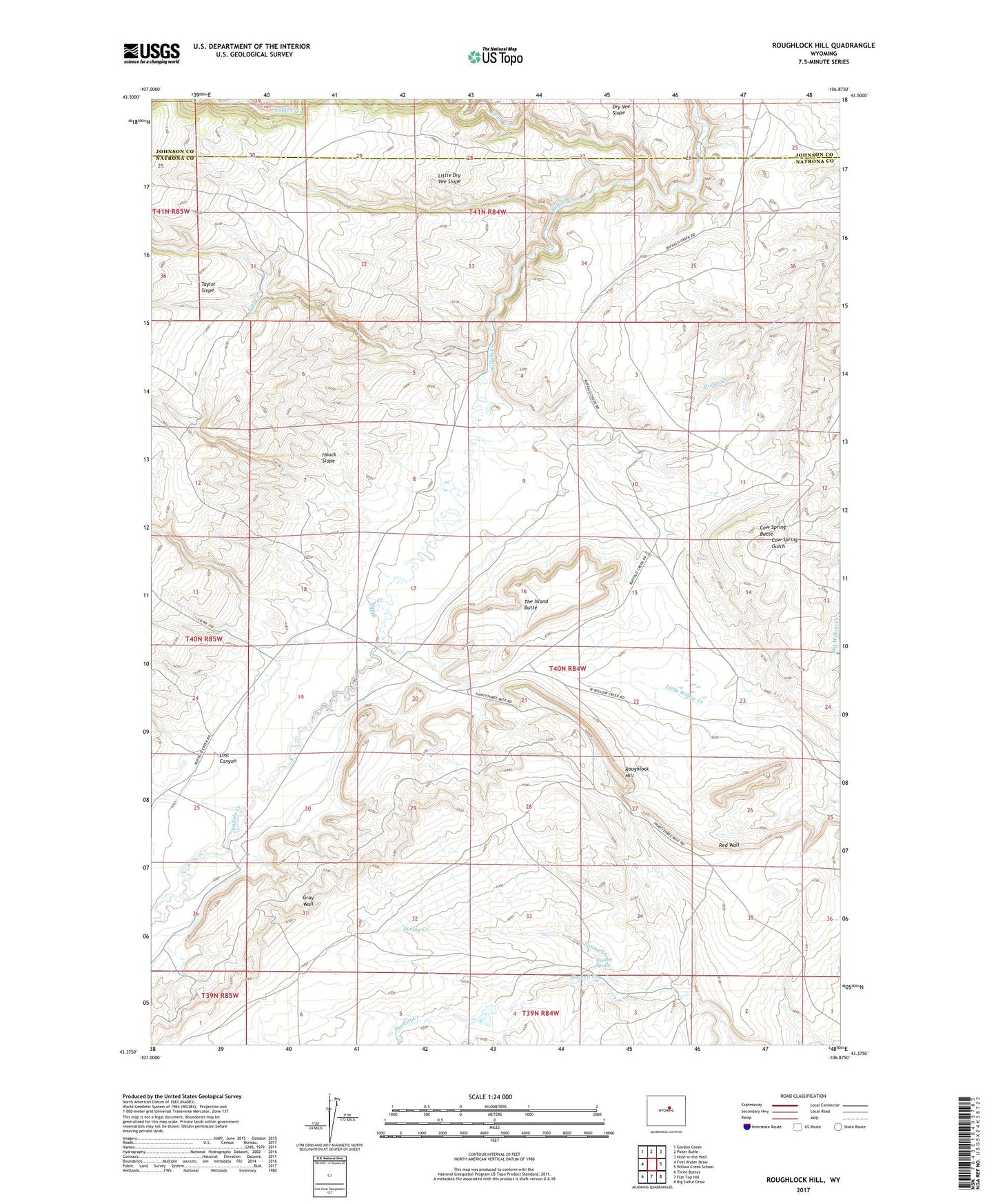
2021 topographic map quadrangle Roughlock Hill in the state of Wyoming. Scale: 1:24000. Based on the newly updated USGS 7.5' US Topo map series, this map is in the following counties: Natrona, Johnson. The map contains contour data, water features, and other items you are used to seeing on USGS maps, but also has updated roads and other features. This is the next generation of topographic maps. Printed on high-quality waterproof paper with UV fade-resistant inks.
Quads adjacent to this one:
West: First Water Draw
Northwest: Gordon Creek
North: Poker Butte
Northeast: Hole-in-the-Wall
East: Willow Creek School
Southeast: Big Sulfur Draw
South: Flat Top Hill
Southwest: Three Buttes
This map covers the same area as the classic USGS quad with code o43106d8.
Contains the following named places: Buffalo Creek Ranch, Cow Spring Butte, Eagle Creek, Hackett Spring, Houck Slope, Little Dry Vee Slope, Lost Canyon, Lost Creek, Red Cabin, Red Wall, Roughlock Hill, Spring Creek, The Island Butte