MyTopo
Gurney Peak Wyoming US Topo Map
Couldn't load pickup availability
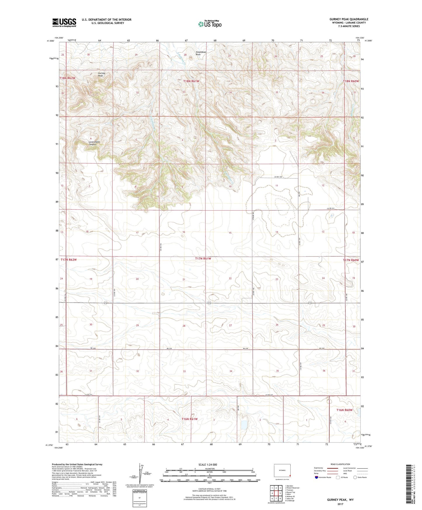
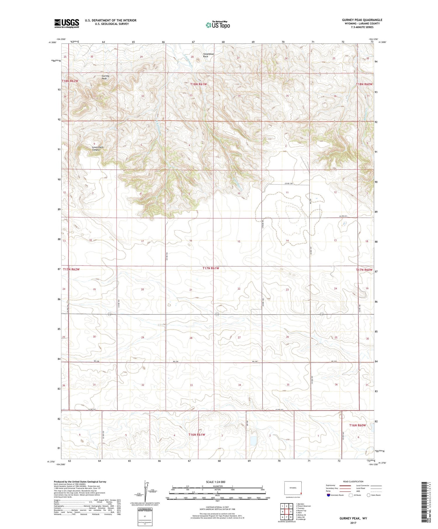
2021 topographic map quadrangle Gurney Peak in the state of Wyoming. Scale: 1:24000. Based on the newly updated USGS 7.5' US Topo map series, this map is in the following counties: Laramie. The map contains contour data, water features, and other items you are used to seeing on USGS maps, but also has updated roads and other features. This is the next generation of topographic maps. Printed on high-quality waterproof paper with UV fade-resistant inks.
Quads adjacent to this one:
West: Round Top
Northwest: Meriden
North: Petsch Reservoir
Northeast: Tremain
East: Albin
Southeast: Lindbergh
South: Albin SW
Southwest: Midway SE
Contains the following named places: Gurney Peak, Lovercheck Canyon, Petsch Ditch Number 1, Steamboat Rock