MyTopo
Petsch Reservoir Wyoming US Topo Map
Couldn't load pickup availability
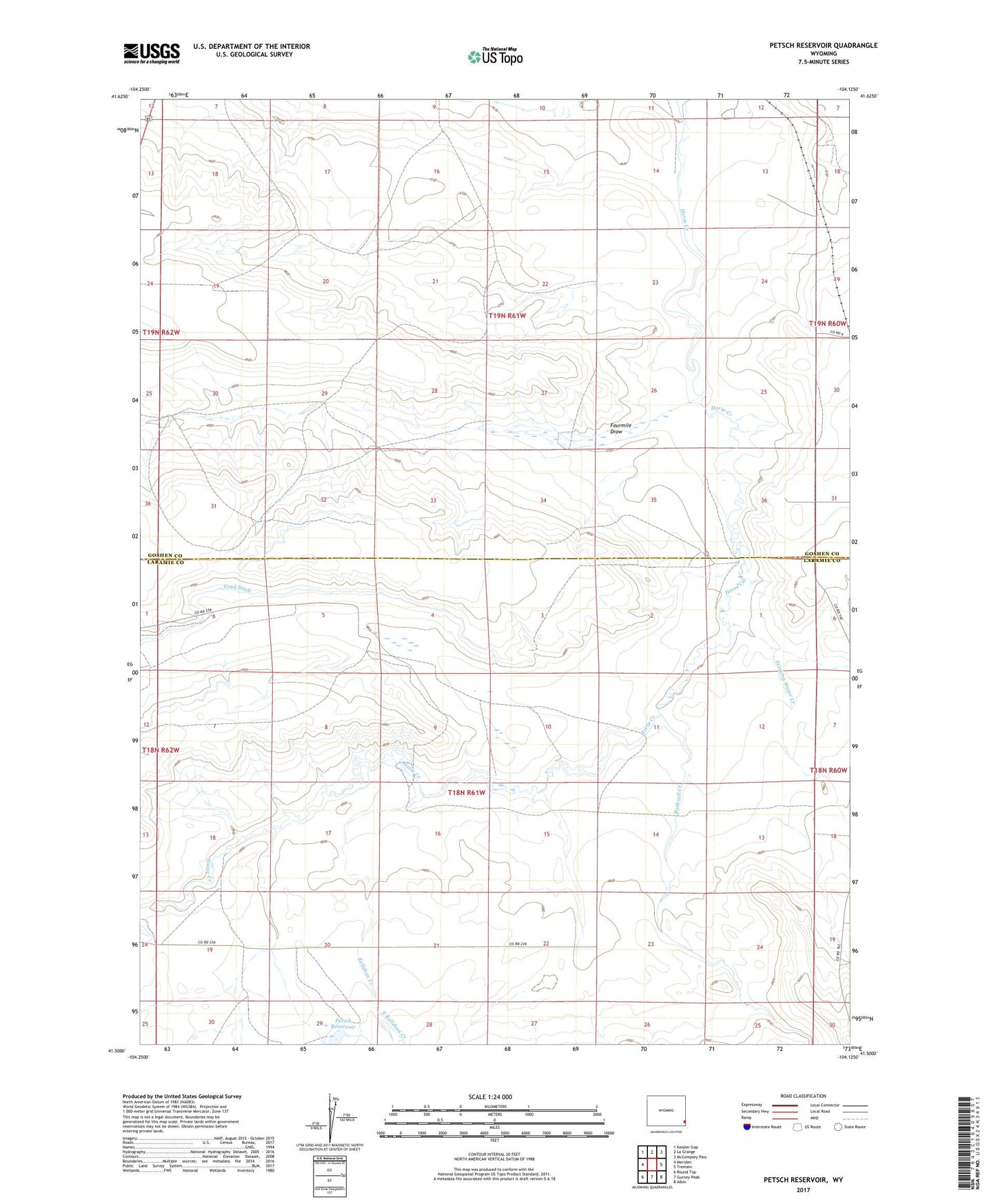
2021 topographic map quadrangle Petsch Reservoir in the state of Wyoming. Scale: 1:24000. Based on the newly updated USGS 7.5' US Topo map series, this map is in the following counties: Laramie, Goshen. The map contains contour data, water features, and other items you are used to seeing on USGS maps, but also has updated roads and other features. This is the next generation of topographic maps. Printed on high-quality waterproof paper with UV fade-resistant inks.
Quads adjacent to this one:
West: Meriden
Northwest: Kessler Gap
North: La Grange
Northeast: McCompsey Pass
East: Tremain
Southeast: Albin
South: Gurney Peak
Southwest: Round Top
This map covers the same area as the classic USGS quad with code o41104e2.
Contains the following named places: Bushnell Creek, Coad Ditch, Crown Number 2 Dam, Crown Reservoir Number 2, Davis Ranch, East Kellehan Creek, Fourmile Draw, Gregory Ranch, Johnson Ranch, Kellehan Creek, Petsch Reservoir, Scoon Ranch, Stinking Water Creek, West Kellehan Creek