MyTopo
Hazelton Wyoming US Topo Map
Couldn't load pickup availability
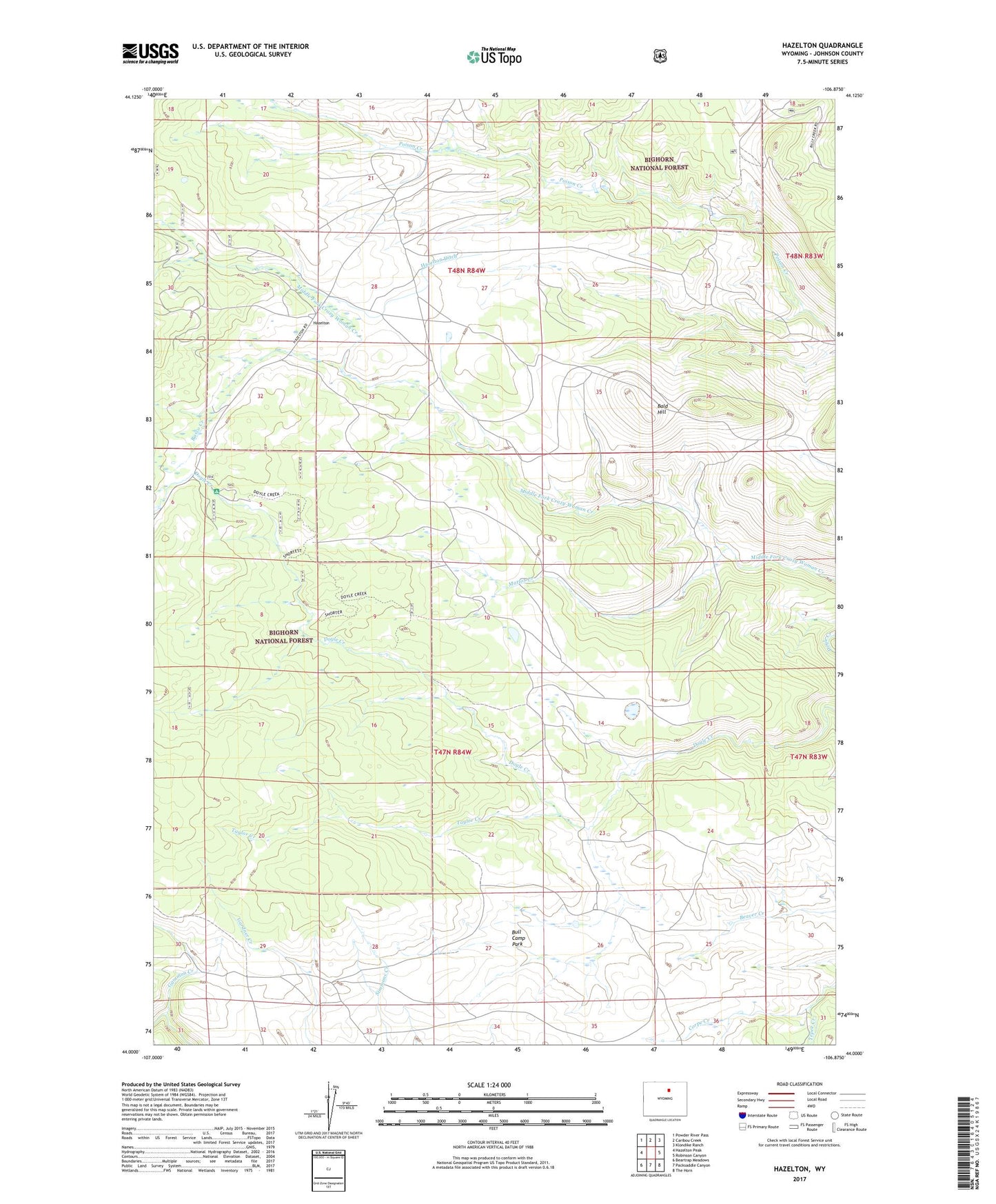
2021 topographic map quadrangle Hazelton in the state of Wyoming. Scale: 1:24000. Based on the newly updated USGS 7.5' US Topo map series, this map is in the following counties: Johnson. The map contains contour data, water features, and other items you are used to seeing on USGS maps, but also has updated roads and other features. This is the next generation of topographic maps. Printed on high-quality waterproof paper with UV fade-resistant inks.
Quads adjacent to this one:
West: Hazelton Peak
Northwest: Powder River Pass
North: Caribou Creek
Northeast: Klondike Ranch
East: Robinson Canyon
Southeast: The Horn
South: Packsaddle Canyon
Southwest: Beartrap Meadows
Contains the following named places: Bald Hill, Basco Creek, Bull Camp Group Mine, Bull Camp Park, Gammon Creek, Hazelton, Hazelton Ditch, Hazelton Post Office, Lower Doyle Creek Campground, Mattox Creek, Taylor Creek, Tepee Creek, Top Hand Group Mine