MyTopo
Caribou Creek Wyoming US Topo Map
Couldn't load pickup availability
Also explore the Caribou Creek Forest Service Topo of this same quad for updated USFS data
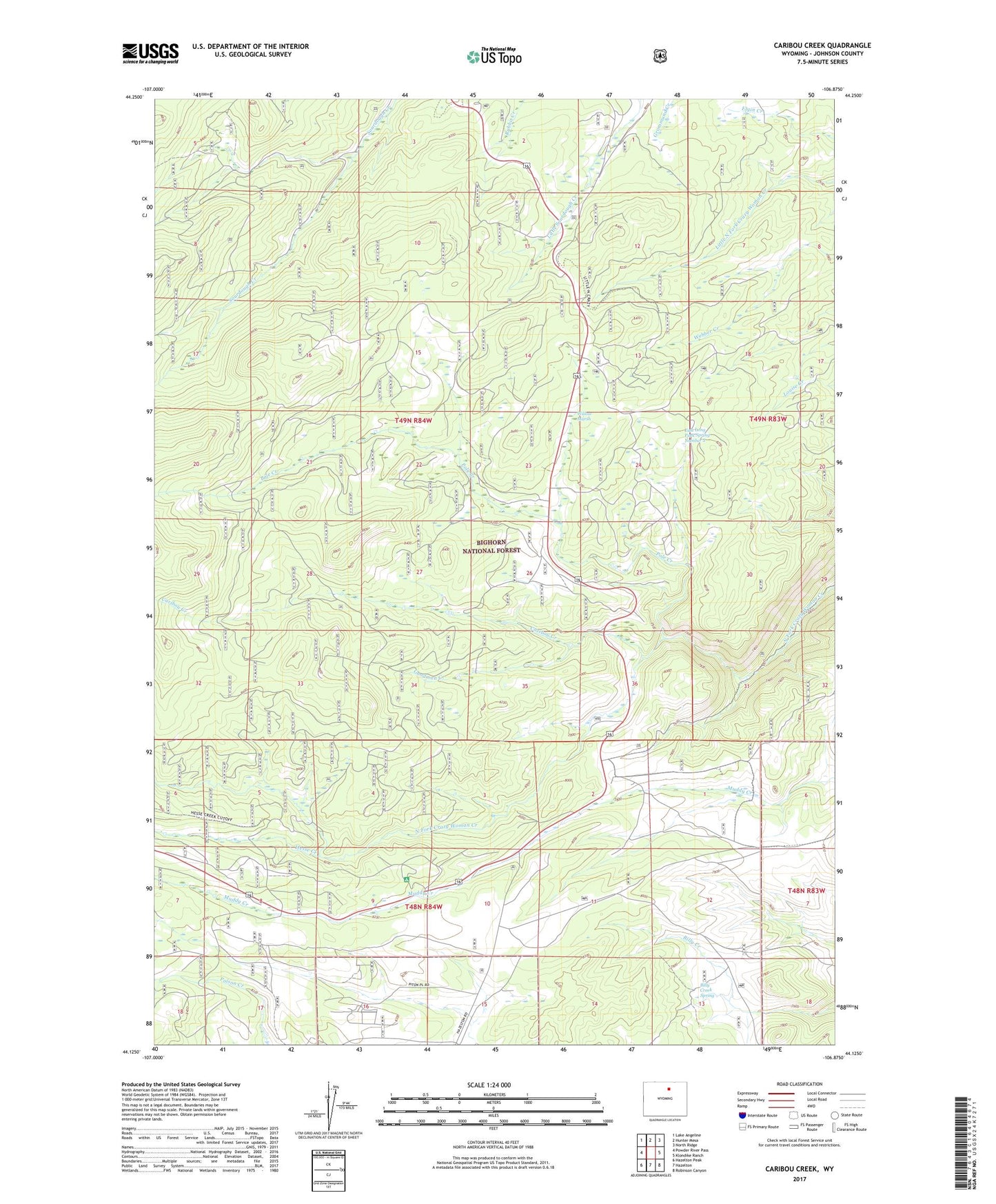
2021 topographic map quadrangle Caribou Creek in the state of Wyoming. Scale: 1:24000. Based on the newly updated USGS 7.5' US Topo map series, this map is in the following counties: Johnson. The map contains contour data, water features, and other items you are used to seeing on USGS maps, but also has updated roads and other features. This is the next generation of topographic maps. Printed on high-quality waterproof paper with UV fade-resistant inks.
Quads adjacent to this one:
West: Powder River Pass
Northwest: Lake Angeline
North: Hunter Mesa
Northeast: North Ridge
East: Klondike Ranch
Southeast: Robinson Canyon
South: Hazelton
Southwest: Hazelton Peak
This map covers the same area as the classic USGS quad with code o44106b8.
Contains the following named places: Billy Creek Spring, Canyon Campground, Caribou Creek, Caribou School, Crazy Woman Campground, Dry Poison Creek, East Long Park Spring Number 2, E-la-ka-wee Camp, Goodman Creek, Hanson Sawmill, Hesse Creek, Lost Cabin Campground, Merle Creek, Muddy Creek Cow Camp, Muddy Creek Guard Station, Pole Creek, State Highway Maintenance Camp, Willow Marsh