MyTopo
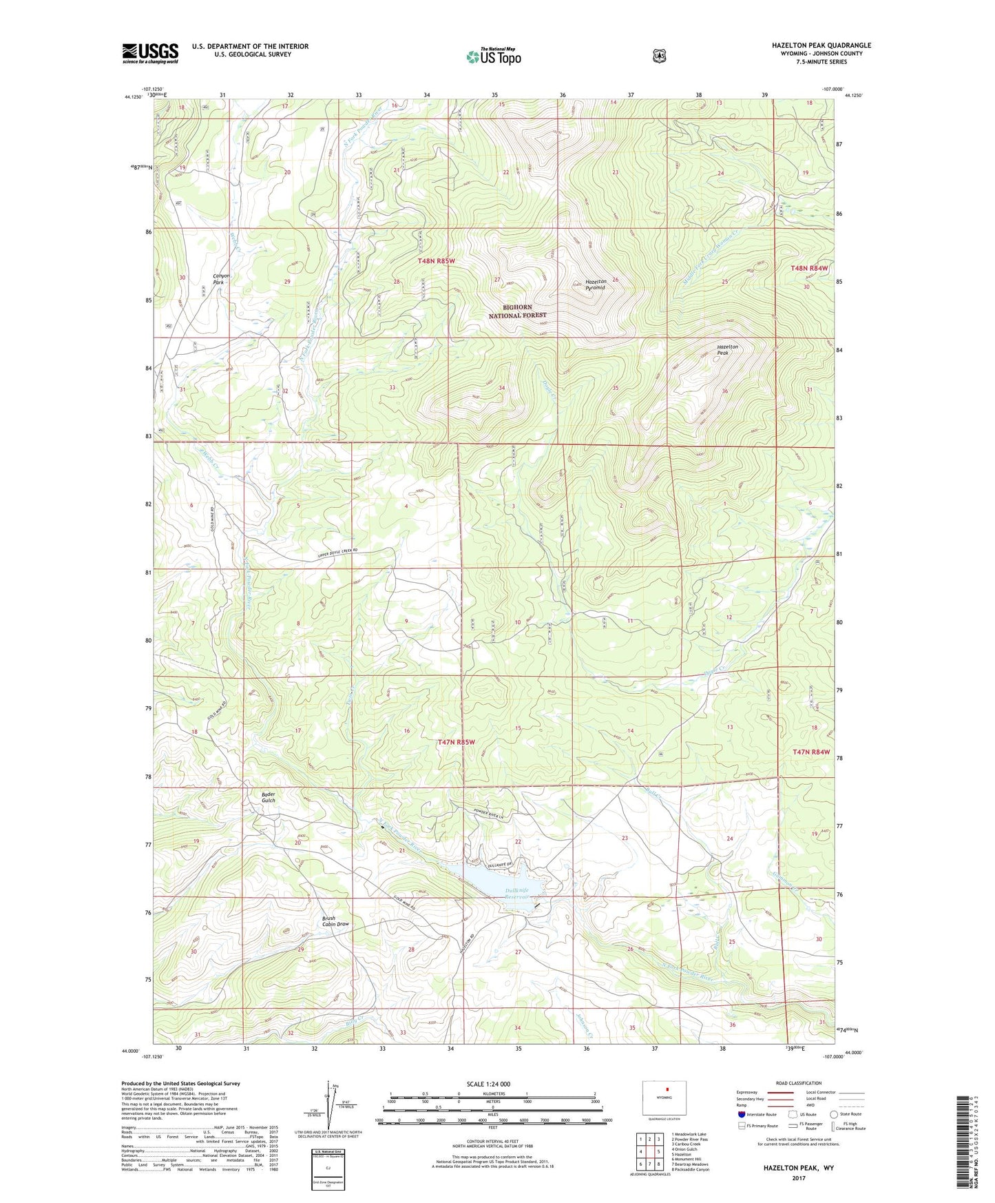
Hazelton Peak Wyoming US Topo Map
Couldn't load pickup availability
Also explore the Hazelton Peak Forest Service Topo of this same quad for updated USFS data
2021 topographic map quadrangle Hazelton Peak in the state of Wyoming. Scale: 1:24000. Based on the newly updated USGS 7.5' US Topo map series, this map is in the following counties: Johnson. The map contains contour data, water features, and other items you are used to seeing on USGS maps, but also has updated roads and other features. This is the next generation of topographic maps. Printed on high-quality waterproof paper with UV fade-resistant inks.
Quads adjacent to this one:
West: Onion Gulch
Northwest: Meadowlark Lake
North: Powder River Pass
Northeast: Caribou Creek
East: Hazelton
Southeast: Packsaddle Canyon
South: Beartrap Meadows
Southwest: Monument Hill
This map covers the same area as the classic USGS quad with code o44107a1.
Contains the following named places: Big Horn Mine, Bull Creek, Canyon Park, Dull Knife Dam, Dullknife Reservoir, Hazelton Peak, Hazelton Pyramid, Powder River Mine, Taylor Prospect Mine, Twin Creek, Webb Creek