MyTopo
Holdup Hollow Wyoming US Topo Map
Couldn't load pickup availability
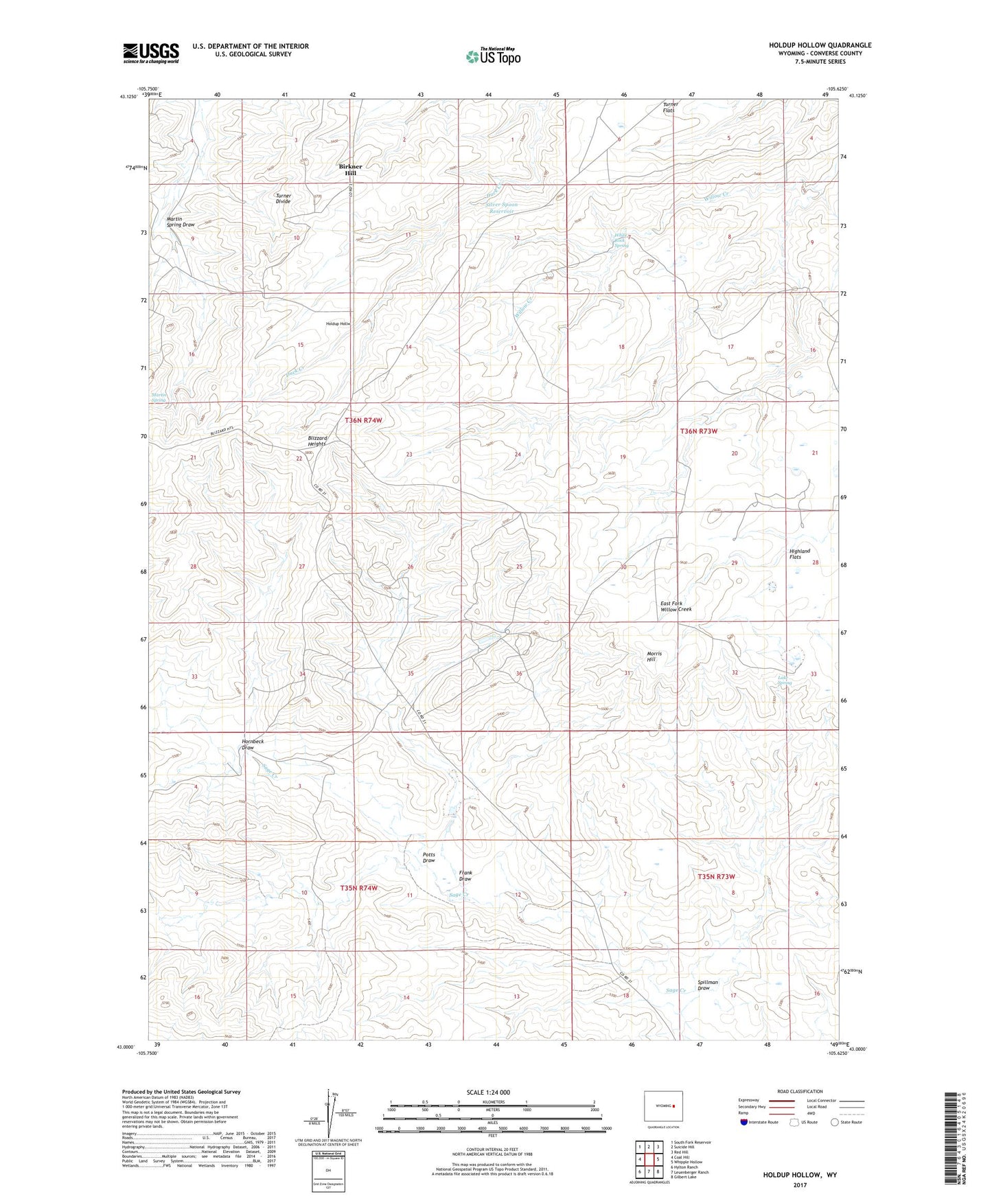
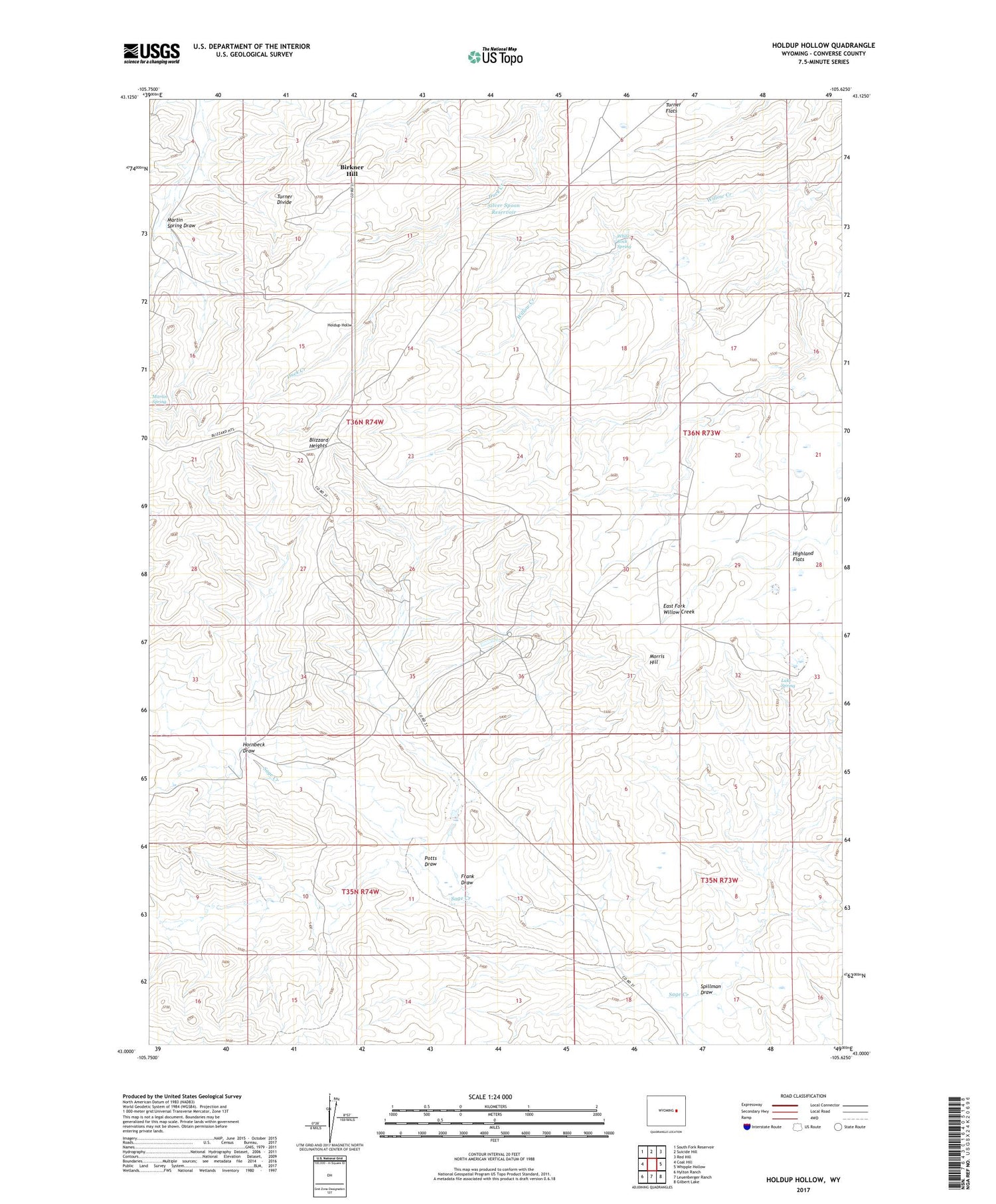
2021 topographic map quadrangle Holdup Hollow in the state of Wyoming. Scale: 1:24000. Based on the newly updated USGS 7.5' US Topo map series, this map is in the following counties: Converse. The map contains contour data, water features, and other items you are used to seeing on USGS maps, but also has updated roads and other features. This is the next generation of topographic maps. Printed on high-quality waterproof paper with UV fade-resistant inks.
Quads adjacent to this one:
West: Coal Hill
Northwest: South Fork Reservoir
North: Suicide Hill
Northeast: Red Hill
East: Whipple Hollow
Southeast: Gilbert Lake
South: Leuenberger Ranch
Southwest: Hylton Ranch
Contains the following named places: Bill Smith Mine, Birkner Hill, Blizzard Heights, Frank Draw, Holdup Hollow, Hornbeck Draw, Lake Spring, Martin Spring, Martin Spring Draw, Morris Hill, Potts Draw, Silver Spoon Reservoir, Spillman Draw, Sundquist Ranch, Turner Divide, Turner Flats, White Rock Spring