MyTopo
South Fork Reservoir Wyoming US Topo Map
Couldn't load pickup availability
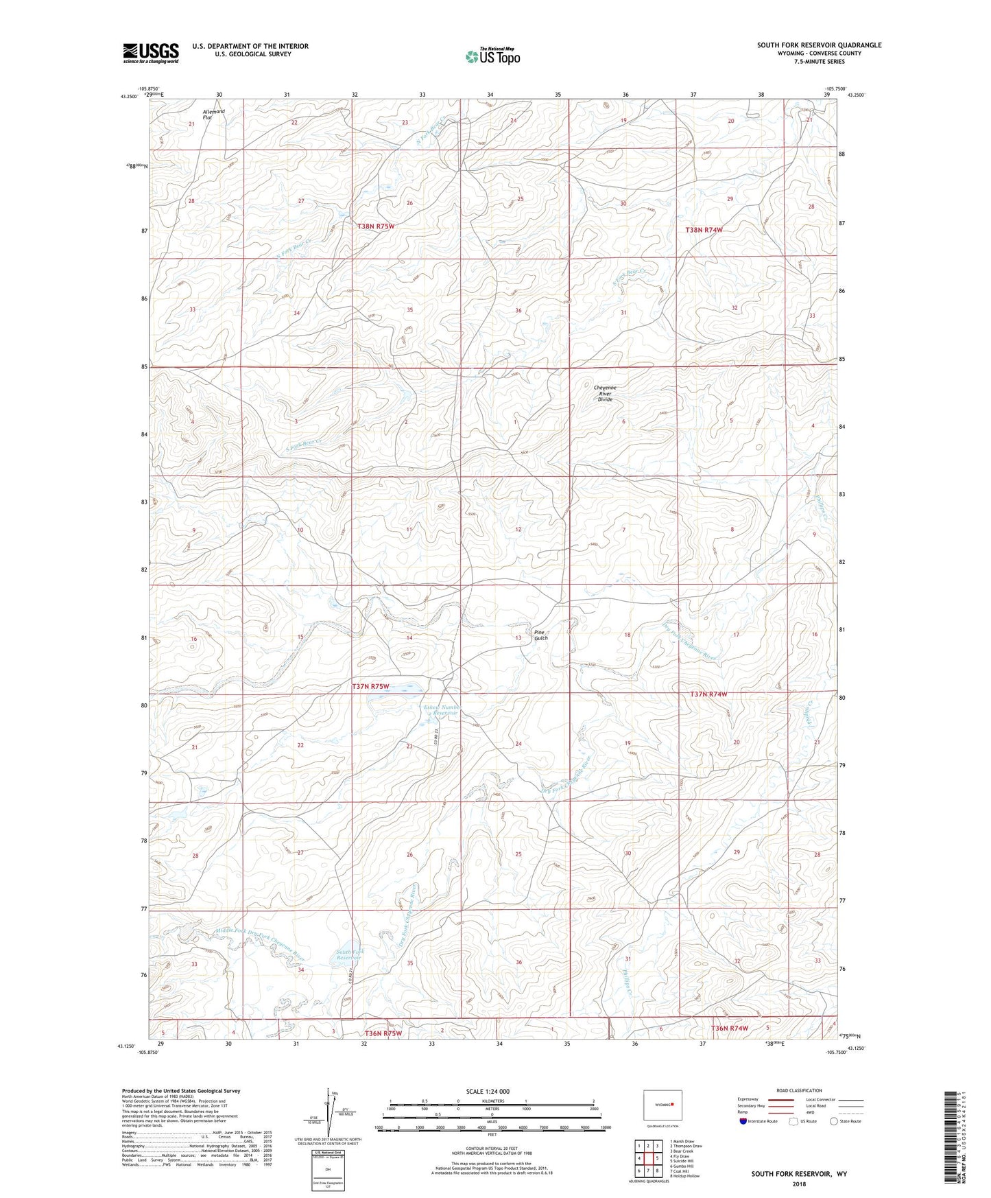
2021 topographic map quadrangle South Fork Reservoir in the state of Wyoming. Scale: 1:24000. Based on the newly updated USGS 7.5' US Topo map series, this map is in the following counties: Converse. The map contains contour data, water features, and other items you are used to seeing on USGS maps, but also has updated roads and other features. This is the next generation of topographic maps. Printed on high-quality waterproof paper with UV fade-resistant inks.
Quads adjacent to this one:
West: Fly Draw
Northwest: Marsh Draw
North: Thompson Draw
Northeast: Bear Creek
East: Suicide Hill
Southeast: Holdup Hollow
South: Coal Hill
Southwest: Gumbo Hill
This map covers the same area as the classic USGS quad with code o43105b7.
Contains the following named places: Badger School, Cheyenne River Divide, Eskew Number 2 Dam, Eskew Number 2 Reservoir, Fifty-five Ranch, Middle Fork Dry Fork Cheyenne River, North Fork Dry Fork Cheyenne River, Patterson Ranch, Phillips Creek, Pine Gulch, South Fork Dry Fork Cheyenne River, South Fork Reservoir, Stevens North Mine, Stevens South Mine