MyTopo
Independence Rock Wyoming US Topo Map
Couldn't load pickup availability
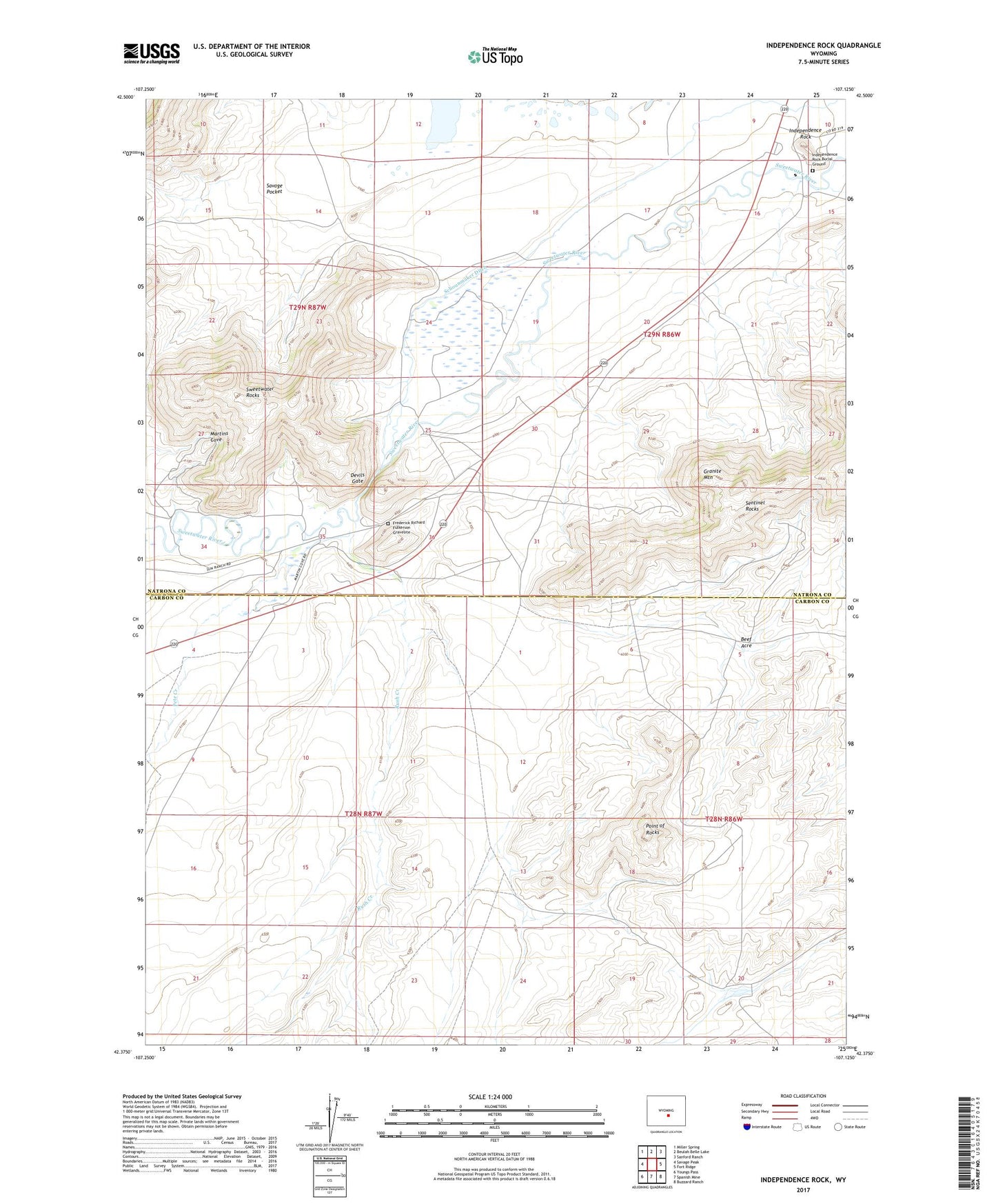
2021 topographic map quadrangle Independence Rock in the state of Wyoming. Scale: 1:24000. Based on the newly updated USGS 7.5' US Topo map series, this map is in the following counties: Carbon, Natrona. The map contains contour data, water features, and other items you are used to seeing on USGS maps, but also has updated roads and other features. This is the next generation of topographic maps. Printed on high-quality waterproof paper with UV fade-resistant inks.
Quads adjacent to this one:
West: Savage Peak
Northwest: Miller Spring
North: Beulah Belle Lake
Northeast: Sanford Ranch
East: Fort Ridge
Southeast: Buzzard Ranch
South: Spanish Mine
Southwest: Youngs Pass
This map covers the same area as the classic USGS quad with code o42107d2.
Contains the following named places: Beef Acre, Devils Gate, Diversion Dam, Frederick Richard Fulkerson Gravesite, Granite Mountain, Independence Deposits, Independence Rock, Independence Rock Burial Ground, Martins Cove, New York Claim, Pete Creek, Philadelphia Claim, Point of Rocks, Pony Express Station, Rush Creek, Savage Pocket, Schounmaker Ditch, Sun Ranch, Sweetwater Rocks