MyTopo
Jay Em Wyoming US Topo Map
Couldn't load pickup availability
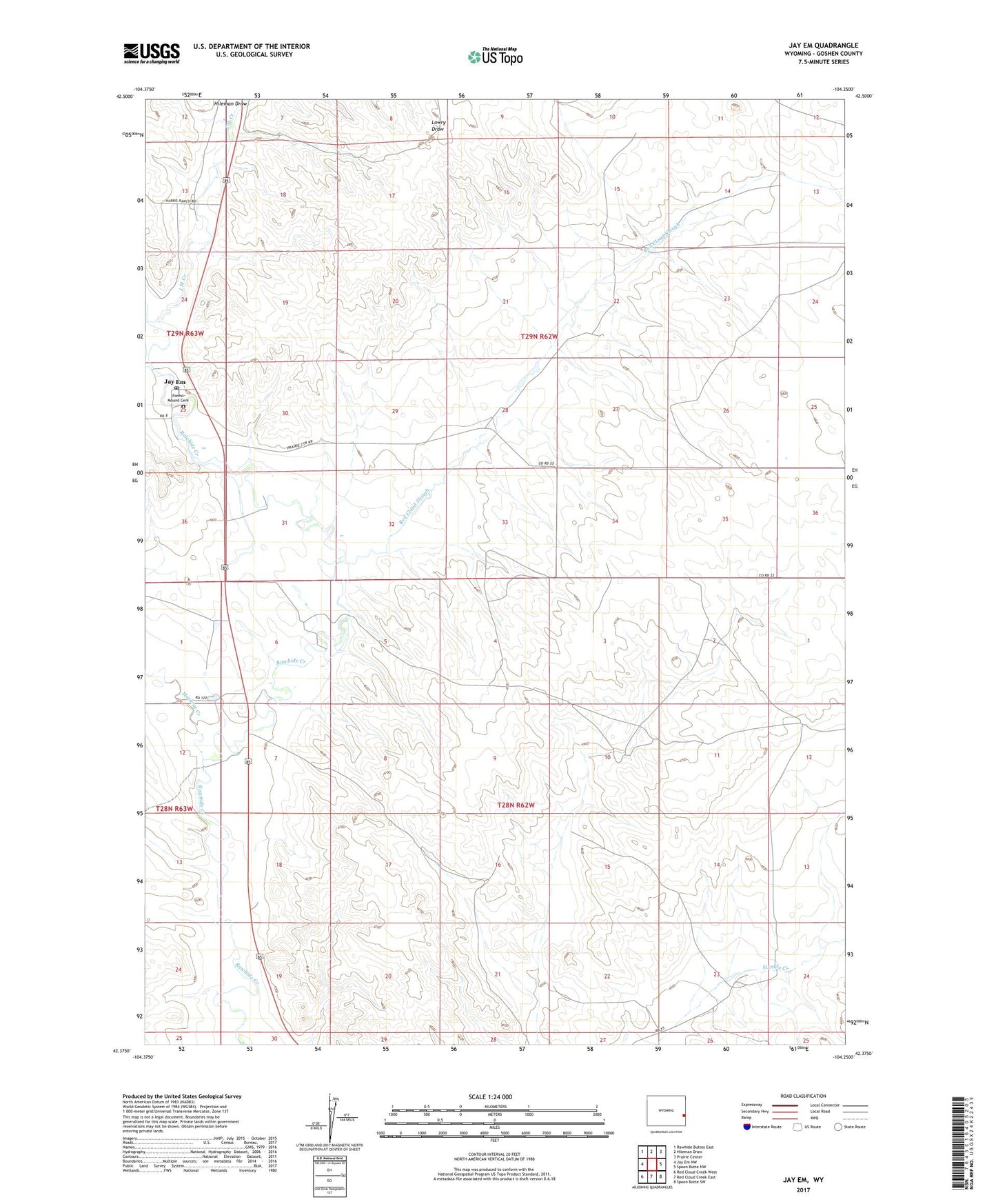
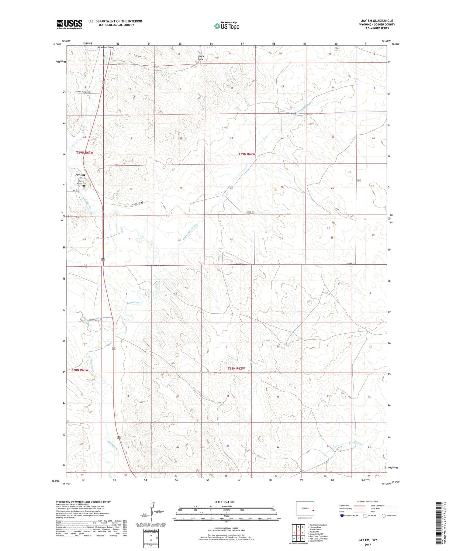
2021 topographic map quadrangle Jay Em in the state of Wyoming. Scale: 1:24000. Based on the newly updated USGS 7.5' US Topo map series, this map is in the following counties: Goshen. The map contains contour data, water features, and other items you are used to seeing on USGS maps, but also has updated roads and other features. This is the next generation of topographic maps. Printed on high-quality waterproof paper with UV fade-resistant inks.
Quads adjacent to this one:
West: Jay Em NW
Northwest: Rawhide Buttes East
North: Hileman Draw
Northeast: Prairie Center
East: Spoon Butte NW
Southeast: Spoon Butte SW
South: Red Cloud Creek East
Southwest: Red Cloud Creek West
Contains the following named places: Forest Mound Cemetery, Harris Dam, Harris Reservoir, Hileman Draw, J M Creek, J M Dam, J M Reservoir, Jay Em, Jay Em Post Office, Muskrat Creek, Rawhide Creek Division, Red Cloud Number 1 Dam, Red Cloud Reservoir Number 1, Red Cloud Slough, Sixmile Creek Ranch