MyTopo
Rawhide Buttes East Wyoming US Topo Map
Couldn't load pickup availability
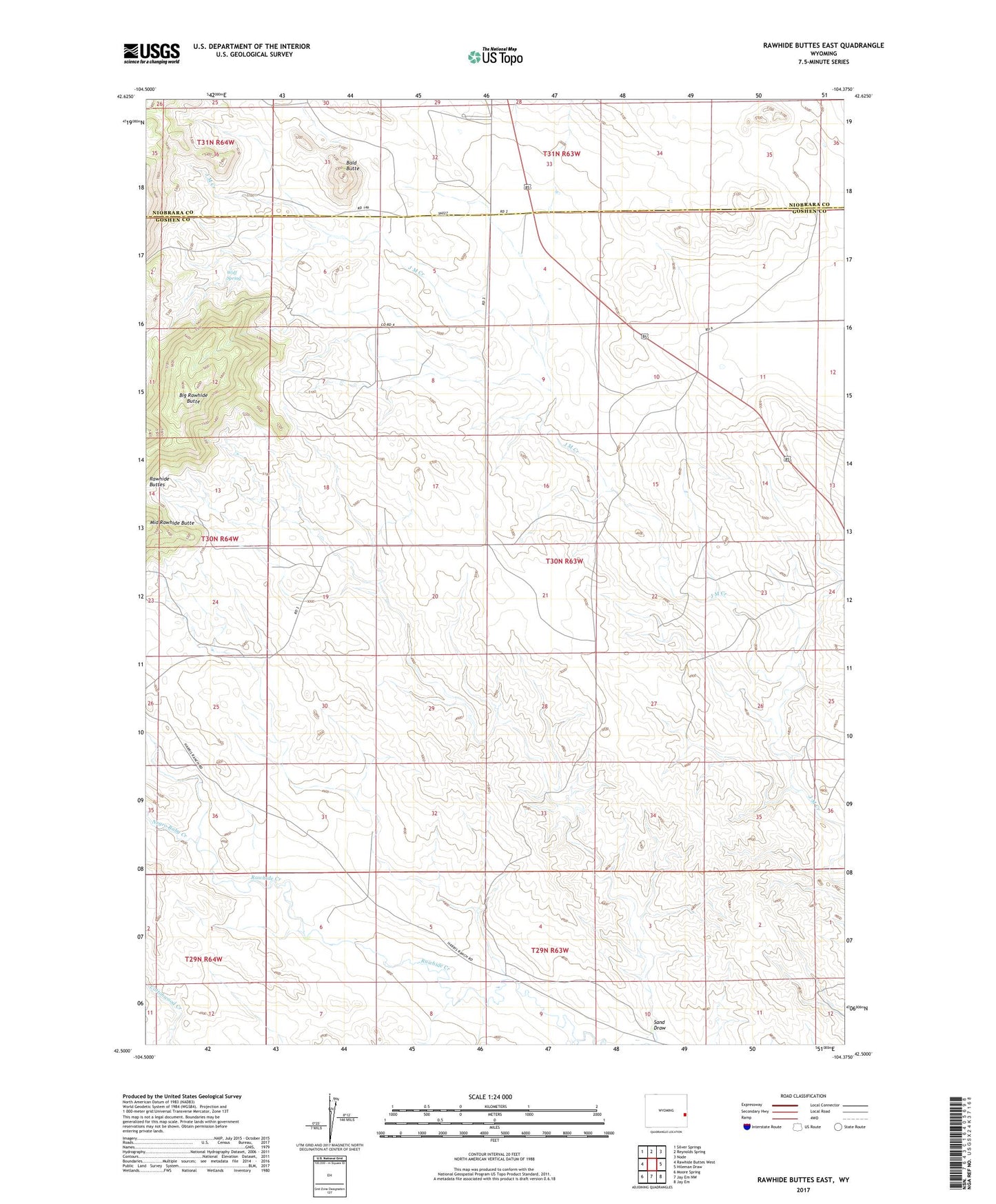
2021 topographic map quadrangle Rawhide Buttes East in the state of Wyoming. Scale: 1:24000. Based on the newly updated USGS 7.5' US Topo map series, this map is in the following counties: Goshen, Niobrara. The map contains contour data, water features, and other items you are used to seeing on USGS maps, but also has updated roads and other features. This is the next generation of topographic maps. Printed on high-quality waterproof paper with UV fade-resistant inks.
Quads adjacent to this one:
West: Rawhide Buttes West
Northwest: Silver Springs
North: Reynolds Spring
Northeast: Node
East: Hileman Draw
Southeast: Jay Em
South: Jay Em NW
Southwest: Moore Spring
This map covers the same area as the classic USGS quad with code o42104e4.
Contains the following named places: Bald Butte, Big Rawhide Butte, Middle Rawhide Butte, Negro Baby Creek, Rawhide Buttes, Sand Draw, Wolf Spring