MyTopo
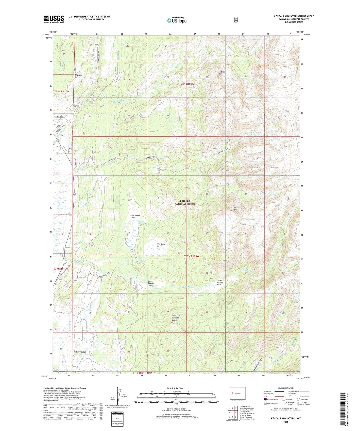
Kendall Mountain Wyoming US Topo Map
Couldn't load pickup availability
Also explore the Kendall Mountain Forest Service Topo of this same quad for updated USFS data
2021 topographic map quadrangle Kendall Mountain in the state of Wyoming. Scale: 1:24000. Based on the newly updated USGS 7.5' US Topo map series, this map is in the following counties: Sublette. The map contains contour data, water features, and other items you are used to seeing on USGS maps, but also has updated roads and other features. This is the next generation of topographic maps. Printed on high-quality waterproof paper with UV fade-resistant inks.
Quads adjacent to this one:
West: Dodge Butte
Northwest: Klondike Hill
North: Big Sheep Mountain
Northeast: Green River Lakes
East: Squaretop Mountain
Southeast: Fremont Lake North
South: New Fork Lakes
Southwest: Warren Bridge
This map covers the same area as the classic USGS quad with code o43109b8.
Contains the following named places: Boulder Basin Trail, Circle S Ranch, Gypsum Creek Mine, Gypsum Hill, Jim Creek Lake, Kendall Mountain, Kim Rush Park, Lower Boulder Basin, McDowell Flat, New Fork Lookout Point, Pot Creek Park, Pot Creek Trail, Saltlick Mountain, Sink Hole Pit Mine, South Fork Gypsum Creek, South Gypsum Trail, Upper Boulder Basin, ZIP Code: 82925