
MyTopo
Leckie Reservoir Wyoming US Topo Map
Couldn't load pickup availability
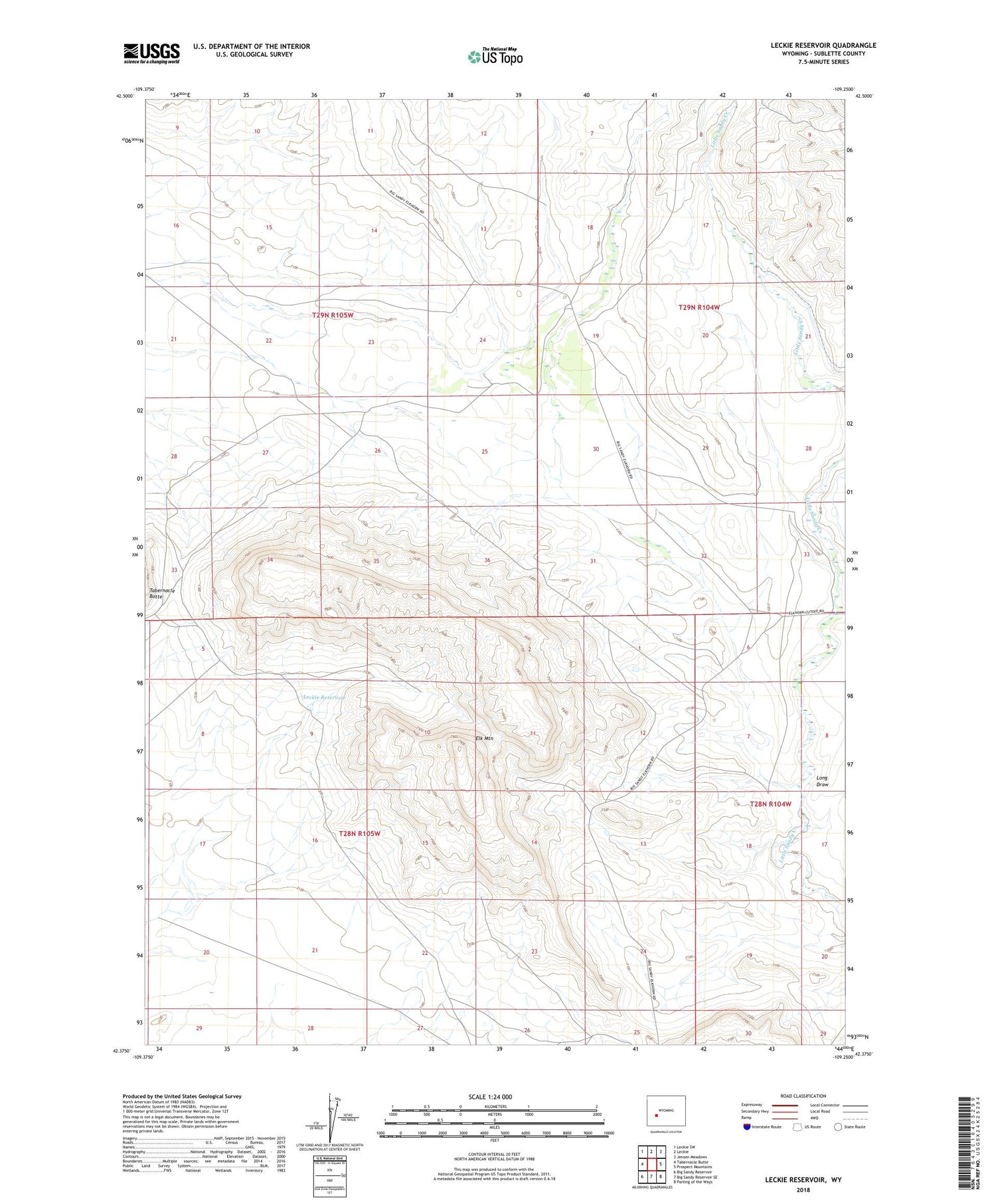
2021 topographic map quadrangle Leckie Reservoir in the state of Wyoming. Scale: 1:24000. Based on the newly updated USGS 7.5' US Topo map series, this map is in the following counties: Sublette. The map contains contour data, water features, and other items you are used to seeing on USGS maps, but also has updated roads and other features. This is the next generation of topographic maps. Printed on high-quality waterproof paper with UV fade-resistant inks.
Quads adjacent to this one:
West: Tabernacle Butte
Northwest: Leckie SW
North: Leckie
Northeast: Jensen Meadows
East: Prospect Mountains
Southeast: Parting of the Ways
South: Big Sandy Reservoir SE
Southwest: Big Sandy Reservoir
Contains the following named places: Arambel Ranch, Elk Mountain, Elkhorn Ditch, Leckie Reservoir, Long Draw


