MyTopo
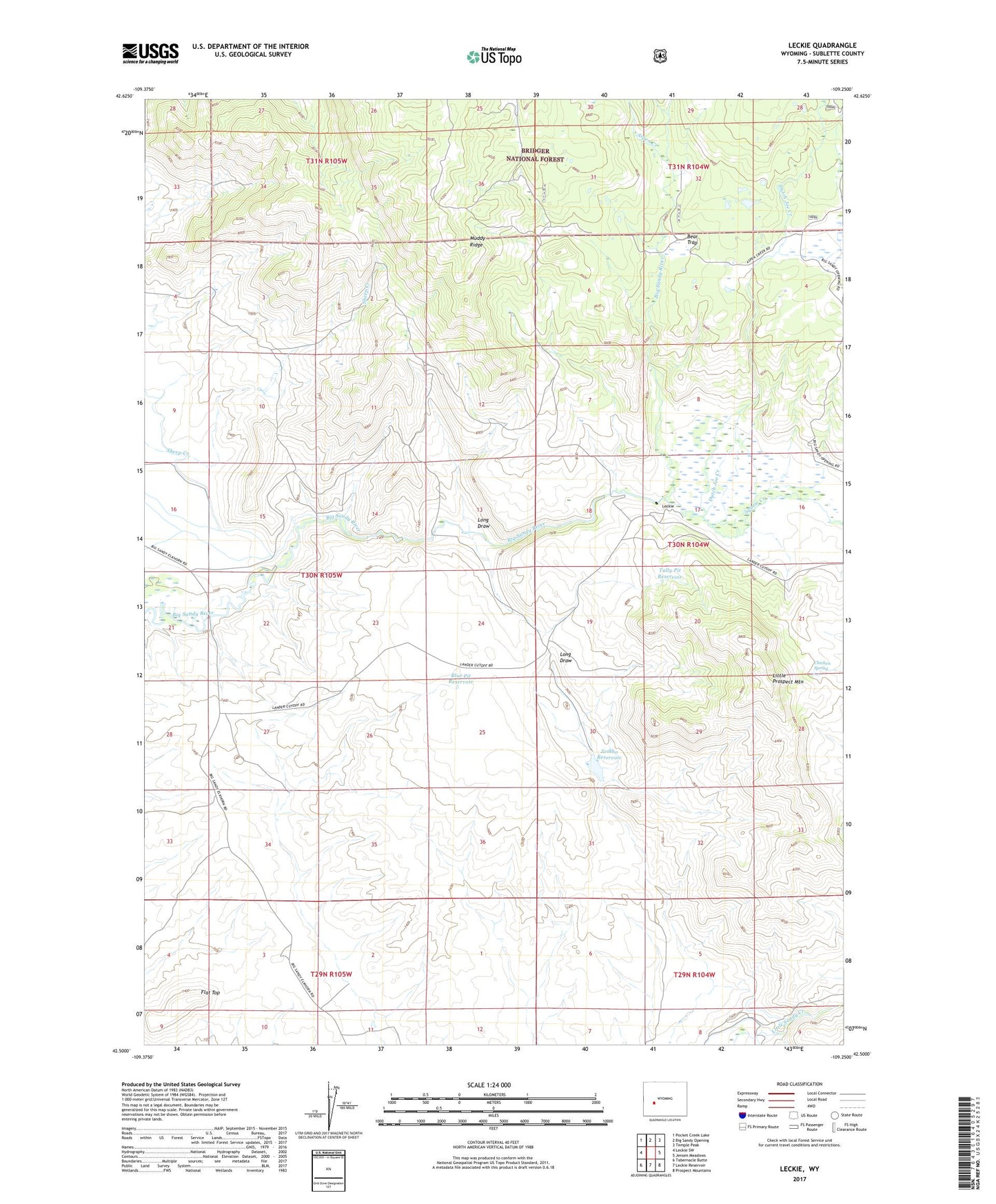
Leckie Wyoming US Topo Map
Couldn't load pickup availability
Also explore the Leckie Forest Service Topo of this same quad for updated USFS data
2023 topographic map quadrangle Leckie in the state of Wyoming. Scale: 1:24000. Based on the newly updated USGS 7.5' US Topo map series, this map is in the following counties: Sublette. The map contains contour data, water features, and other items you are used to seeing on USGS maps, but also has updated roads and other features. This is the next generation of topographic maps. Printed on high-quality waterproof paper with UV fade-resistant inks.
Quads adjacent to this one:
West: Leckie SW
Northwest: Pocket Creek Lake
North: Big Sandy Opening
Northeast: Temple Peak
East: Jensen Meadows
Southeast: Prospect Mountains
South: Leckie Reservoir
Southwest: Tabernacle Butte
This map covers the same area as the classic USGS quad with code o42109e3.
Contains the following named places: Aspen Creek, Bear Trap, Blue Pit Reservoir, Buckskin Crossing, Chicken Spring, Driveway Creek, Dutch Joe Creek, Emigrant Trail, Flat Top, Leckie, Little Prospect Mountain, Muddy Ridge, Squaw Creek, Tally Pit Reservoir, Zemba Dam, Zembo Reservoir