MyTopo
Jensen Meadows Wyoming US Topo Map
Couldn't load pickup availability
Also explore the Jensen Meadows Forest Service Topo of this same quad for updated USFS data
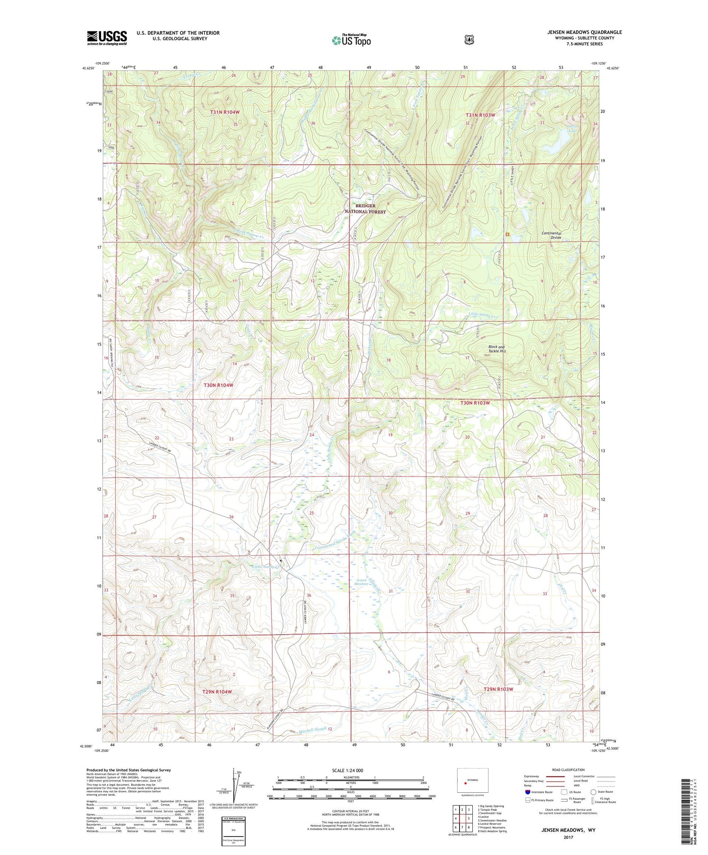
2023 topographic map quadrangle Jensen Meadows in the state of Wyoming. Scale: 1:24000. Based on the newly updated USGS 7.5' US Topo map series, this map is in the following counties: Sublette. The map contains contour data, water features, and other items you are used to seeing on USGS maps, but also has updated roads and other features. This is the next generation of topographic maps. Printed on high-quality waterproof paper with UV fade-resistant inks.
Quads adjacent to this one:
West: Leckie
Northwest: Big Sandy Opening
North: Temple Peak
Northeast: Sweetwater Gap
East: Sweetwater Needles
Southeast: Halls Meadow Spring
South: Prospect Mountains
Southwest: Leckie Reservoir
This map covers the same area as the classic USGS quad with code o42109e2.
Contains the following named places: Block and Tackle Hill, Chicken Creek, Continental Divide Ditch, Corral Creek, Crows Nest Trail, Dutch Joe Guard Station, Dutch Joe Larsen Creek Trail, East Fork Squaw Creek, Elkhorn Dam, Elkhorn Reservoir, Grass Creek, Jensen Meadows, Little Sandy Creek, Little Sandy Trail, Lookout Creek, Middle Fork Squaw Creek, Ord Creek, Sheet Lake, Trail Creek, West Fork Squaw Creek, Wolf Creek