MyTopo
Leuenberger Ranch Wyoming US Topo Map
Couldn't load pickup availability
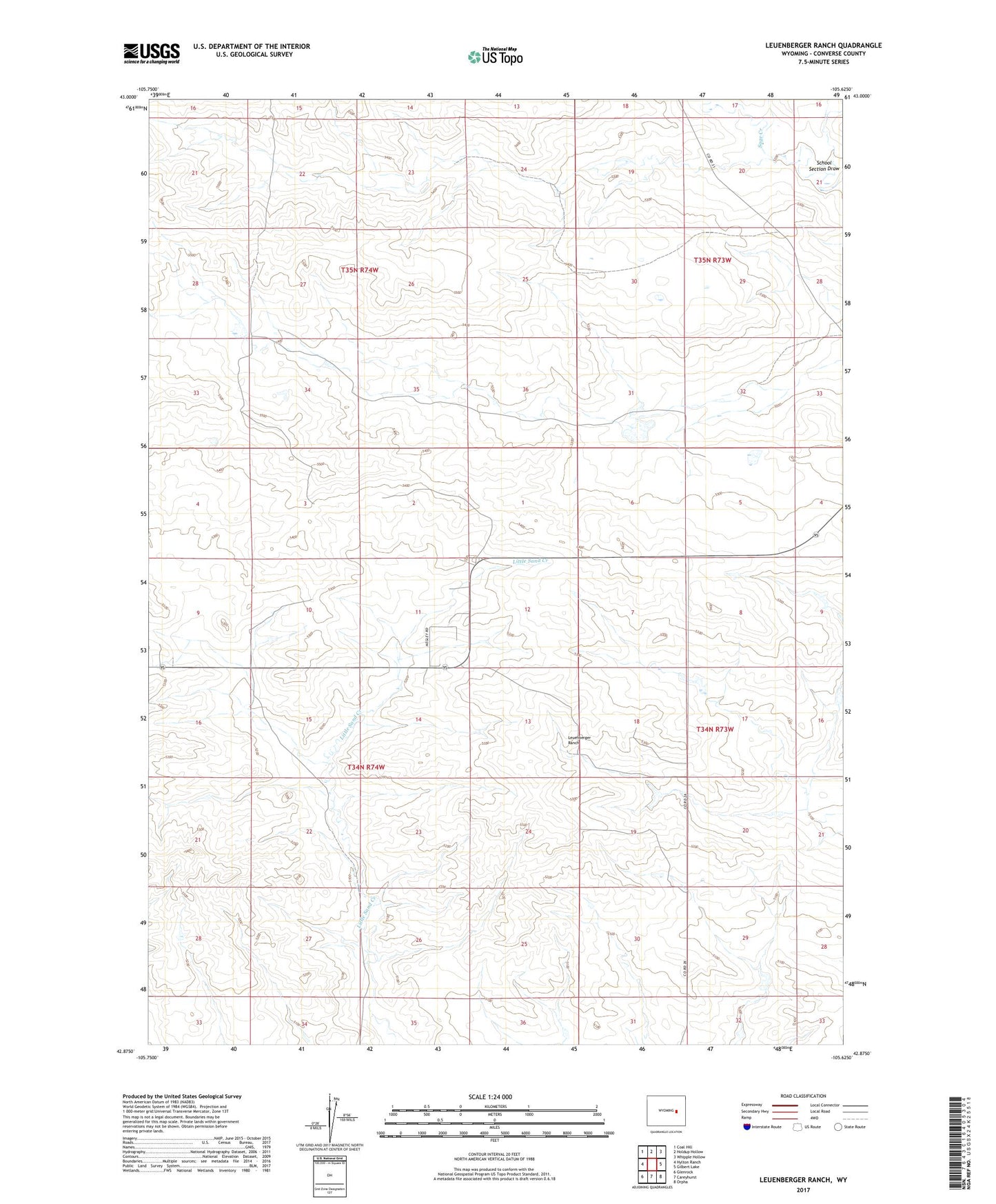
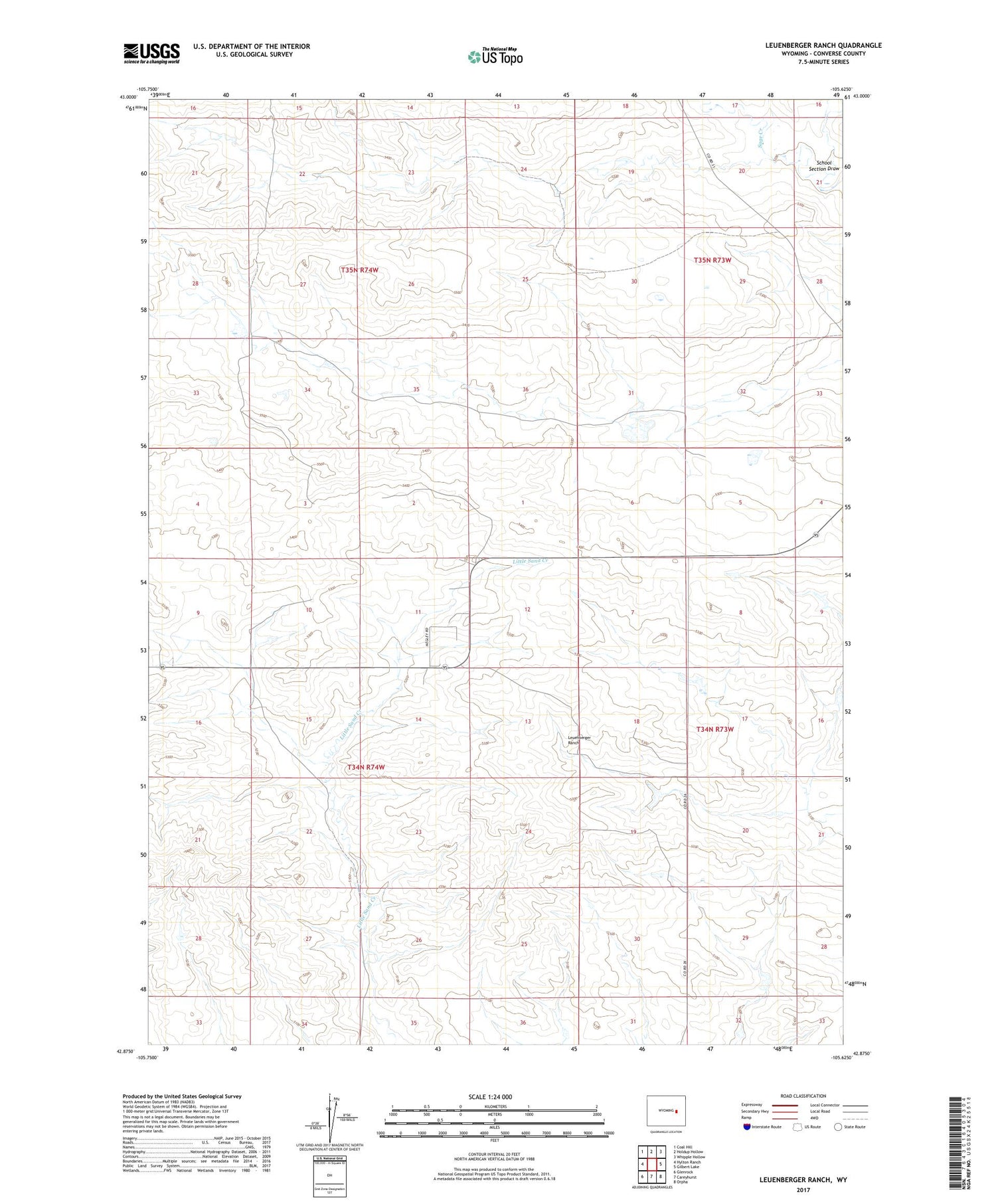
2021 topographic map quadrangle Leuenberger Ranch in the state of Wyoming. Scale: 1:24000. Based on the newly updated USGS 7.5' US Topo map series, this map is in the following counties: Converse. The map contains contour data, water features, and other items you are used to seeing on USGS maps, but also has updated roads and other features. This is the next generation of topographic maps. Printed on high-quality waterproof paper with UV fade-resistant inks.
Quads adjacent to this one:
West: Hylton Ranch
Northwest: Coal Hill
North: Holdup Hollow
Northeast: Whipple Hollow
East: Gilbert Lake
Southeast: Orpha
South: Careyhurst
Southwest: Glenrock
Contains the following named places: Keenan Ranch, Layton Ranch, Leuenberger Ranch, Negley Ranch, School Section Draw