MyTopo
Glenrock Wyoming US Topo Map
Couldn't load pickup availability
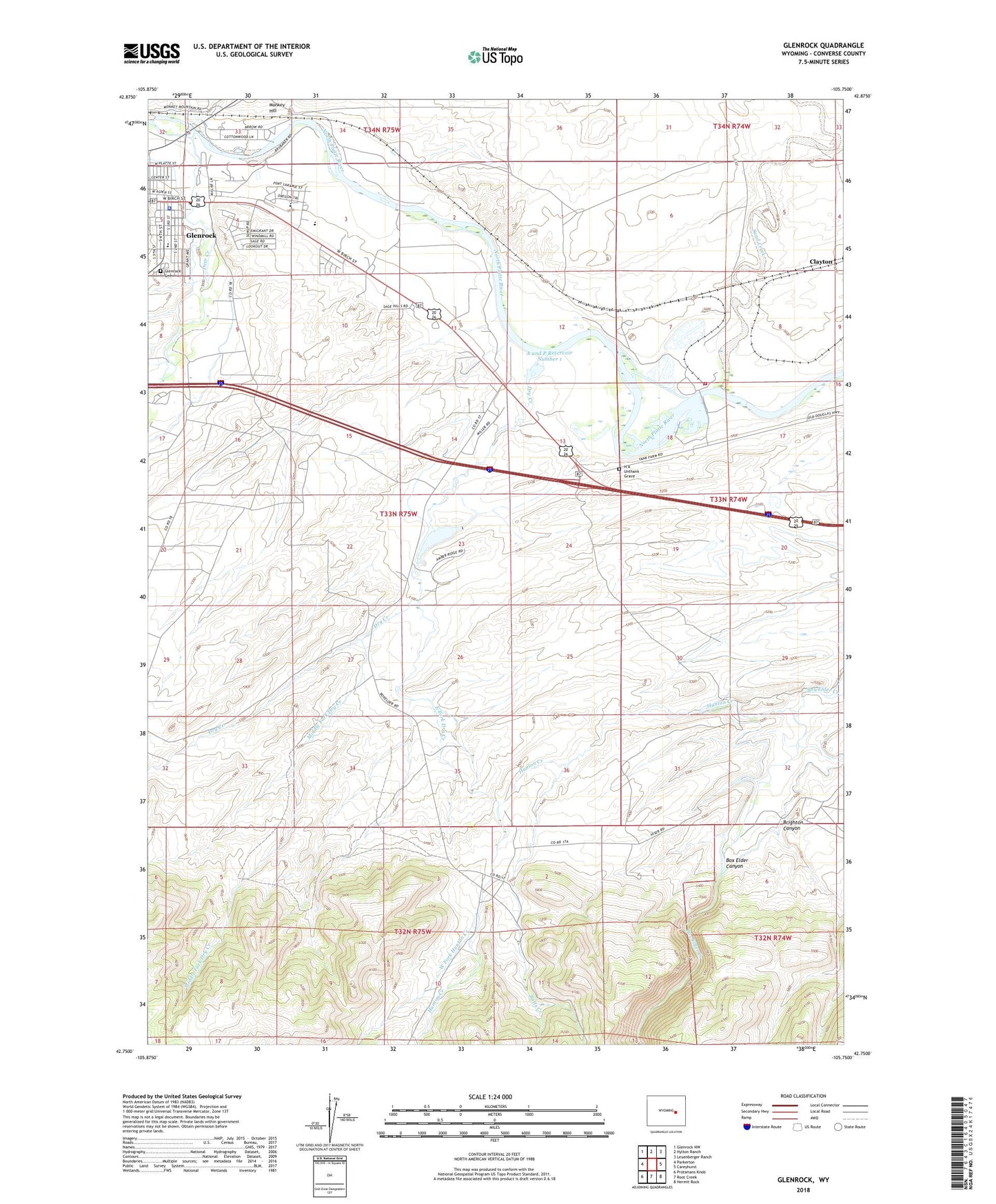
2021 topographic map quadrangle Glenrock in the state of Wyoming. Scale: 1:24000. Based on the newly updated USGS 7.5' US Topo map series, this map is in the following counties: Converse. The map contains contour data, water features, and other items you are used to seeing on USGS maps, but also has updated roads and other features. This is the next generation of topographic maps. Printed on high-quality waterproof paper with UV fade-resistant inks.
Quads adjacent to this one:
West: Parkerton
Northwest: Glenrock NW
North: Hylton Ranch
Northeast: Leuenberger Ranch
East: Careyhurst
Southeast: Hermit Rock
South: Root Creek
Southwest: Protsmans Knob
This map covers the same area as the classic USGS quad with code o42105g7.
Contains the following named places: A and P Number 1 Dam, A and P Reservoir Number 1, Abbott Sand and Gravel Pit, Batts Creek, Box Elder Canyon, Boxelder School, Brighton Canyon, Brubaker Pit, Cannondale Number 2 Dam, Cannondale Number 2 Reservoir, Clayton, Dave Johnston Power Plant Fire Brigade, Deer Creek, Dry Creek, East Fork Dry Creek, Fairview Mine, Forbis Pit, Glenrock, Glenrock Cemetery, Glenrock Gravel Pit, Glenrock High School, Glenrock Intermediate School, Glenrock Middle School, Glenrock Number One Mine, Glenrock Number Two Mine, Glenrock Police Department, Grant School, H A Unthank Grave, Higgins Number 2 Dam, Higgins Number 2 Reservoir, Hunton Creek, Ionia Dam, Ionia Reservoir, J E Higgins Number 1 Dam, Macy Place, Middle Fork Dry Creek, Number 1 Reservoir, Oregon Trail Marker, Point of Rock Reservoir, Sand Creek, Town of Glenrock, West Fork Hunton Creek