MyTopo
Careyhurst Wyoming US Topo Map
Couldn't load pickup availability
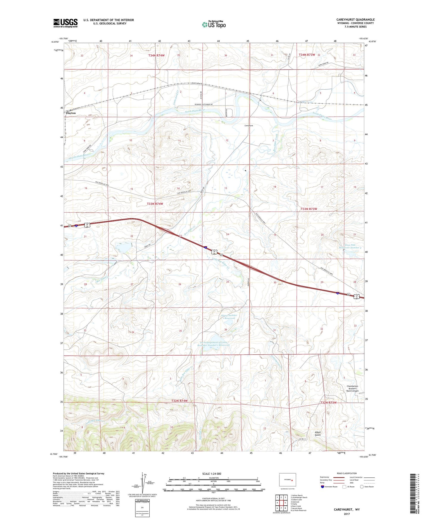
2021 topographic map quadrangle Careyhurst in the state of Wyoming. Scale: 1:24000. Based on the newly updated USGS 7.5' US Topo map series, this map is in the following counties: Converse. The map contains contour data, water features, and other items you are used to seeing on USGS maps, but also has updated roads and other features. This is the next generation of topographic maps. Printed on high-quality waterproof paper with UV fade-resistant inks.
Quads adjacent to this one:
West: Glenrock
Northwest: Hylton Ranch
North: Leuenberger Ranch
Northeast: Gilbert Lake
East: Orpha
Southeast: La Prele Reservoir
South: Hermit Rock
Southwest: Root Creek
This map covers the same area as the classic USGS quad with code o42105g6.
Contains the following named places: 1st Enlargement of Little Boxelder Number 1 Dam, Abney Number 1 Dam, Abney Number 1 Reservoir, Box Elder Creek, Carey, Careyhurst, Careyhurst Ranch, Chamberlain Number 1 Dam, Chamberlain Reservoir Number 1, Cottonwood Creek, Fletcher, Little Box Elder Creek, Little Boxelder Number 1 Dam, Little Boxelder Number 3 Dam, Little Boxelder Number One Reservoir, Little Boxelder Reservoir Number 3, Little Sand Creek, Running Dutchman Ditch, Sawmill Creek, Welch, West Side Ditch, West Side Number 1 Dam, West Side Number 4 Dam, West Side Reservoir Number 1, West Side Reservoir Number 4