MyTopo
Lockett Wyoming US Topo Map
Couldn't load pickup availability
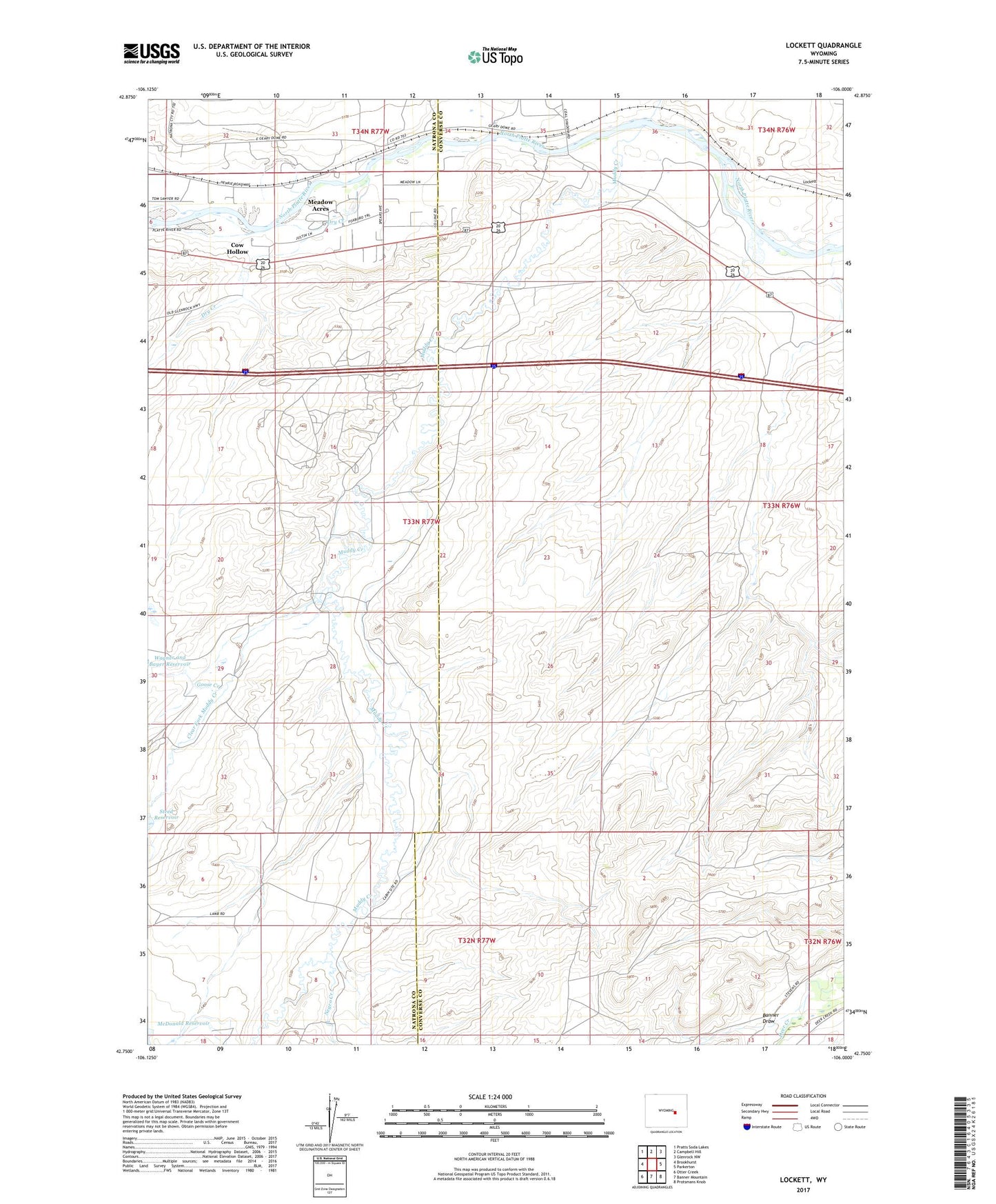
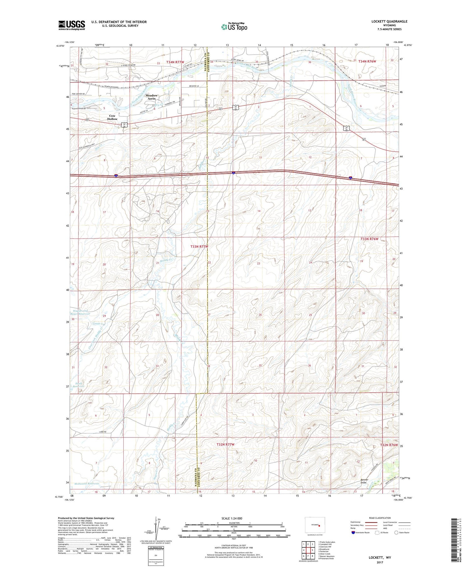
2021 topographic map quadrangle Lockett in the state of Wyoming. Scale: 1:24000. Based on the newly updated USGS 7.5' US Topo map series, this map is in the following counties: Converse, Natrona. The map contains contour data, water features, and other items you are used to seeing on USGS maps, but also has updated roads and other features. This is the next generation of topographic maps. Printed on high-quality waterproof paper with UV fade-resistant inks.
Quads adjacent to this one:
West: Brookhurst
Northwest: Pratts Soda Lakes
North: Campbell Hill
Northeast: Glenrock NW
East: Parkerton
Southeast: Protsmans Knob
South: Banner Mountain
Southwest: Otter Creek
Contains the following named places: Banner Draw, Big Muddy, Brooks Ranch Oil Field, Clear Fork Muddy Creek, Coal Creek Mine, Cole Creek, Cow Hollow, Dry Creek, Goose Creek, Lamb Lower Dam, Lamb Lower Reservoir, Lamb Ranch, Lockett, Lockett Mine, Meadow Acres, Meadow Acres Census Designated Place, Mountain Home Number 1 Dam, Mountain Home Number 1 Reservoir, Muddy Creek, Negro Creek, Old Altman Ranch, Old Webble Ranch